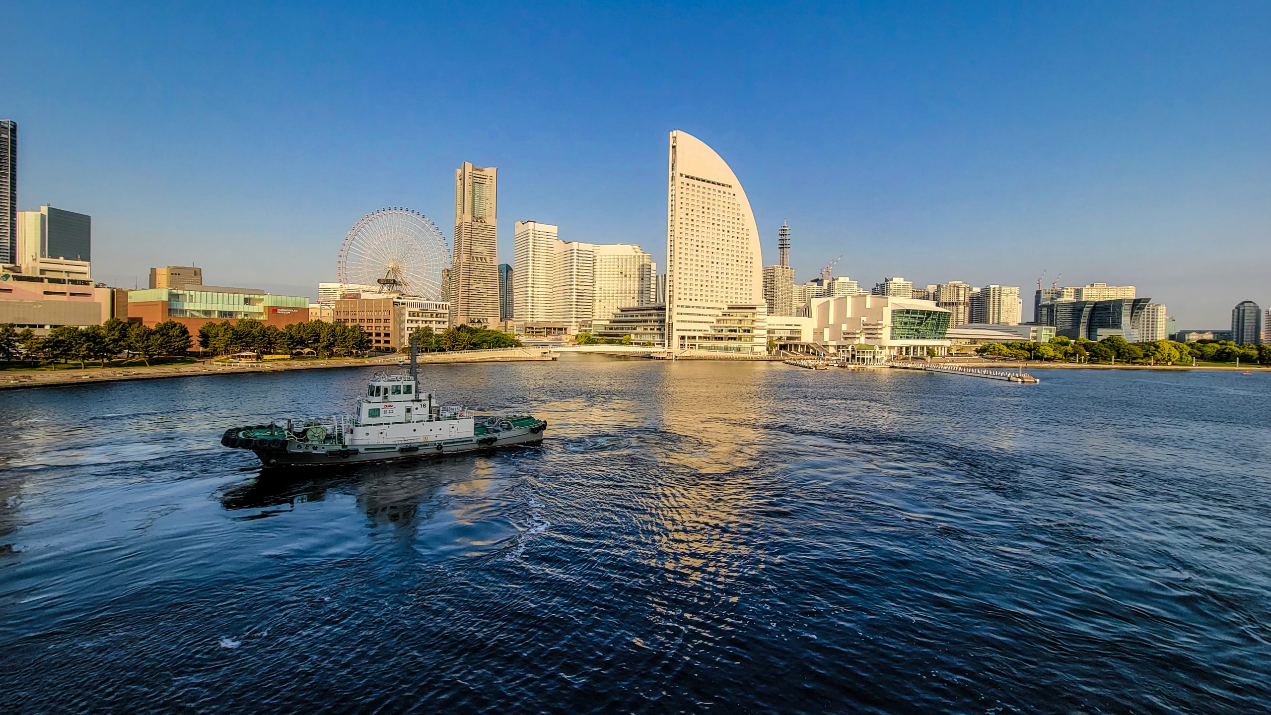
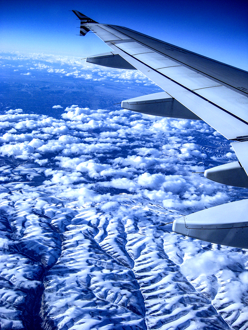
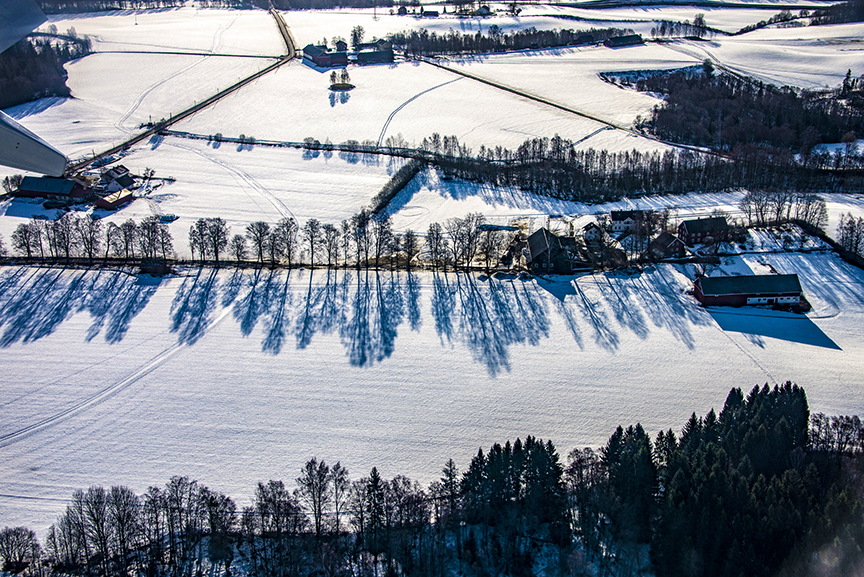
Our second cruise of the winter to the top of Norway, some 200 miles into the Arctic Circle, proceeded more or less on schedule.
Don’t blame the cruise line. Don’t blame the captain. Don’t blame me.
The high latitudes near the North Pole (and those near Antarctica at the other end of our planet) are places that are predictably unpredictable. Usually very cold, often very windy, sometimes heavily occluded with heavy clouds.
We were there in hopes of seeing the Northern Lights, something I have enjoyed quite a few times.
So here’s the deal: the Northern Lights–or to use its more formal title, the Aurora Borealis–are present in the earth’s atmosphere nearly all the time. Our planet’s protective magnetic field directs most the sun’s solar particles toward the Arctic Circle or the Antarctic Circle where the magnetism is weaker. (At the equator, the earth’s diameter is much greater than it is at the top or bottom, and so magnetic fields have less effect in the high latitudes.)
The second thing that is needed in order to see the Northern Lights is darkness. Sunlight washes out the diaphanous curtains and swirls. In the Arctic in winter, there is very little sunlight for at least three months of the year, from about December to March. (The Antarctic’s seasons are the opposite of the Arctic, with the dark midwinter on June 21 of each year.)
The third necessary element is a clear sky. The Northern Lights are the result of collisions between solar particles and various atoms in our atmosphere. Most of these collisions occur in the earth’s Thermosphere, the second-highest layer of the atmosphere, about 50 to 440 miles above the planet’s surface. If there is heavy cloud cover overhead, there’s little chance of seeing them. I always tell guests that if you cannot see stars or planets in the sky, there’s little chance of seeing the aurora.
And the fourth element: luck. You can be in the right place at the wrong time, or the wrong place at the right time.
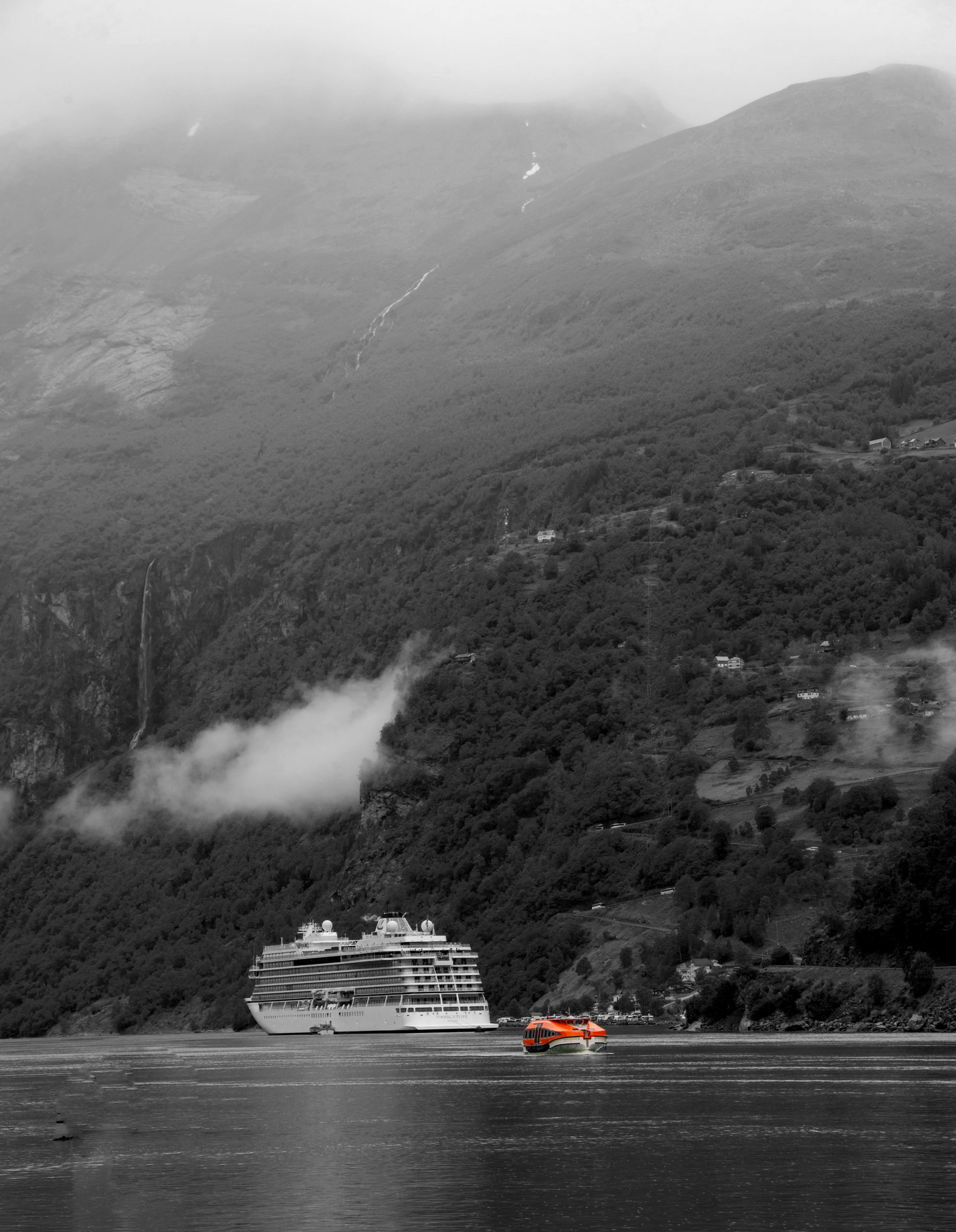
On our long sail from Bergen to the top of mainland Norway we had a few faint sightings of the lights; crew on the navigational bridge alerted passengers. But it wasn’t until we were tied up at the pier in Alta that all four elements: solar particles, darkness, clear skies, and luck aligned.
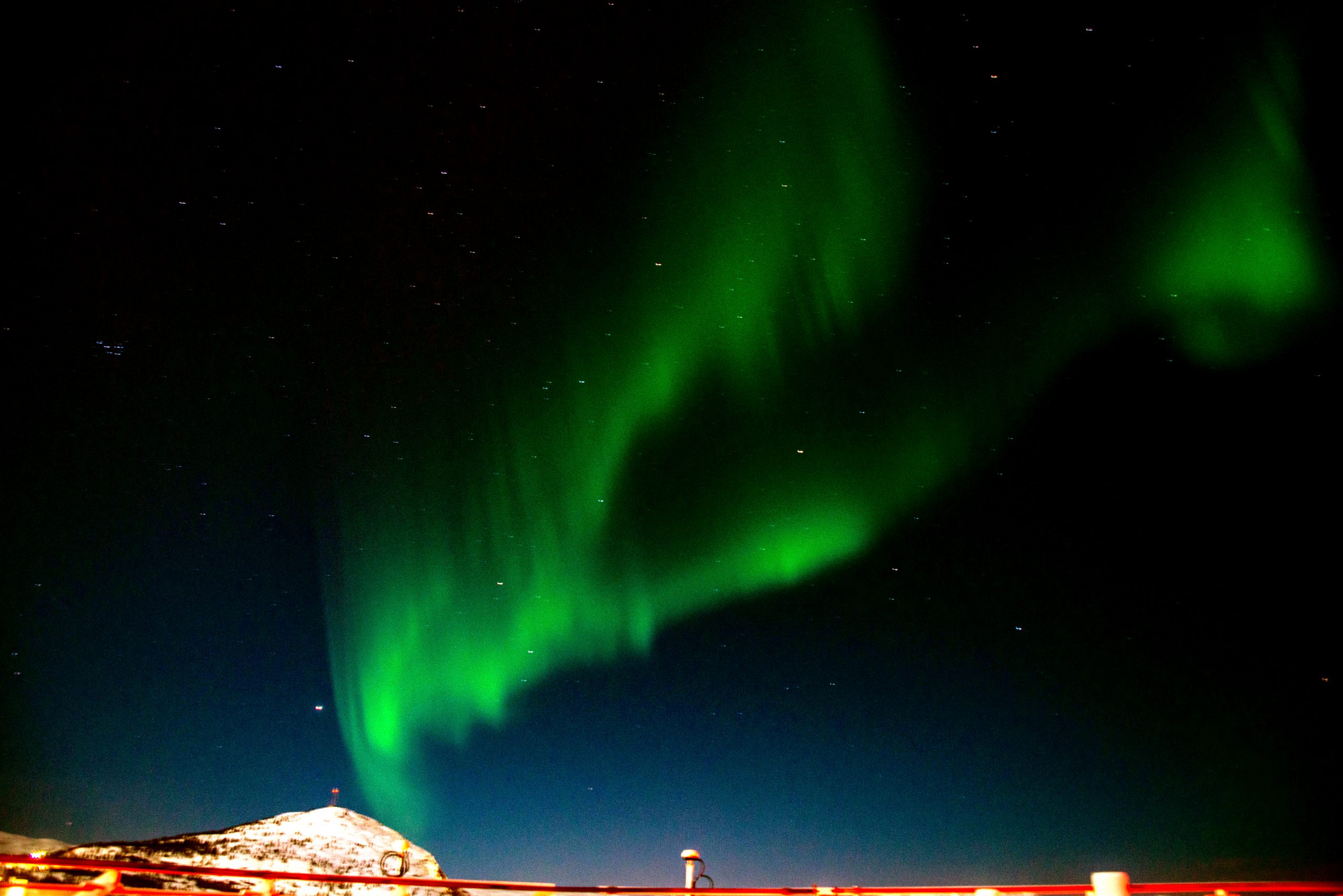
I headed for the highest deck of the ship with my tripod, full-frame digital camera, thermal underwear, and down-filled mittens. The first glimmer was a claw-like green image on the horizon:
Northern Lights appear on the horizon in Alta, Norway. If you can see stars, that’s a good sign that there are no clouds between you and the aurora. Photo by Corey Sandler, copyright 2024. All rights reserved.
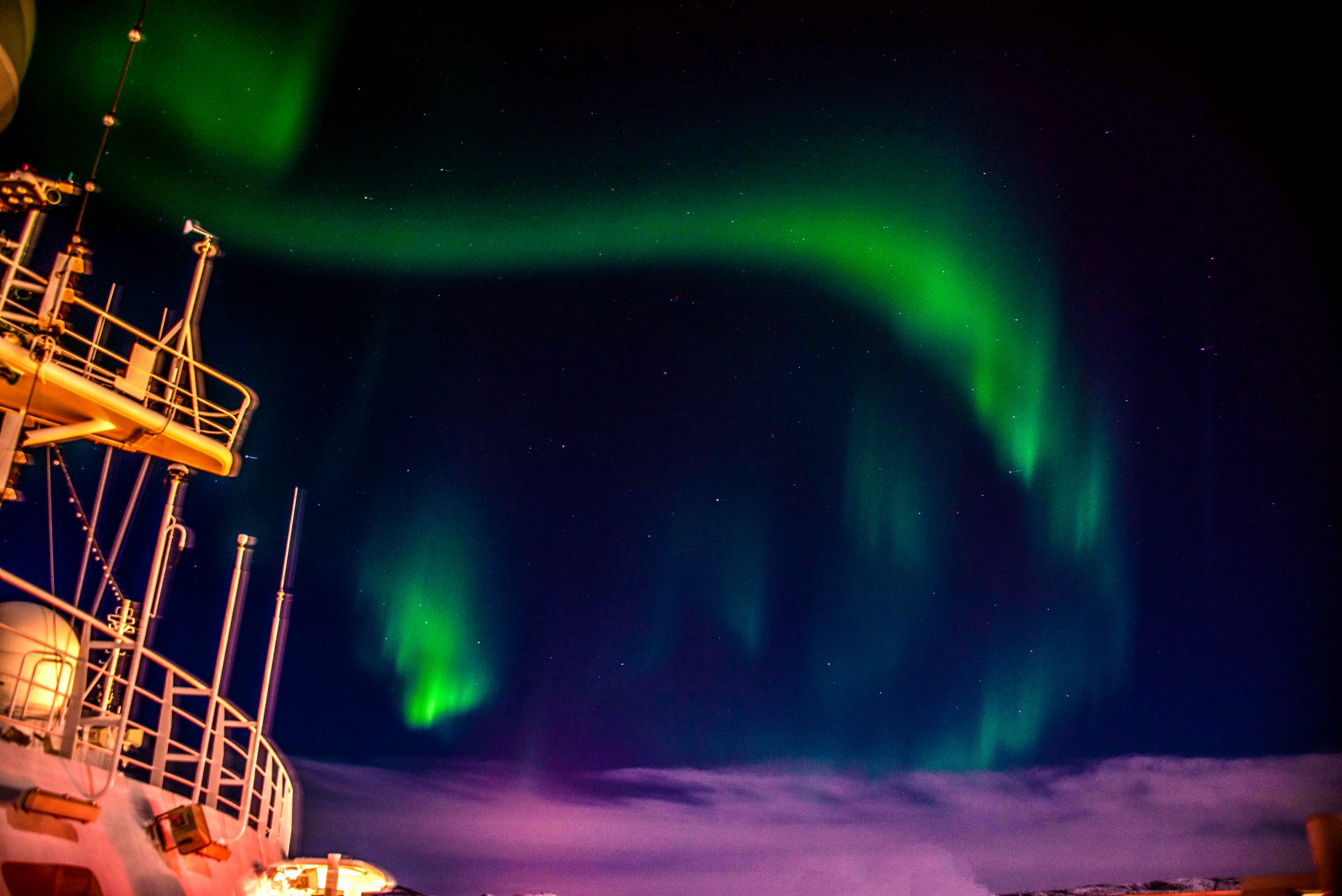
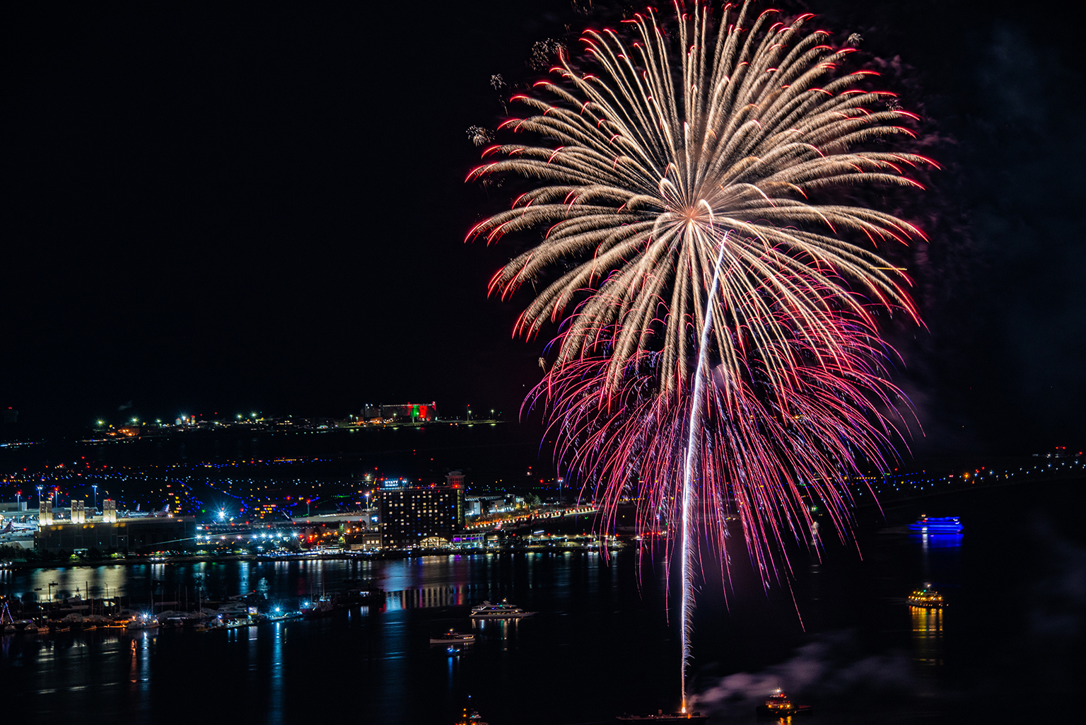
I headed from the stern to the bow of the ship, near the radar and communications equipment and set up again.
An Aurora Borealis swoop. Photo by Corey Sandler, copyright 2024. All rights reserved.
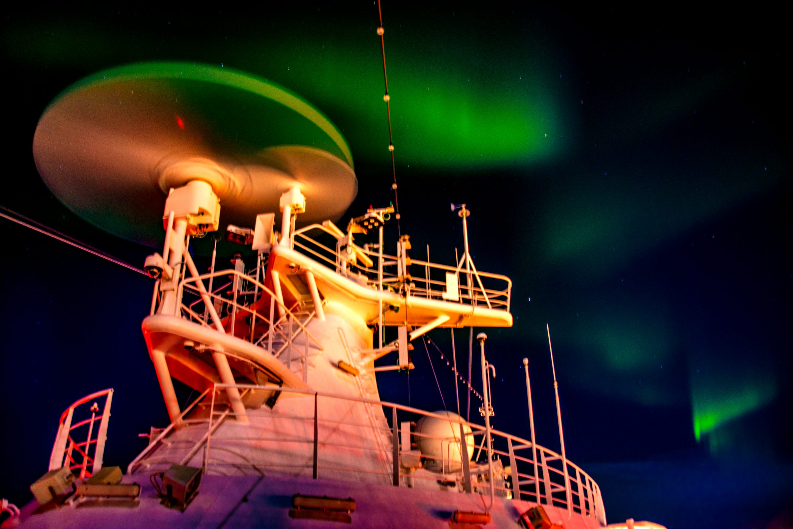
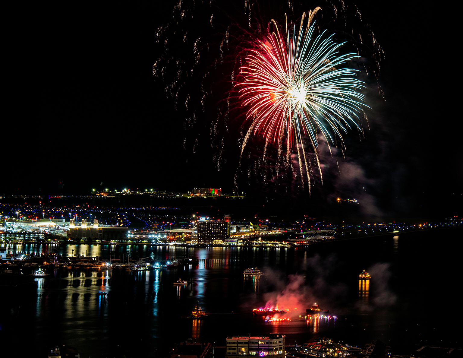
Our ship was due to depart Alta about 11pm, and as a group of us waited on the upper deck the navigator set the radar antenna to rotate. We heard the whir and saw the antenna move…and then as if summoned, the Northern Lights came directly over the ship.
The Northern Lights watch us as we watched them. Photo by Corey Sandler, copyright 2024. All rights reserved.
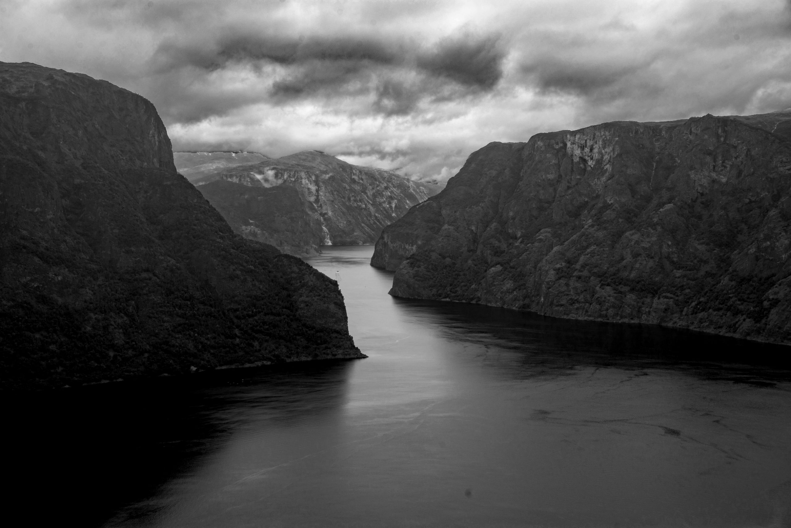
On our way down the coast, headed for the port of Tilbury on the Thames River, we made a call at Narvik in Norway. This is a place of great beauty and possessed of a history that still seems to echo through the fjord.
In the 1890s, a combined British and Swedish group engineered a spectacular railway that ran from iron ore mines in landlocked northern Sweden to the port of Narvik where it could be loaded onto ships and taken to steel mills in Europe.
Narvik in mid-winter, February 2024. The waters of the port and offshore in the Norwegian Sea, though, remain ice-free, benefitting from a finger of the Gulf Stream. Photo by Corey Sandler, all rights reserved.
The biggest customer for the Swedish steel coming through the Norwegian port was Germany. And soon after World War II began, Germany invaded and occupied Norway; one of the main reasons was to gain access to Narvik and its railway to neutral Sweden.
One of the largest naval battles of Europe took place within the confines of Narvik, and for a few weeks the British, along with Free French and the Norwegian resistance held off and then ousted the Germans. But the Allied foothold could not be sustained, and they withdrew; German bombers and naval vessels all but leveled Narvik and the export of iron ore from the port was halted.
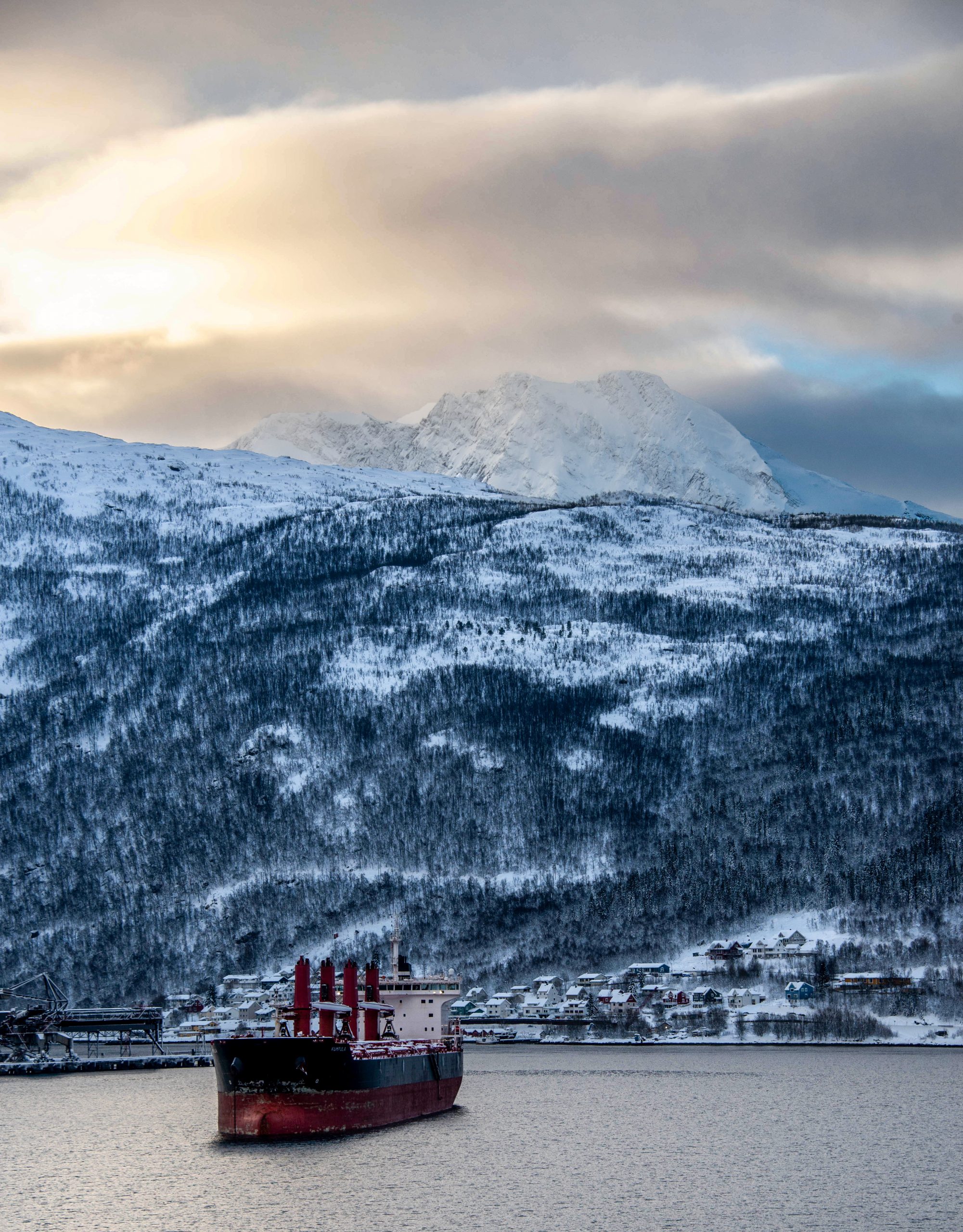
An iron ore freighter waiting its turn to approach the loading station at Narvik. Photo by Corey Sandler, all rights reserved.
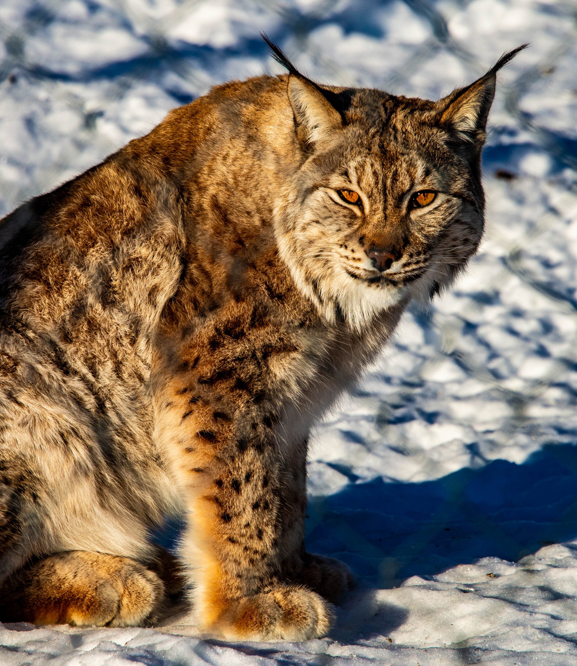
Up in the hills above the rebuilt town is a private nature preserve called Arctic Park. I went there with some guests, and we clamped ice spikes to our boots to visit large enclosures that were home to Arctic wolves and fox, wolverines, reindeer, and other creatures including several very large lynx, which are known as bobcats in North America.
Frigid staredown. The lynx and I stared at each other for a while. I wanted a picture. He wanted, I think, me. Photo by Corey Sandler, all rights reserved.
After Narvik, we set sail for IJmuiden, the port of Amsterdam, which was our last scheduled call before disembarkation at Tilbury on the Thames River in England.
A month before, our ship had been unable to make it to Tilbury because of a massive winter storm along the west coast of Norway; we had to fly from London to begin a re-jiggered cruise.
This time we ran into high winds and rough seas as we sailed toward IJmuiden and eventually it became apparent there was no way to make our call in The Netherlands and then cross over the North Sea to end the cruise in Tilbury at the scheduled hour.
And so we ended with an extra day at sea and a nighttime arrival in the United Kingdom.
And then we flew home, unpacked our bags, and began planning our next voyage, scheduled for the end of May. I’ll see you here with details.
All text and photos by Corey Sandler, all rights reserved. If you want to obtain a copy of one of my photographs for personal or commercial use, please contact me using the link on this page.
So our trip by ship from London to the top of mainland Norway in search of the Northern Lights had started out with a few glitches.
An historically strong winter storm had all but shut down coastal Norway the week before our planned starting date, and that meant our ship Viking Venus had been unable to escape relative shelter in Alta and Tromsø. Guests had boarded in Bergen and headed north, but missed out on most of their cruise ports of call. And those of us arriving in London to board the ship were all dressed up with no vessel to board.
There’s a saying in the cruise industry: Ship happens.
By the time we reached Viking Venus in Tromsø, she was ready to set sail for Alta, the farthest north port on the much-amended itinerary. It was plenty cold and windy in Alta and though the winter sights were lovely, sightings of the Northern Lights were few and far between.
Sailing south toward Bergen, we added a port call in Ålesund, a handsome fishing and trade town. I’ve been there many times in summer, but not so much in the much quieter seriously cold season. Our ship was among the big events of the winter.
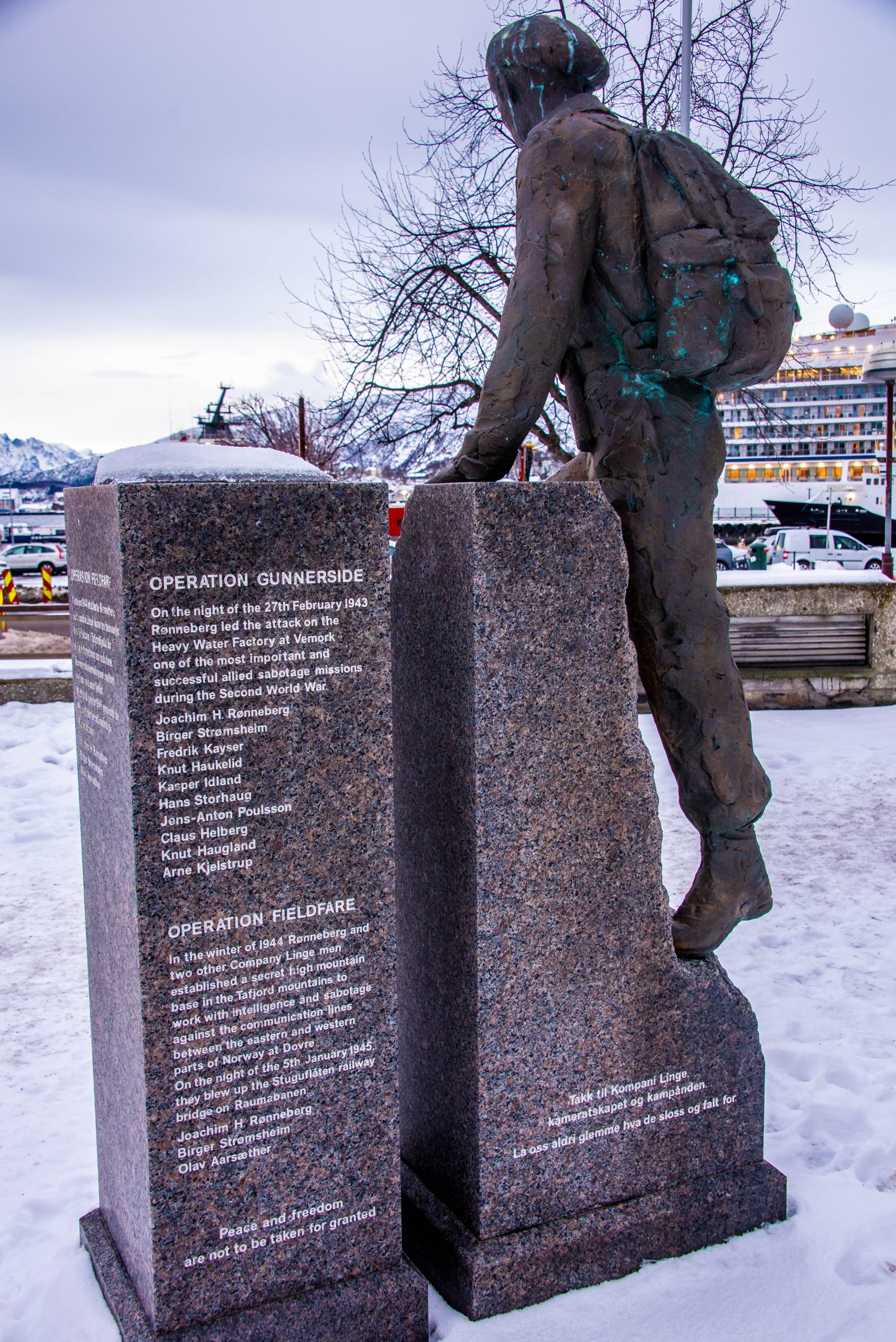
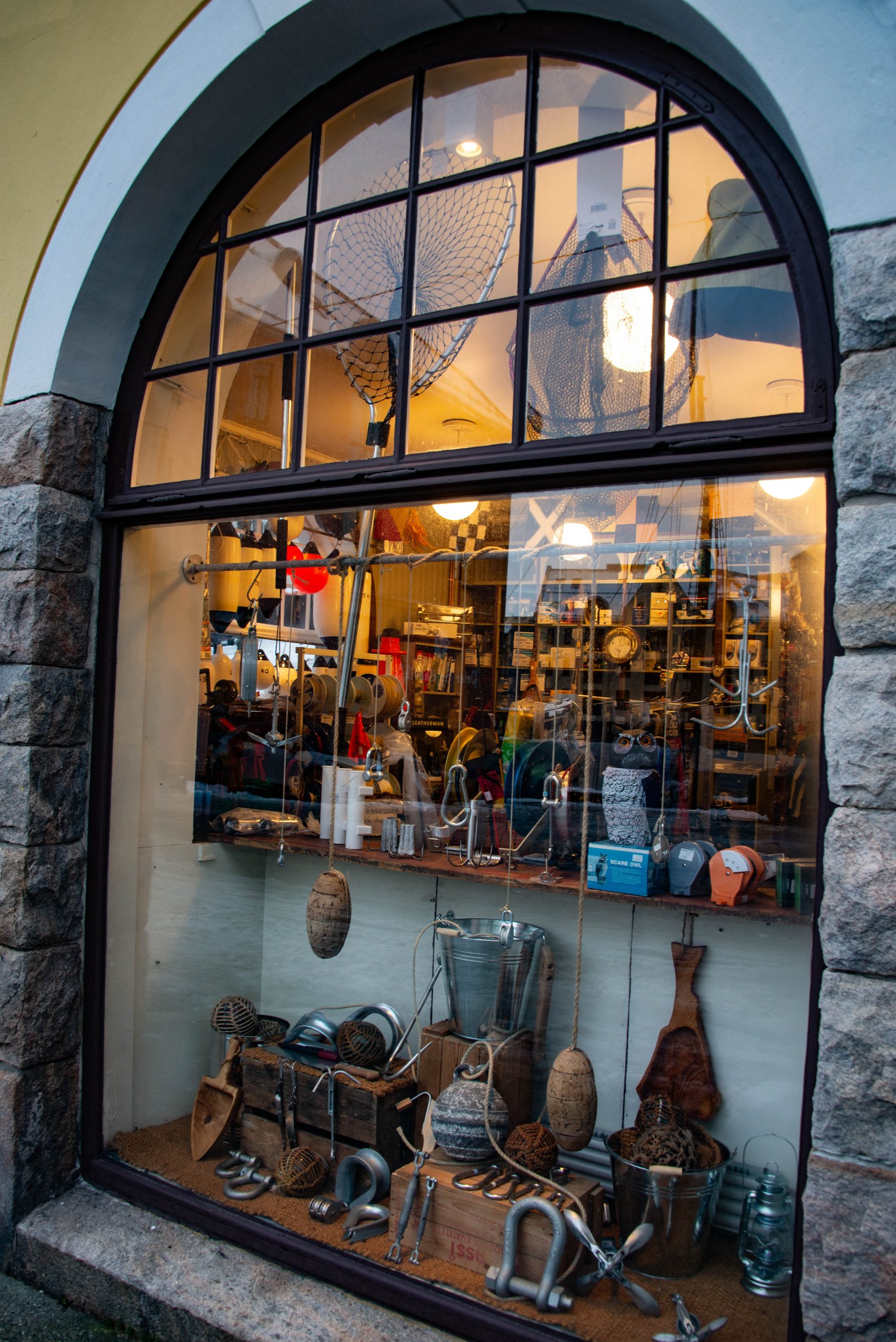
A memorial to the Norwegian resistance in Ålesund notes Operation Gunnerside, which was the code name for the successful sabotage of Nazi Germany’s heavy water factory in 1943. The Germans were preparing their own atomic bomb and using abundant hydroelectric power and the relative security of Norway to hide their efforts. The plant was sabotaged and damaged several times before work was eventually moved back to Germany. And then, Hitler was said to have decided that the project was not all that important. Without the sabotage and the flawed thinking of the German leader, World War II might have been an even greater global disaster. Photo by Corey Sandler, all rights reserved.A combination ship chandlery and home goods store in Ålesund. Photo by Corey Sandler, all rights reserved.
Due to Norway’s homegrown version of cabotage regulations, Viking Venus was obliged to make two port calls outside of Norway. A pair of short courtesy calls were made at IJmuiden (the port of Amsterdam in The Netherlands) and an unusual touch-and-go across the North Sea at Newcastle upon Tyne in the northeast of England.
The Victorian-era train station at Tyneside is defiantly out of date. The people of Newcastle, with a distinctive and sometimes incomprehensible dialect and accent, are nicknamed “Geordies”, by some accounts because local miders used George Stephenson’s safety lamp down in the mines. We brought no coal to Newcastle. Photo by Corey Sandler, all rights reserved.
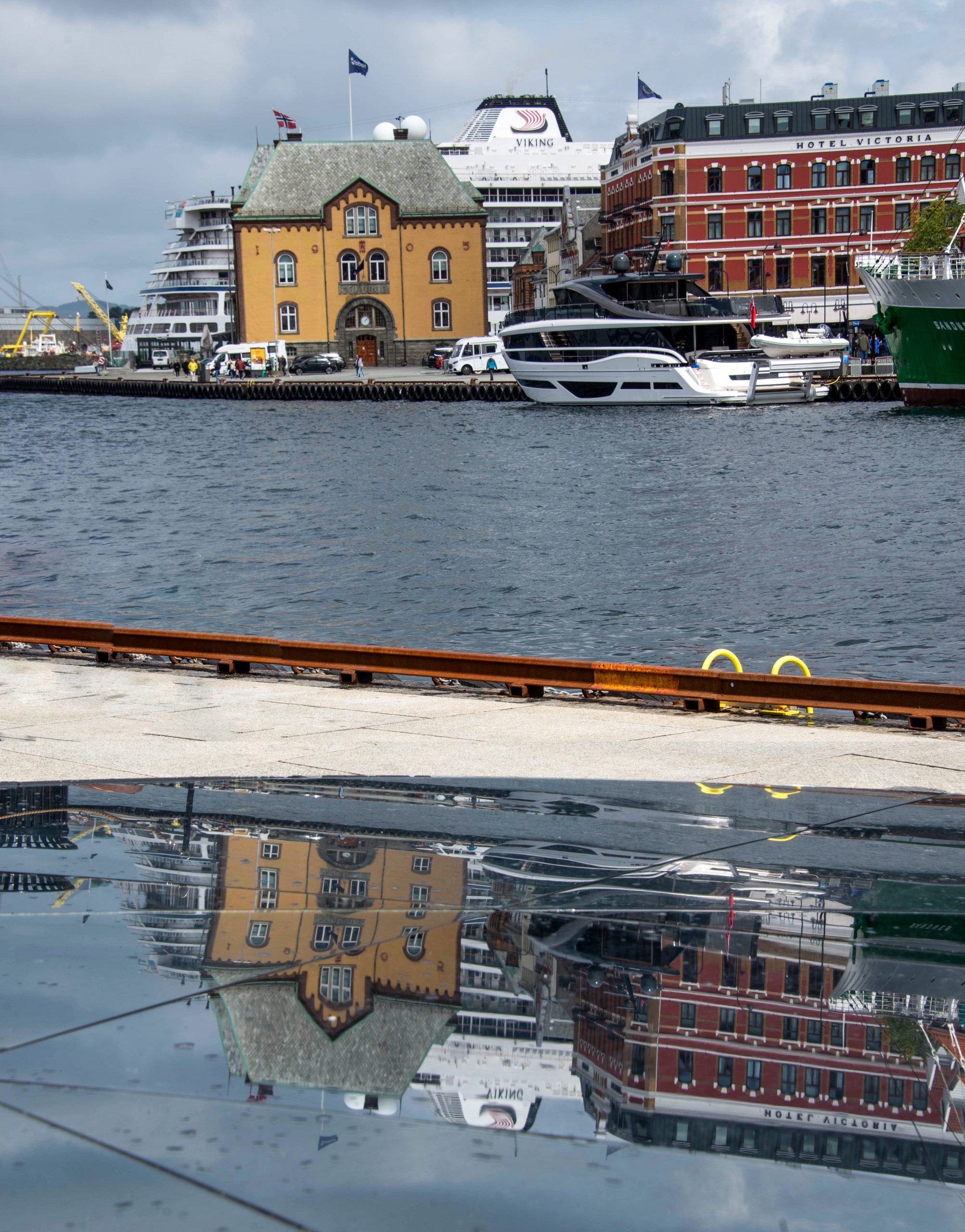
The jumbled cruise ended in Bergen, Norway. Guests departed in the morning, and a new group boarded a few hours later. The turn-around day was an unusually bright and sunny day in Bergen; our departure day that followed was a more typical rainy and blustery February day.
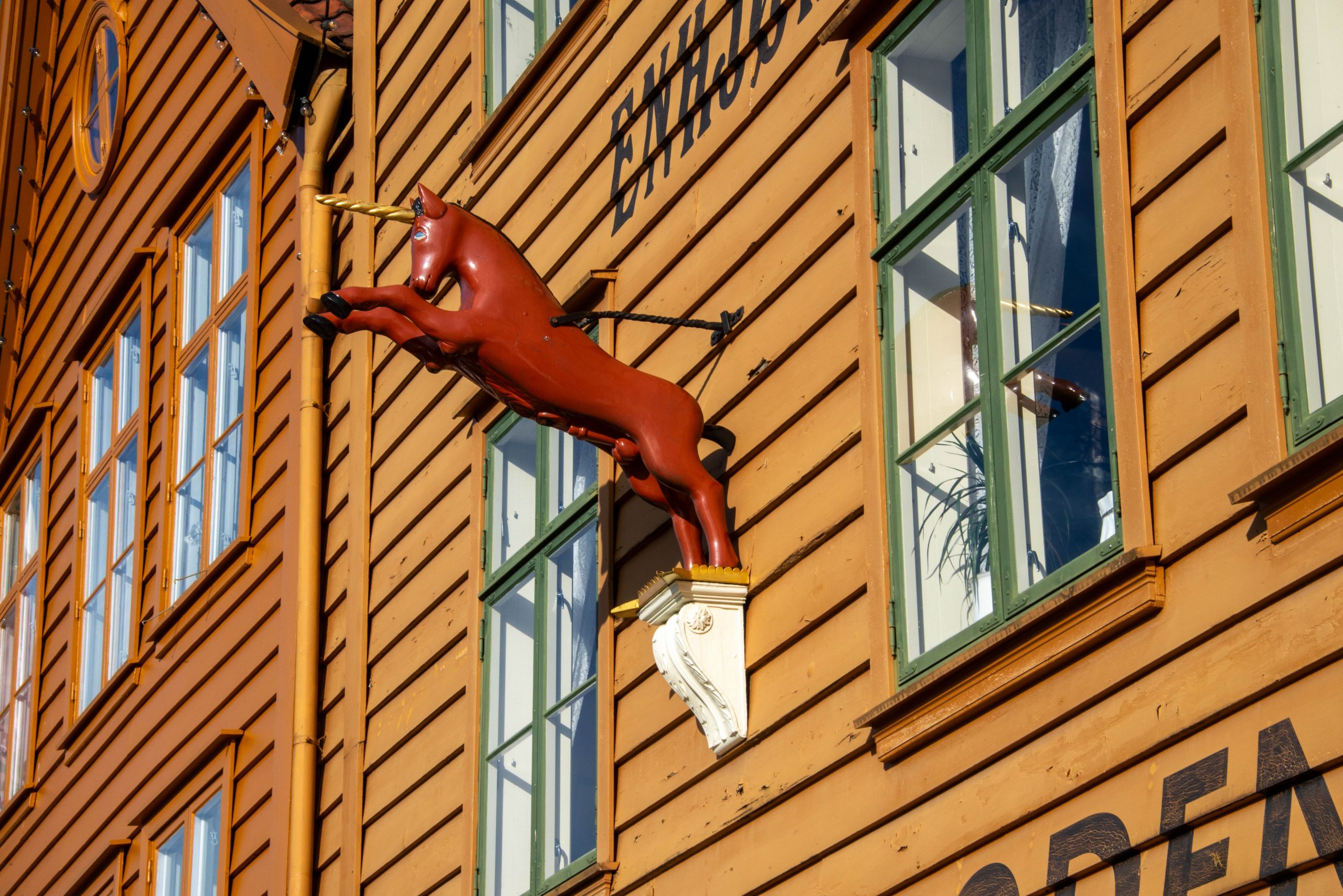
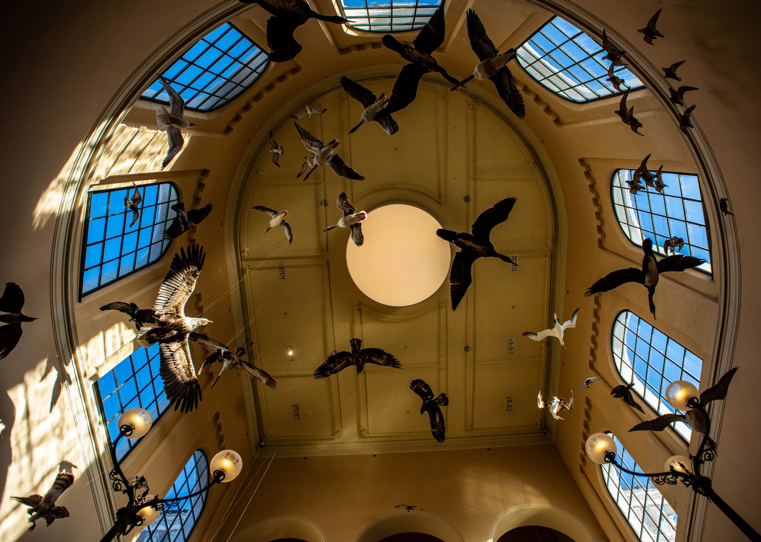
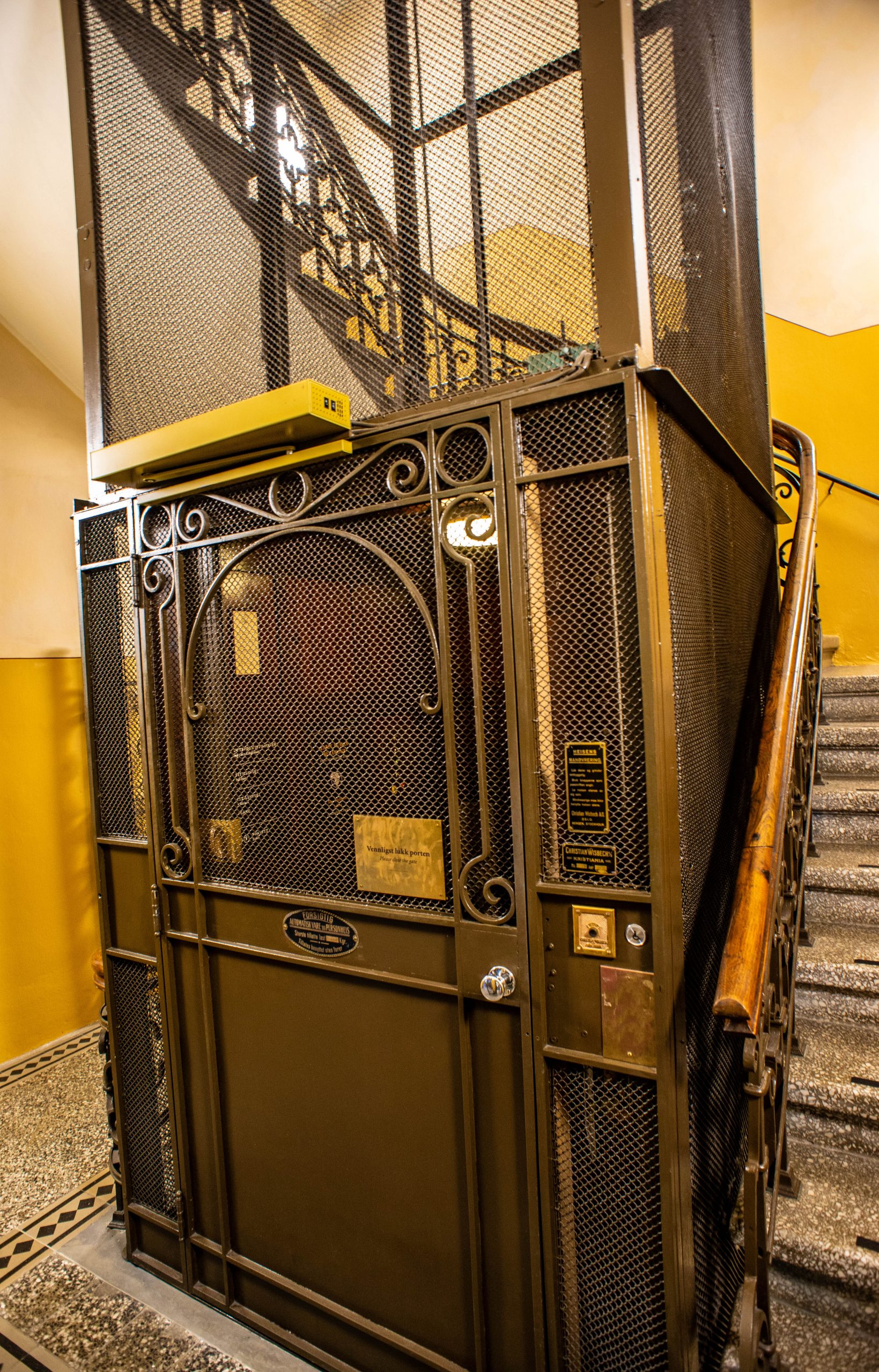
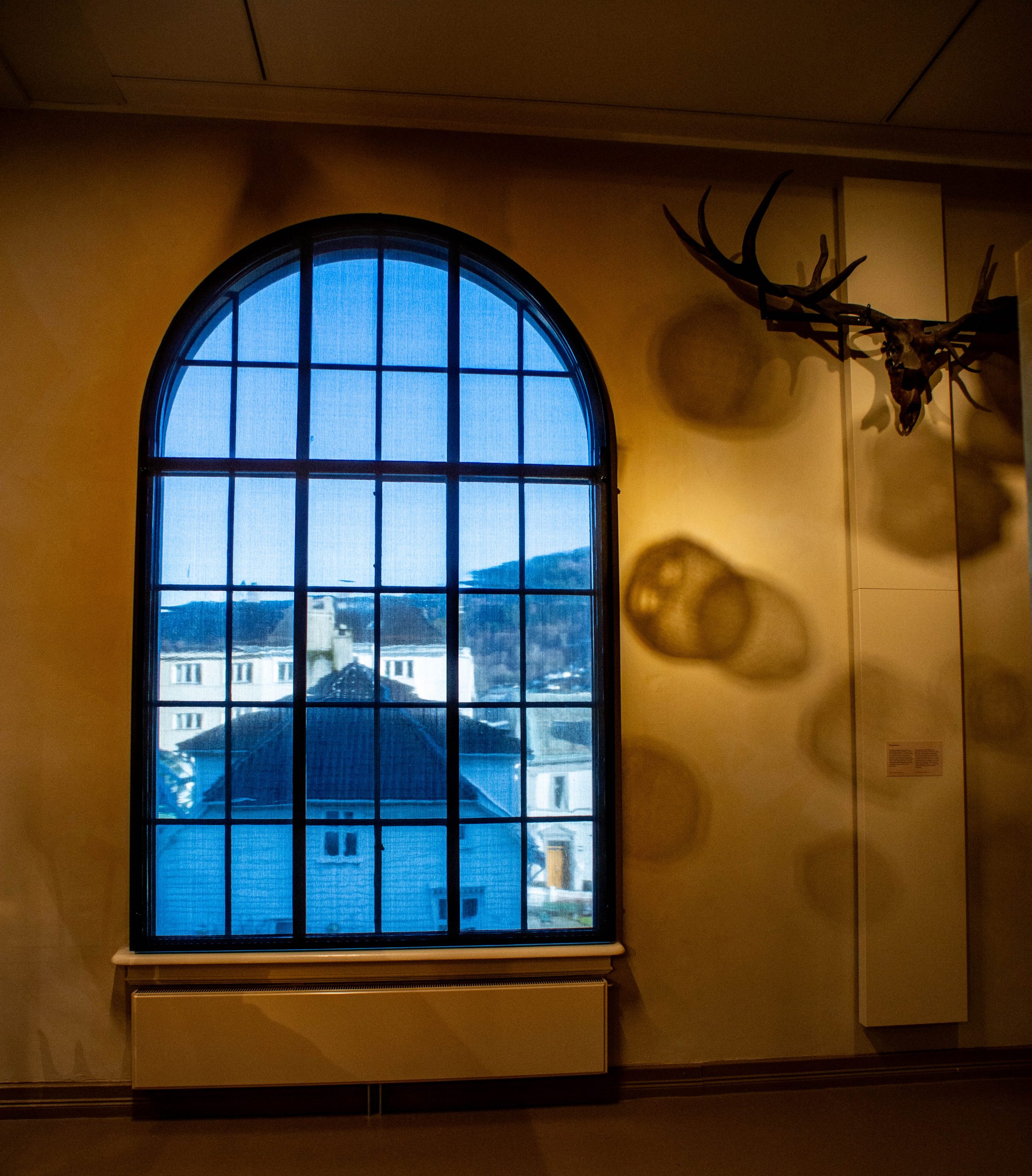
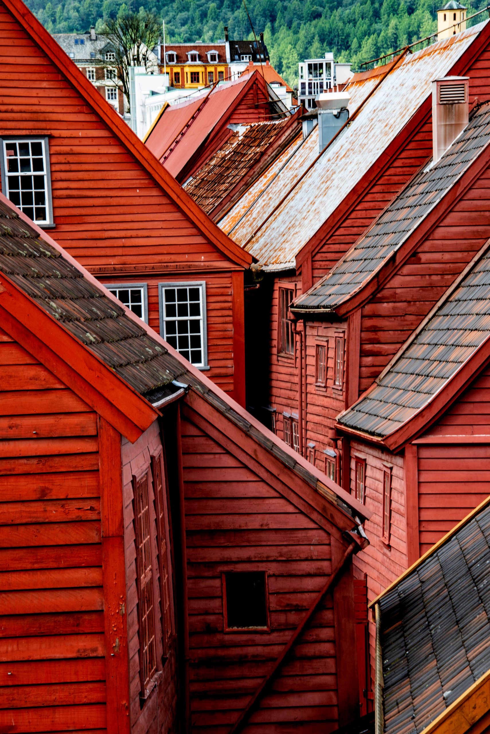
Blue skies on the turnaround day in Bergen, Norway; the skies would go back to clouds and fog soon afterwards. Photo by Corey Sandler, all rights reserved.A storefront in Bryggen, the ancient Hanseatic trading kontor in Bergen. Most of the fishermen and traders were illiterate, and businessmen identified themselves with carved effigies out front, this one a version of a unicorn. Photo by Corey Sandler, all rights reserved.The University Museum of Bergen–Natural History is one of my favorite places, emerged from a major renovation but still thankfully cast in the past. Photo by Corey Sandler, all rights reserved.A working part of the museum, thankfully unmodernized, is its antique elevator. One of the oldest still in use in Europe, the staff calls it “The Titanic.” We survived. Twice. Photo by Corey Sandler, all rights reserved.As we prepared to head back to the ship to begin the next cruise up north to the top of Norway, we enjoyed blue sky framed in the museum’s old windows. Photo by Corey Sandler, all rights reserved.
Next month, I’ll take you back up north on our resumed search for the Northern Lights.
All photos and text copyright by Corey Sandler, all rights reserved. If you’d like to obtain an image for personal or commercial use please contact me.
I’ve just returned…last night, to be precise…from nearly a month at sea. Safe and sound, well fed, and restocked with new stories and photos.
We spent the largest portion of two cruises inside the Arctic Circle. In February, generally the coldest and snowiest and windiest time of the year.
And for the first two weeks that was exactly what we got: cold, wind, and snow. The second two weeks were strangely, terrifyingly warmer than usual greatly confusing visitors, reindeer, Arctic fox, and other denizens.
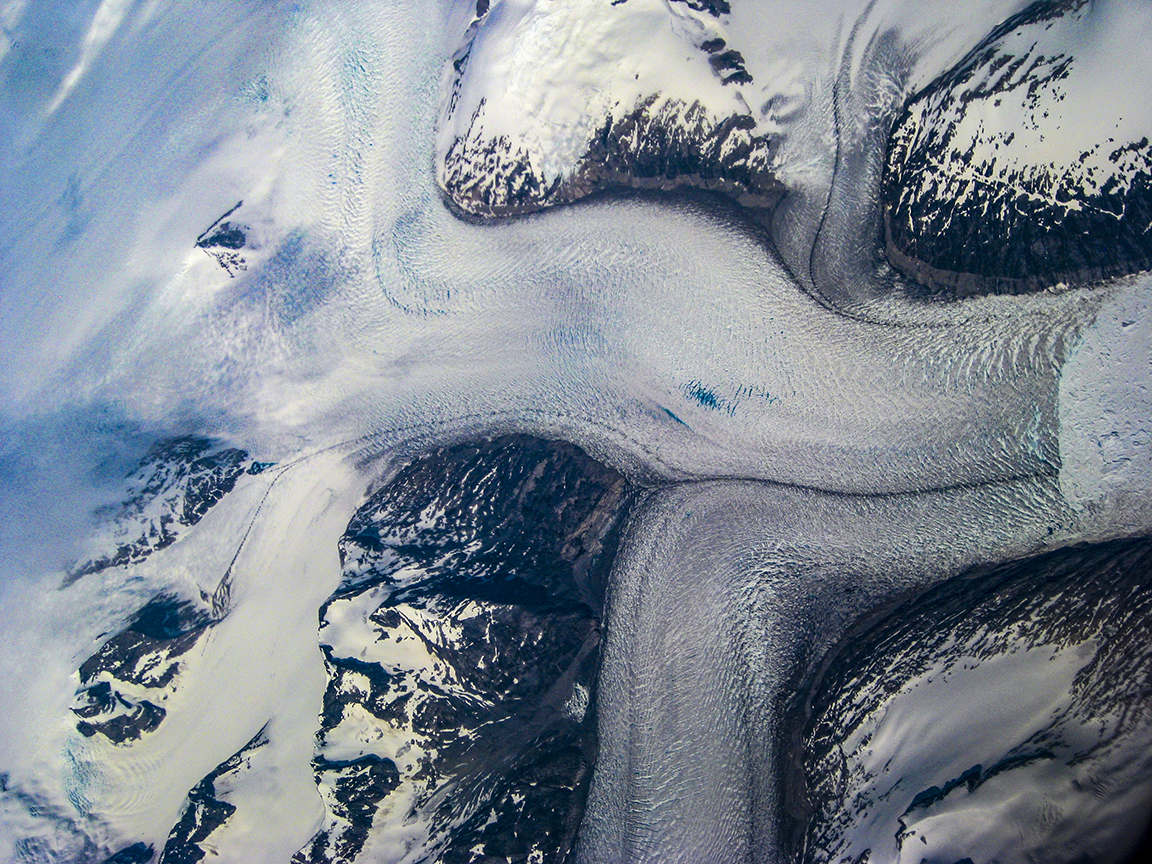
I’ve spent a lot of time in the high latitudes up north, including research trips to Svalbard, upper Norway, Iceland, Greenland, and far northern Canada; those trips initially were for the book I wrote retracing the four known voyages of the English explorer Henry Hudson from 1607 to 1610.
Hudson got trapped in the ice near Svalbard and then Russia’s Novaya Zemlya island near Arkhangelsk before he turned westward and headed for North America…where he got caught in the ice of Canada’s James Bay.
On our trip in February of 2024, we sailed in great comfort, with indoor heating and conveniences, and fine food. I was a featured speaker aboard Viking Venus, a vessel Henry Hudson could not possibly have imagined.
But that’s not to say we were oblivious to the weather. As I said, inside the Arctic Circle in February.
As we prepared to fly from Boston to London to meet our ship at the Port of Tilbury on the Thames, we heard the first intimations of meterological mayhem.
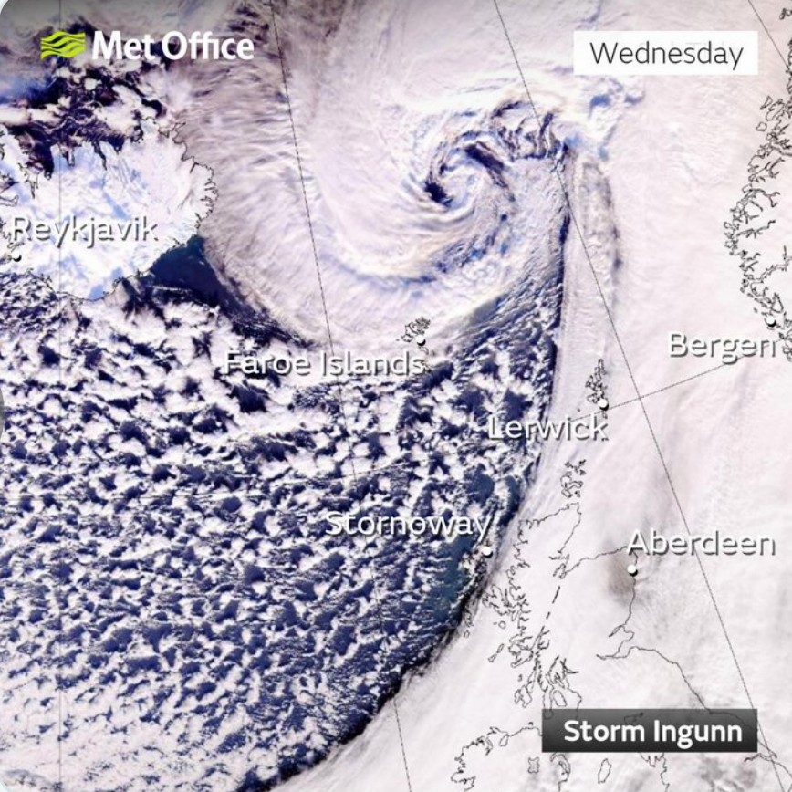
The winter’s strongest storm, big enough to be given a name, was lashing the North Sea and the Norwegian Sea.
Storm Ingunn hit the coast of Norway with hurricane-force winds. Scientists said it had the characteristics of a relatively rare “sting jet”, a narrow band of very strong winds caused by the unusually rapid strengthening of an extreme low-pressure system. Very fast upper-level winds were redirected downward to sea level.
In fact, atmospheric pressure dropped to a level very close to the lowest on record in Norway, a mark not seen since 1907. The storm itself was judged to be the fiercest to hit Norway since 1992.
Storm Ingunn brought hurricane force winds of 115 miles per hour to the island of Heimøya, north of Trondheim. Up and down the coast, sustained winds of 100mph were recorded, and in Bergen to the south a bus was blown off the road.
The day before our flight to London we received an email with a few scant details. Get to London, it said, and we’ll figure out out from there.
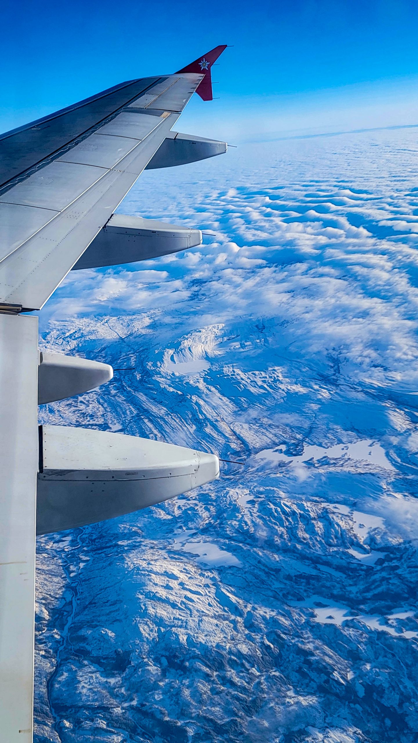
When we arrived in London, our ship was still securely tied up at the pier in Tromsø, 2,178 miles away, at the top of Norway inside the Arctic Circle.
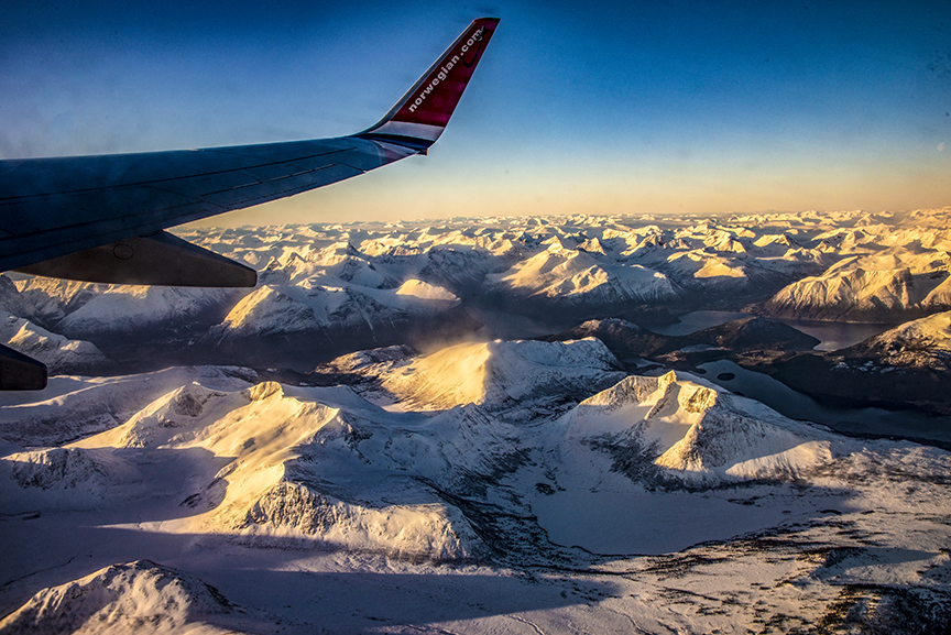
It took three days to ferry the guests on board the ship—by chartered jet—from Tromsø to London and to transport new guests (and us) from London up into the Arctic.
Flying north on a charter airliner from London to Tromsø, 217 miles into the Arctic Circle. Photo by Corey Sandler, all rights reserved,
The itinerary was completely scrambled, and I was madly at work reordering and adjusting my lectures for the guests.
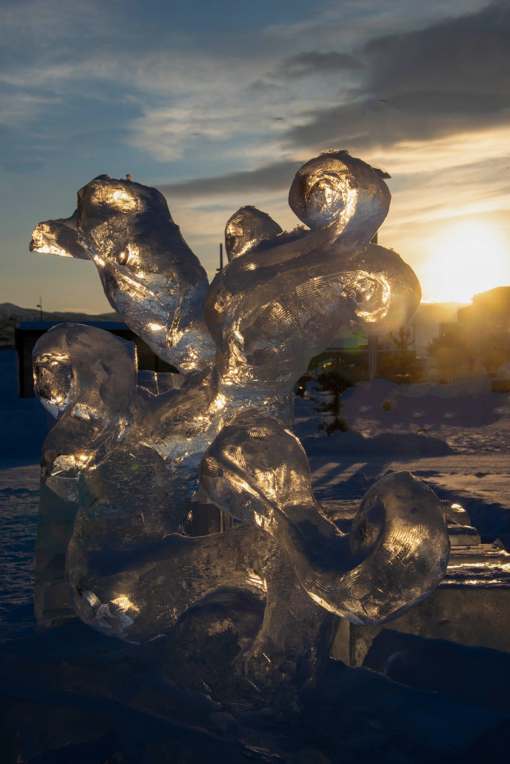
But we were safe and the ship was grand and Norway, as always, was gorgeous. And our suitcases were properly crammed with winter clothing. Nothing like a good set of thermal underwear, a ski parka, down-filled mittens, and a balaklava to make you feel at home. I hardly noticed the -2 degree Fahrenheit (-18 Celsius) morning in Alta, Norway.
Cold morning in Alta, Norway on a day with about six hours of light. Photo by Corey Sandler, all rights reserved.Ice sculpture in Alta, Norway on a -4 Fahrenheit morning. Photo by Corey Sandler, all rights reserved.
Oh, all right, I did notice the temperature. But this was the Arctic in February, right?
Here are some photos from that first cruise, which ended as per schedule in Bergen, Norway. Next month I’ll share photos from the second cruise which sailed back up north to Tromsø and Alta and then returned us to Tilbury on the Thames and our flight home.
We made it back, unlike Henry Hudson.
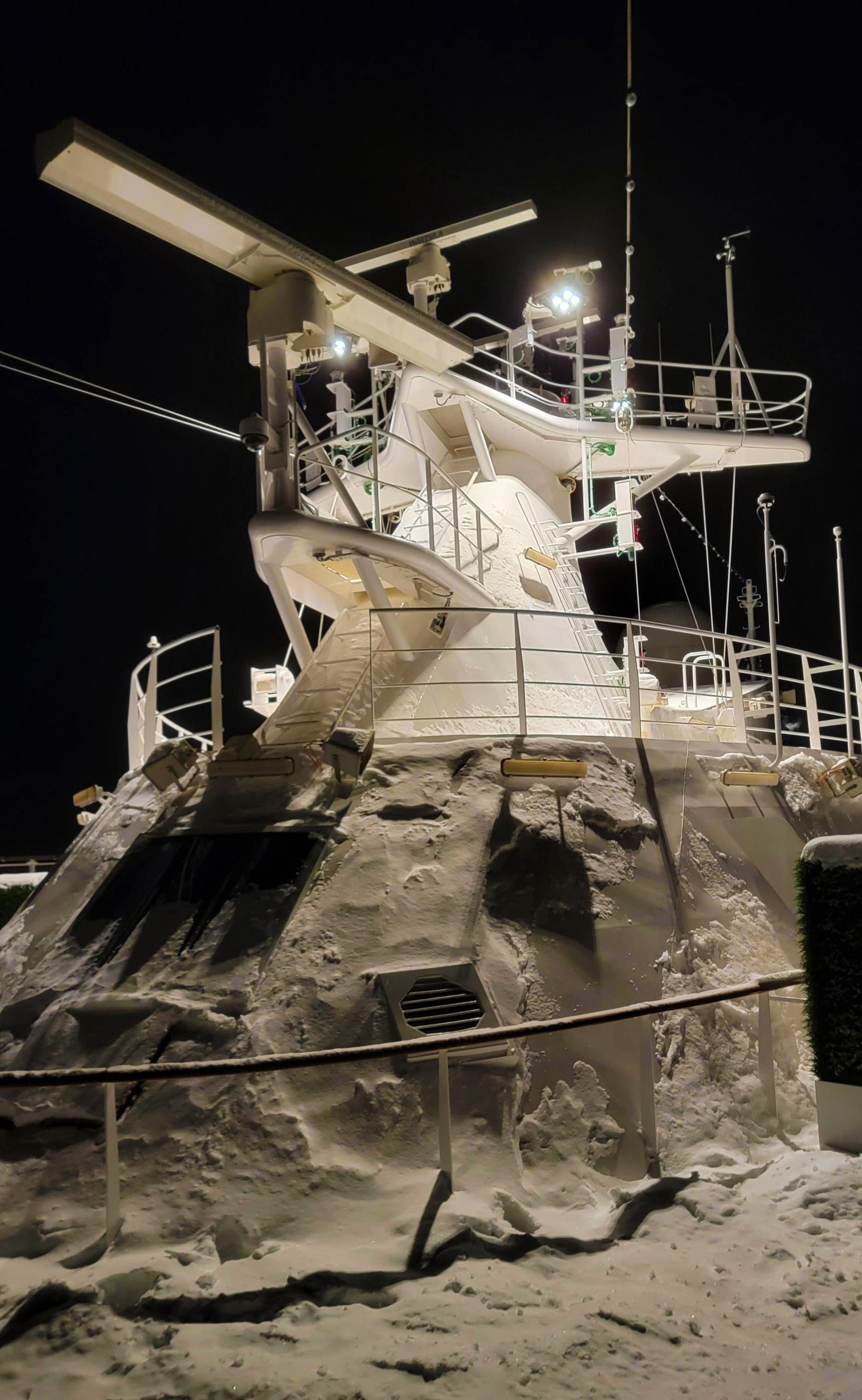
Aboard our ship, a different type of sculpture, with the superstructure encased in ice. Photo by Corey Sandler. All rights reserved. The handsome port of Narvik, Norway, the terminus of a century-old mountain railroad that brings iron ore from across the border in Sweden. The train and the iron export was a major reason for Germany’s invasion on Norway in early 1940. Photo by Corey Sandler, all rights reserved.Narvik inside the Arctic Circle in February. Photo by Corey Sandler, all rights reserved.Memorial to World War II fallen in Narvik. Photo by Corey Sandler, all rights reserved.
Copyright 2024. All rights reserved. If you would like to purchase a photo for personal or commercial use please contact me.
The last two ports of call on our Asian trip were Taiwan and Hong Kong, both of them places with complex histories of independence and occupation and modern stories that keep them on the front lines of cultural and economic and political conflict.
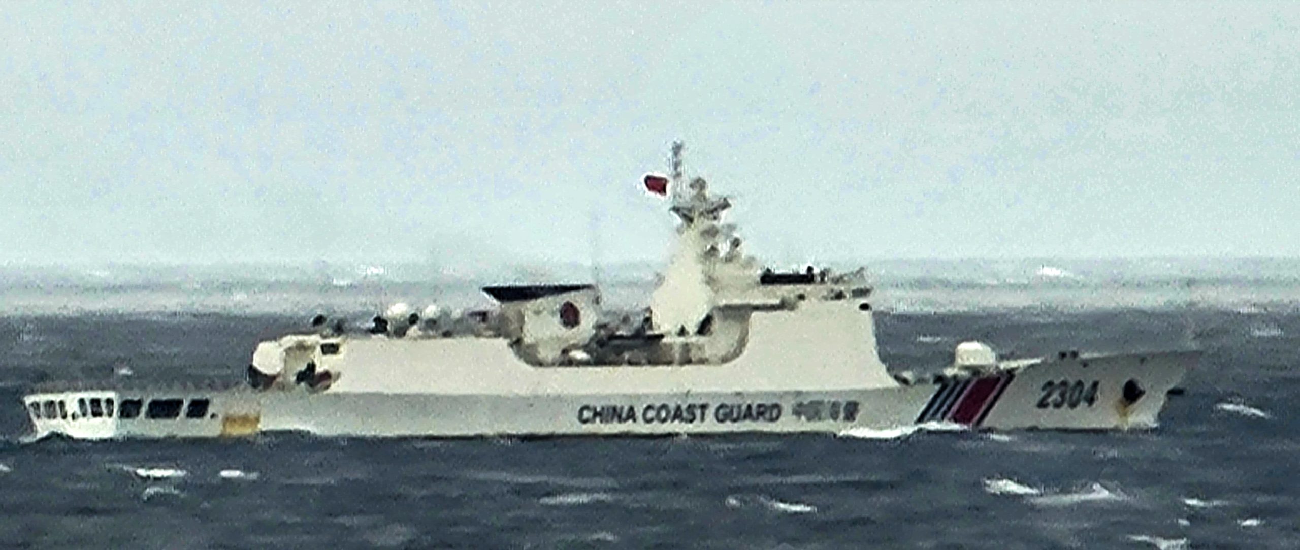
As we sailed from Nagasaki in southern Japan through the East China Sea toward Taiwan, we could see dozens of Chinese fishing vessels as well as other ships whose purpose was less apparent. In the late afternoon, with mainland China to our starboard side and Taiwan a few hundred miles ahead, a Chinese coast guard vessel cut across our bow and stopped in our path.
We were a civilian cruise ship, registered in Norway, carrying Americans, Canadians, Australians, Brits, and others.
I am not privy to whatever communication took place between the coast guard vessel and our cruise ship; it eventually moved west, toward China and we continued.
A Chinese Coast Guard cutter made a statement of some kind as we sailed between Japan and Taiwan. Photo by Corey Sandler, all rights reserved.
We docked in the port of Keelung, Taiwan’s second-largest port, about half an hour from the capital city of Taipei. Taiwan’s largest port is to the south, at Kaohsiung, where I had visited many years ago when researching a magazine piece about Taiwan’s then-booming electronic industry.
Taiwan is an unusual island nation with a strong economy and a functioning democracy, in a very tough neighborhood. There are some 168 islands, about a dozen of them significant; the main island of Taiwan is nearly 14,000 square miles in size and home to about 24 million people. Even with the vast jungle and mountain ranges in the center and east, that makes the Republic of China one of the world’s most densely populated countries.
Its official name is the Republic of China, which is easy enough to remember until you need to distinguish it from the People’s Republic of China which lies 80 to 100 miles to its west across the Taiwan Strait.
Both countries call the stretch of water by the same name, but that is one of the few points of agreement.
Mainland China–the People’s Republic of China–claims sovereignty and jurisdiction over the strait, declaring to the world that these are “internal territorial waters”.
In theory, that means any foreign vessel does not have freedom of navigation without official consent from the People’s Republic. In practice, vessels registered in the Republic of China and those of most other seafaring nations regularly traverse the strait.
The People’s Republic sends coast guard and naval vessels into the waterway and from time to time conducts “exercises” with weaponry, a literal form of saber rattling. The United States and a few other nations send naval vessels through the strait and aircraft above in response. There have been numerous incidents of close encounters, probably more than publicly known.
It’s not just Taiwan and the People’s Republic who squabble–sometimes loudly–in the region. Mainland China and the Philippines are at odds over small islands. And the Spratly Islands are disputed by the People’s Republic of China, the Republic of China, Vietnam, Brunei, Malaysia, and the Philippines.
It seems a place where a misstep could quickly escalate into an incident or worse. Watch this space.
There is evidence of humans on the island dating back at least 25,000 years, and a history of indigenous peoples from about 6,000 years.
In 1542, Portuguese sailors passed by an uncharted island, marking it on their charts Ilha Formosa (“beautiful island”). That name still rattles around in some parts of the world.
But the large island began to become more significant in the 17th century under a short-lived Dutch colony which lured large numbers of Han Chinese from northern China. It passed through several rulers until 1683 when it was annexed by the Qing dynasty of mainland China.
Things might have been simpler (not necessarily better) in the region if that had remained the status quo, but in 1895 the Qing dynasty ceded Taiwan to the expansionist Empire of Japan after being defeated in the First Sino-Japanese War.
Japan would occupy and defend the island through the end of World War II in 1945.
The Qing dynasty was the last imperial dynasty of China. I’m leaving out entire shelves of history books here, including intrusions and battles with Western nations, but for our purposes two events are most important:
In 1911, the Qing dynasty was overthrown and replaced by the first version of the Republic of China. During World War II, competing forces of the Chinese Nationalists (the Kuomintang, led by Generalissimo Chiang-Kai Shek) and the Chinese Communist Party (led by Chairman Mao Zedong) mostly cooperated in fighting Japanese forces in China.
Again, a long story made short:
After the end of World War II, the Chinese Civil War resumed between the Chinese Nationalists and the Chinese Communist Party. By the end of 1949, the Nationalists had been defeated on the mainland, but Chiang Kai-shek evacuated his government across the Strait to Taiwan.
About two million people, soldiers and the members of the Nationalists’ ruling elite, came to Taiwan and took control of about six million residents already in place. According to some historians, the Nationalists also brought with them much of mainland China’s gold and currency reserves and other treasures.
Things were rough on both sides of the Strait. The CCP in the People’s Republic of China ruled with an iron hand. The KMT in Taiwan declared itself a democracy but also imposed martial law which remained in place until 1987.
The vast People’s Republic of China claimed sovereignty over Taiwan, while the Republic of China proclaimed its goal to regain the mainland.
Although Taiwan was–and to a great extent still is–an economic powerhouse, by the late 1960s the tides had turned toward an uneasy accommodation by most of the world away from Taiwan and toward mainland China.
Today, most nations recognize the People’s Republic and many nations–the United States and major Western powers among them–maintain informal or third-party representation with the ROC.
Chiang Kai-shek died in 1975. It was not until 1986 that the first opposition party was allowed to participate in elections, and only in 2000 was there a change in leadership at the top.
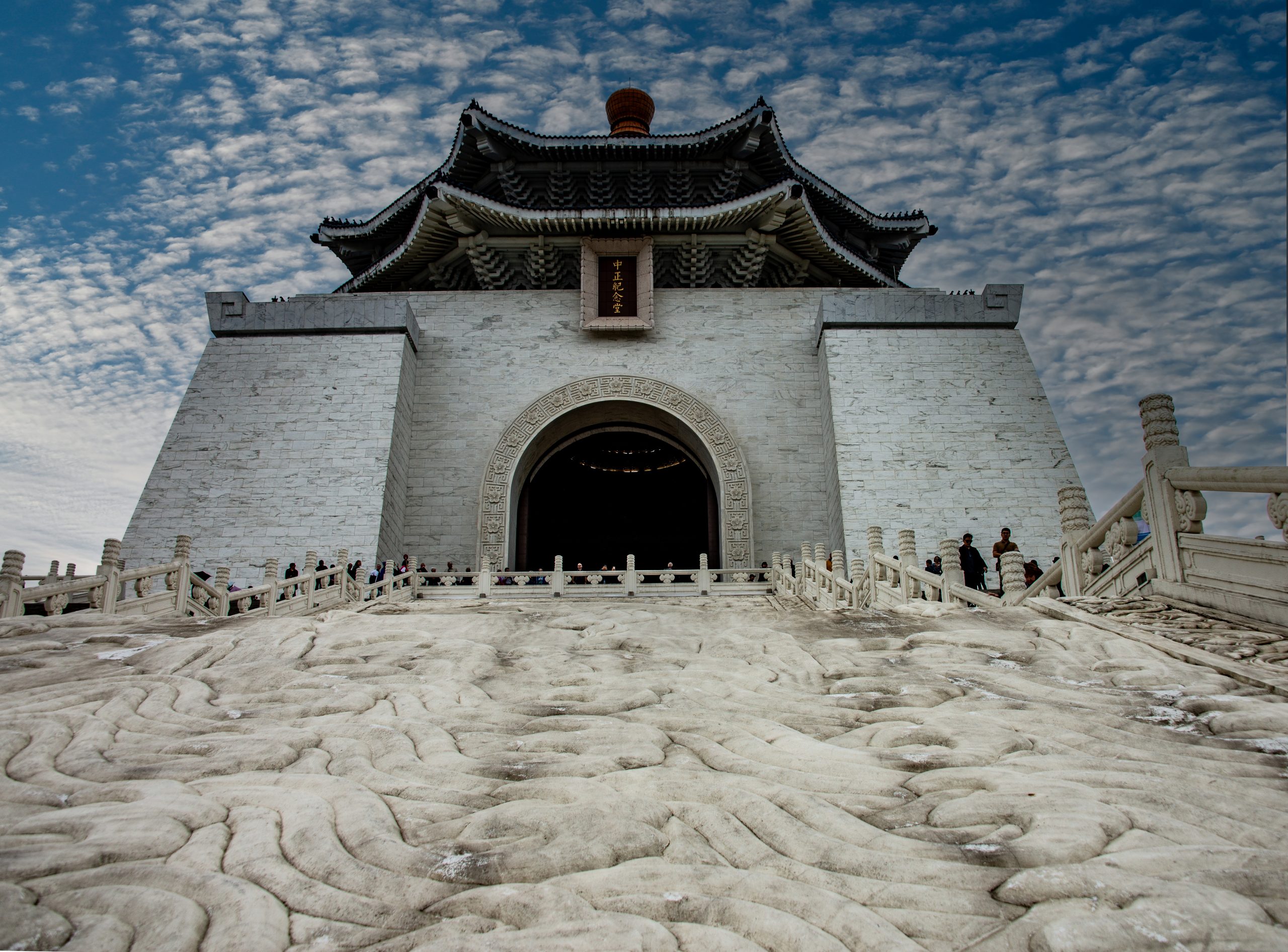
The massive Chang Kai-Shek Memorial Hall was erected after the generalissimo’s death and completed in 1980. Photo by Corey Sandler, all rights reserved.Nearly 50 years after his death, Chang Kai-shek’s star appears to have dimmed considerably, especially amongst younger Taiwanese. Photo by Corey Sandler, all rights reserved.
Today, Taiwan is generally considered a democracy, And Chiang Kai-shek, though his monument dominates a large section of Taipei, is not universally revered by the citizens of the country he helped establish.
Hong Kong: One country, two systems, many questions
Our final call on this trip was to another place with a very complex backstory: Hong Kong.
Hong Kong became a colony of the British Empire after it was ceded by the Qing Empire in 1842. That foothold was expanded in 1860 to the Kowloon Peninsula and again in 1898 to the New Territories.
Like much of this part of Asia, Hong Kong was occupied by Japan from 1941 to 1945 during World War II.
In 1997, the United Kingdom and the People’s Republic completed a negotiated “handover.” Since then it has been a “special administrative region” of the People’s Republic under a purposely vague doctrine called “One country, two systems.”
To my way of thinking, Hong Kong is a place that enjoys a bit more freedom than exists in the People’s Republic, the country of which it is a part and a pretty robust capitalist economy. In theory, that will continue, although the people of Hong Kong have to know that they can only push the boundaries so far.
Hong Kong has its own flag, its own currency, and uses both Cantonese Chinese and English as official languages. You need a visa to cross the border into the People’s Republic of China.
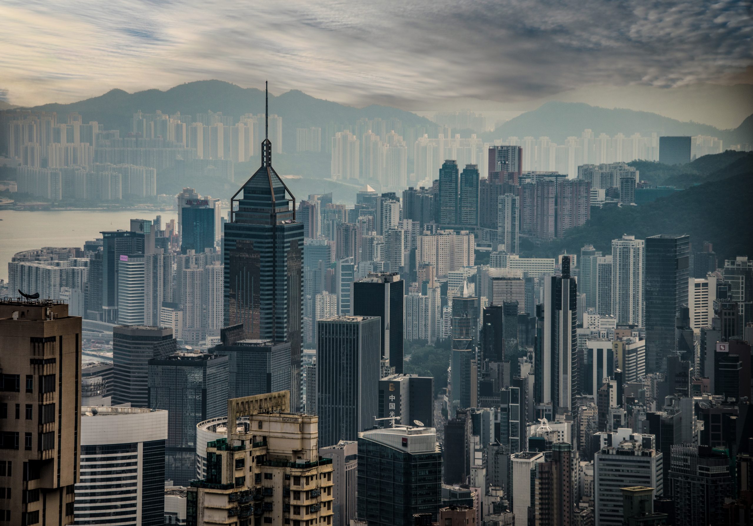
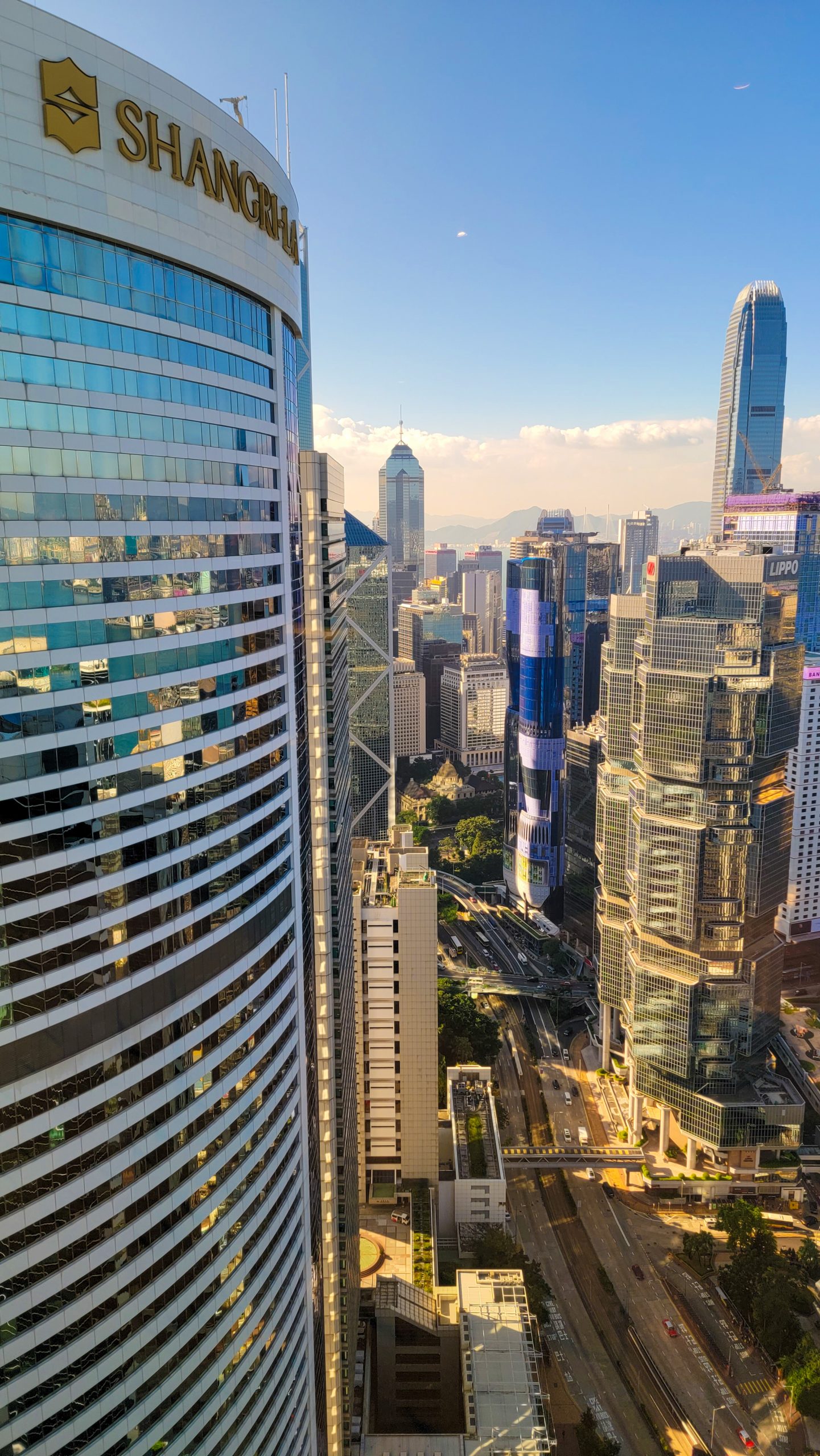
Today, Hong Kong has a bustling economy that is immediately evident when you look at the shops filled with ultra-expensive automobiles and designer cloths and luxury goods. It also, by one measure, has the world’s largest collection of skyscrapers, with nearly 500 structures taller than 150 meters or 490 feet.
Tall trees. Limited and expensive real estate has led to a thicket of skyscrapers on Hong Kong Island and Kowloon, seen here from the top of the tram to Victoria Peak. Photo by Corey Sandler, all rights reserved.Penthouse view. The view from the top floor lounge, a five-star hotel affiliated with an American chain. Down below was a sprawling mall almost exclusively populated by Western outlets of companies like Balenciaga. Brooks Brothers, Burberry, Cartier, Dior, Ferragamo, Hermès, Montblanc, and Prada. Out on the street, salesrooms for ultraluxury cars. Photo by Corey Sandler, all rights reserved.
At the same time, sections of Hong Kong remain very much Old China.
We visited the rabbit warrens of Stanley Market on Hong Kong Island. You could buy just about anything from vendors, up to and including “genuine fake jade.”
The district received its name in recognition of Lord Stanley, the British Colonial Secretary at the time the United Kingdom added Hong Kong as a colony; Stanley would later serve five short terms as British Prime Minister. His second son, Frederick Arthur Stanley, served as Governor General of Canada from 1888 to 1893 and he presented Canada with a trophy for the champion of its ice hockey tournament; the Stanley Cup is still in use in the National Hockey League.
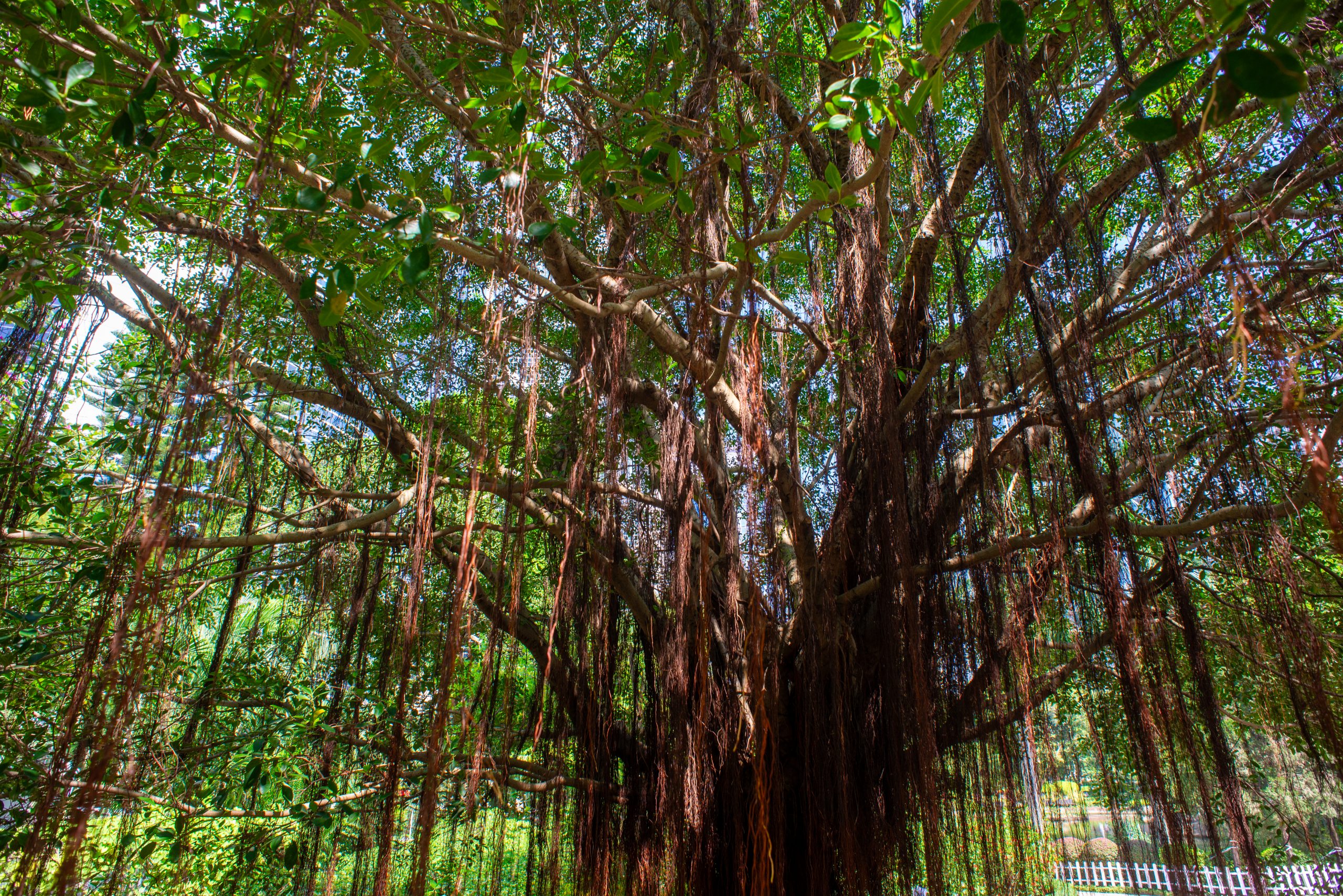
A flower stand built into a banyan tree at Stanley Market in Hong Kong. Photo by Corey Sandler, all rights reserved.
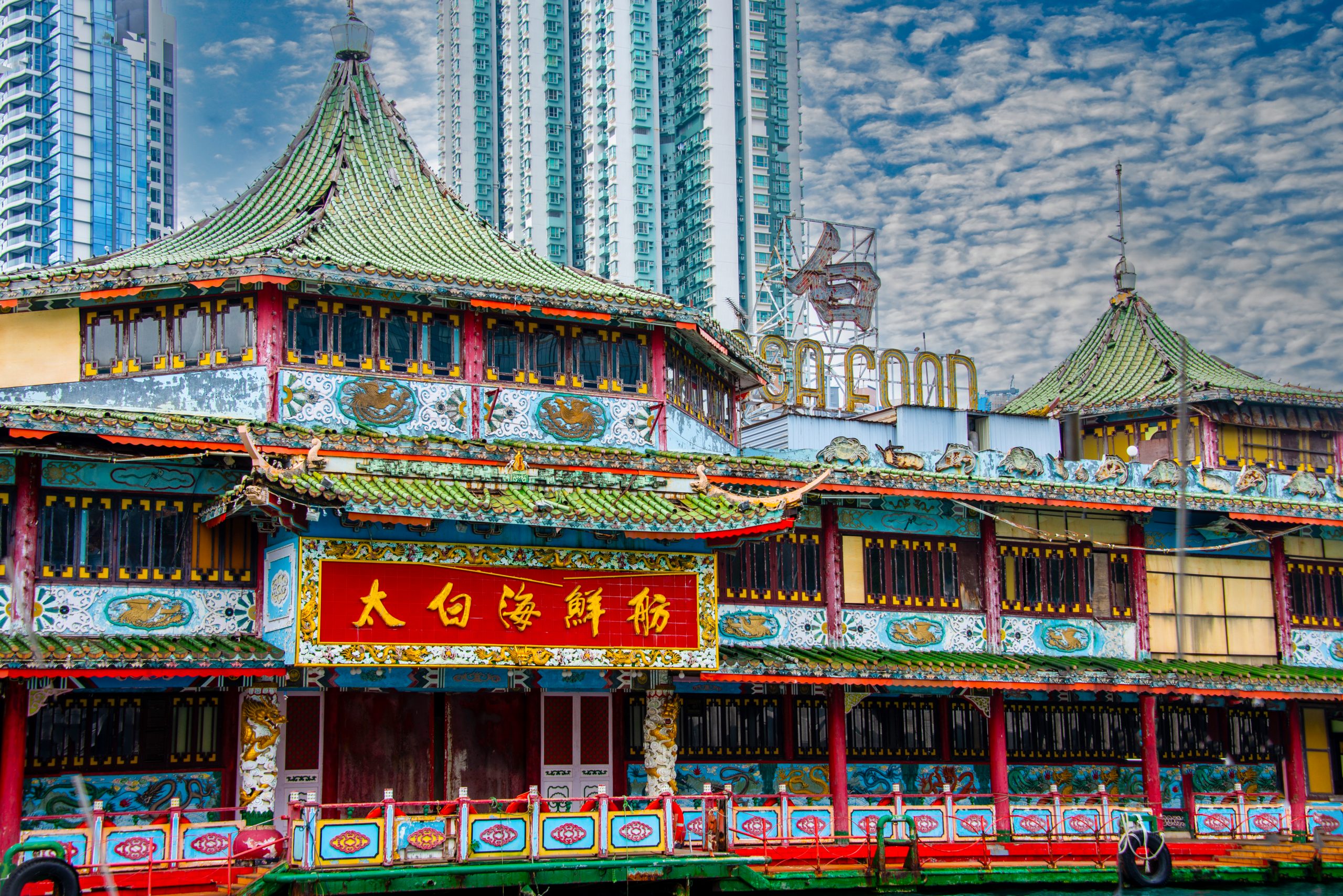
And we also took a motorized sampan tour of Aberdeen Harbour, where many people still live aboard old fishing boats or shacks on shore.
The Taibai Seafood Restaurant. the last of several floating eateries in Aberdeen Harbour. Hong Kong has nine internal harbors. Photo by Corey Sandler, all rights reserved.
And strangely–or perhaps not so in this odd corner of the world–Hong Kong maintains unofficial relations with Taiwan. The cynic in me would observe this allows the People’s Republic a backdoor connection to a place it would otherwise claim to be an illegitimate claimant.
On our last day in Hong Kong, from our luxury hotel surrounded by upscale malls, we went for a walk into Hong Kong Park.
It is a rare piece of manicured greenery in the crowded city center, renovated in 1996 on the former site of Cantonment Hill under British colonial rule and the former location of the Victoria Barracks. One of the restored buildings, Rawlinson House, was the former home of the British Deputy General but today serves a government offices including the Cotton Tree Drive Marriage Registry.
A stand of trees in the park gives a hint of some of the original vegetation of Hong Kong. Photo by Corey Sandler, all rights reserved.
All text and photos copyright 2024 by Corey Sandler, all rights reserved. If you would like to use a photo for personal or commercial use, please contact me.
We arrived at the dawn of 2024 with the world in a parlous state. War, lies, autocrats; they’re all connected.
I wish the solution was as simple as turning the page to a new year.
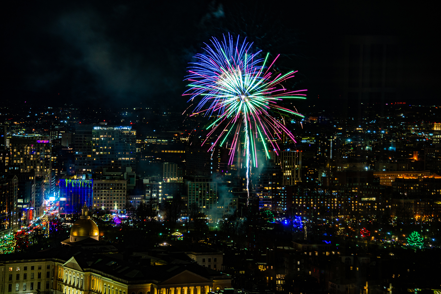
As I watched the New Year’s Eve fireworks over Boston Common and then over Boston Harbor I thought of Leonard Cohen’s “Anthem”:
“There is a crack in everything. That’s how the light gets in.”
Let us try.
Boston Uncommon
The lights come in over the Massachusetts Statehouse and Boston Common. Photo by Corey Sandler, all rights reserved.
Harbor Lights
Midnight over Boston Harbor. January 1, 2024. Photos by Corey Sandler, all rights reserved.
All photos and text copyright 2024 by Corey Sandler, all rights reserved. If you would like to obtain a copy of any of my photos for personal or commercial use please contact me.
Japan sits perched on the edge of the Pacific’s Ring of Fire, which gives it earthquakes, fumaroles, hot springs, and more than a few active volcanos.
And it also holds the unhappy distinction of being the site of the only two atomic bomb wartime attacks: two days in August 1945 which all but destroyed a pair of cities.
A few months ago we returned to Japan for several weeks, and among the places we visited were Beppu, Kagoshima, Hiroshima, and Nagasaki.
Each of these cities, in different ways, made us feel very small when measured against natural and manmade extremes.
Beppu
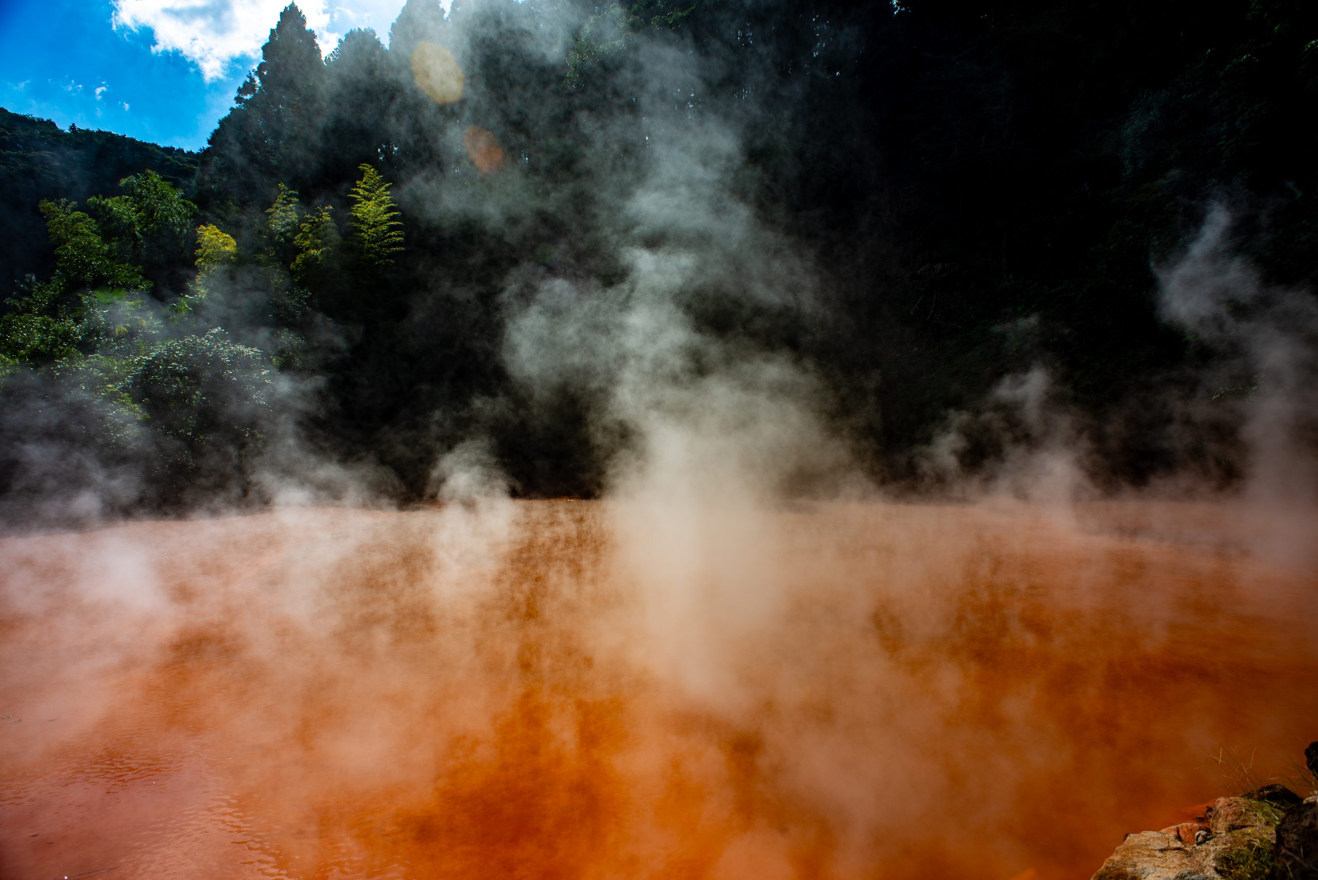
We went to hell in Beppu.
The town on the southern island of Kyushu doesn’t have a heck of a lot going for it, with the exception of its numerous steaming gas vents and eight geothermal hotspots.
In Japanese they are called joguku, which can be roughly translated from Buddhist beliefs as hells. I’m pretty sure that Western visitors and modern residents have seized on a hot topic to lure tourists.
Japanese Buddhism includes the concept of hot and cold regions below the surface of the earth, ruled over by Emma-ō, the lord of death. He judges the dead by consulting a register that lists all of their sins.
Residency is not necessarily permanent; the dead can move out after they serve their sentence or reduce their time by responding to the prayers of the living.
There are turquoise and chalky white and green hells, but the one that grabbed my attention was Chinoike Jigoku, which means “blood hell” or “bloody hell.” Either way, it is more like a hot bowl of rust, which makes sense since its color comes from iron oxide bubbling up to the surface.
Blood Hell in Beppu. Photo by Corey Sandler, all rights reserved.
The ponds were somewhat threatening. Much worse were the souvenir stands which you had to pass through to get to them. Commercial hell, they were, filled with trinkets and candies and bath salts. And lots of kittens.
Kagoshima
A few days later we visited Kagoshima, another relatively obscure port that features an impossible-to-overlook geologic formation.
The local tourism folk would have you call the place the “Naples of the Eastern World.” Not for its architecture or for the invention of that essential food, pizza. What Kagoshima shares with Naples is the fact that it is a city with a hyper-active volcano in very close proximity to just about everything.
Sakurajima is Japan’s most active volcano.
Sakura is the Japanese word for cherry blossom. Jima means island. So, cherry blossom island.
Only it is no longer an island. In 1914, the last major eruption connected it to the mainland with a narrow spit of land.
Sakurajima is almost constantly erupting, sending plumes of fine ash and smoke into the sky. It was active all day when we were there, but luckily the wind was blowing away from downtown and the port where our ship was tied up.
Residents of the city, population about 680,000, regularly participate in shelter drills; schoolchildren wear hard hats. Scientists says the stratovolcano could produce a major event at almost any time.
We took a 15-minute ferry from town to Sakurajima to look around; we scuttled back to the ship for lunch with a view.
On June 17, 1945 about half the city was destroyed by incendiary and cluster bombs dropped by American aircraft, part of the preparation for the expected land invasion of Japan.
Sakurajima in the morning from Kagoshima port. Photo by Corey Sandler, all rights reserved.Later in the day, the setting sun illuminated a more active Sakurajima. It was impossible not to think of an atomic mushroom cloud. Photo by Corey Sandler, all rights reserved.
Hiroshima
The last two Japanese cities in this month’s blog are forever etched into world history: Hiroshima and Nagasaki.
On August 6, 1945 the first use of an atomic bomb killed about 90,000 people in Hiroshima; the final death toll, including those who died later of injuries and radiation sickness was about 160,000.
Modern Hiroshima is a prosperous city, and it is almost possible to forget what happened there. That is until you come to the park near its center. There are a few monuments, a large bronze bell, and along a river bank the Genbaku Dome, the Hiroshima Peace Memorial.
The people of Hiroshima chose to leave standing the shell of the former Hiroshima Prefectural Industrial Promotion Hall. The city has been rebuilt all around, but the dome is intended to be forever a ruin.
After the visit to the dome, I spent the afternoon re-reading one of the great works of American non-fiction, John Hersey’s book “Hiroshima,” first published in 1946 just after the one-year anniversary of the blast.
The piece occupied all of the editorial pages of a single issue of the New Yorker magazine, telling of the aftermath of the blast through the stories of a handful of survivors. Not that I needed the lesson, but it was especially sobering to read the book while at the dock a few miles from the hypocenter of the first atomic bomb.
The Hiroshima Peace Memorial, forever in ruins. Photo by Corey Sandler, all rights reserved.The A-Bomb detonated at 8:15 in the morning on August 6, 1945. I took this photo 78 years later as the morning sun breached the skeleton of the hall. Photo by Corey Sandler, all rights reserved.
Nagasaki
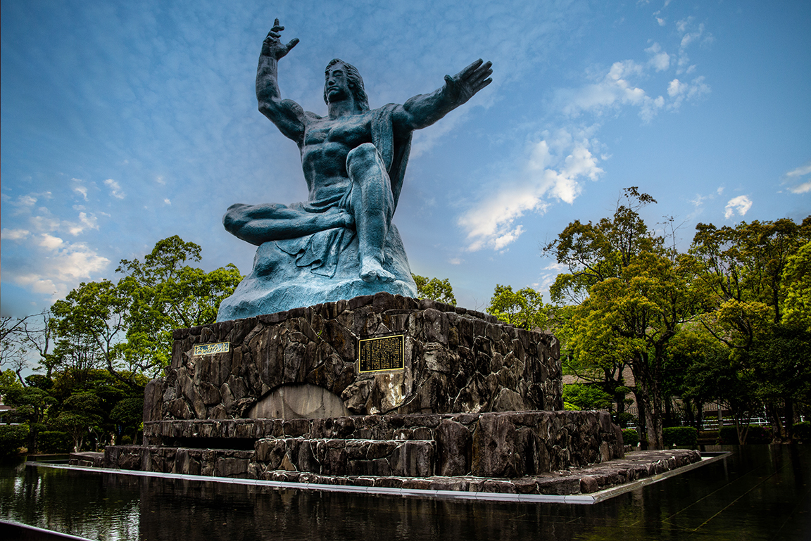
While Hiroshima chose the stark reality of a ruined building at the hypocenter of the first atomic bomb blast, the people of Nagasaki took a different approach. There is also a gaping hole in that city, but they chose to build a park of monuments contributed by countries around the world, speaking to the hope for peace.
Nagasaki was bombed on August 9, 1945. It was not the original target for the second atomic bomb; the intent had been to strike Kokura but that city was obscured by clouds.
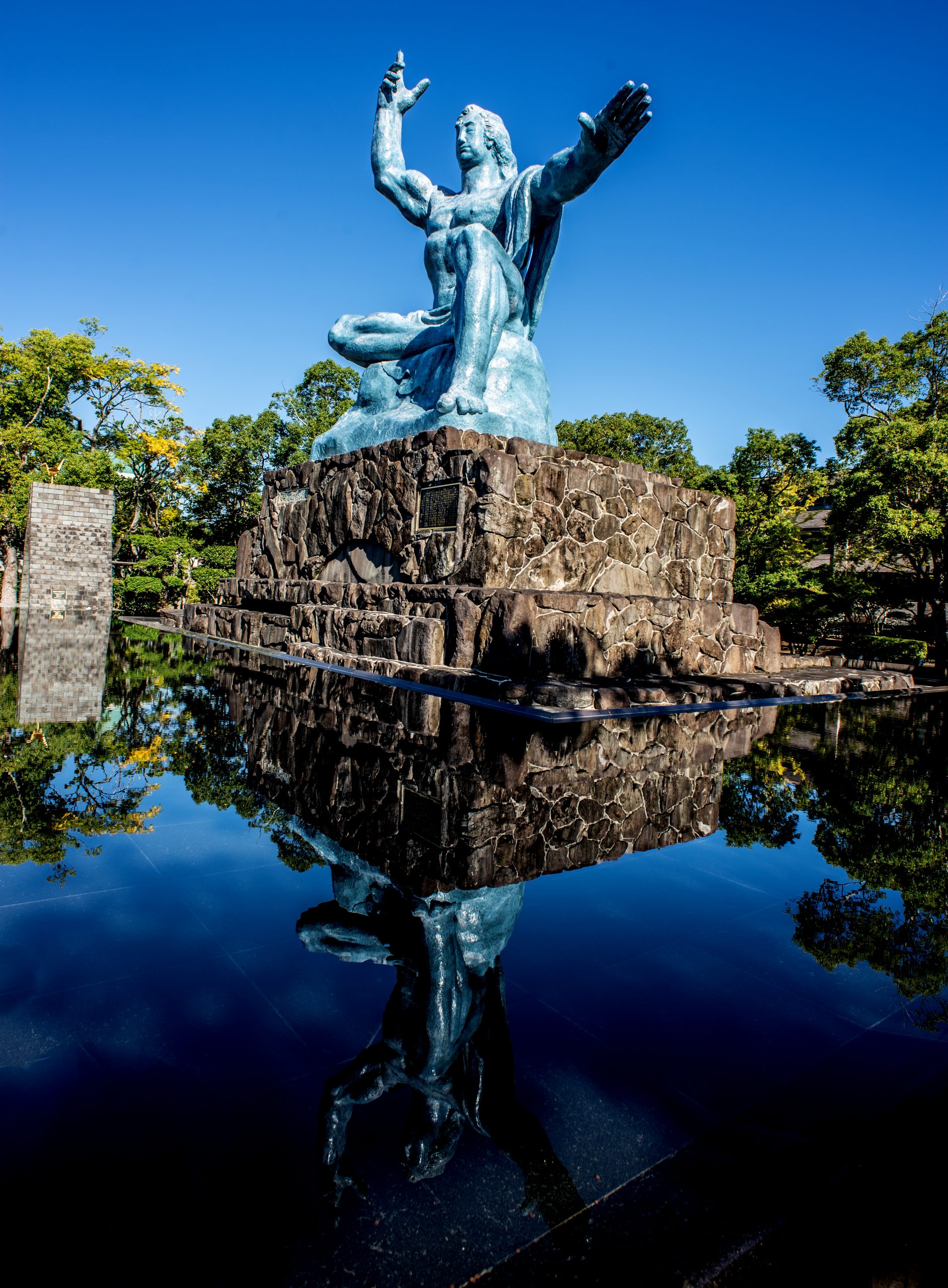
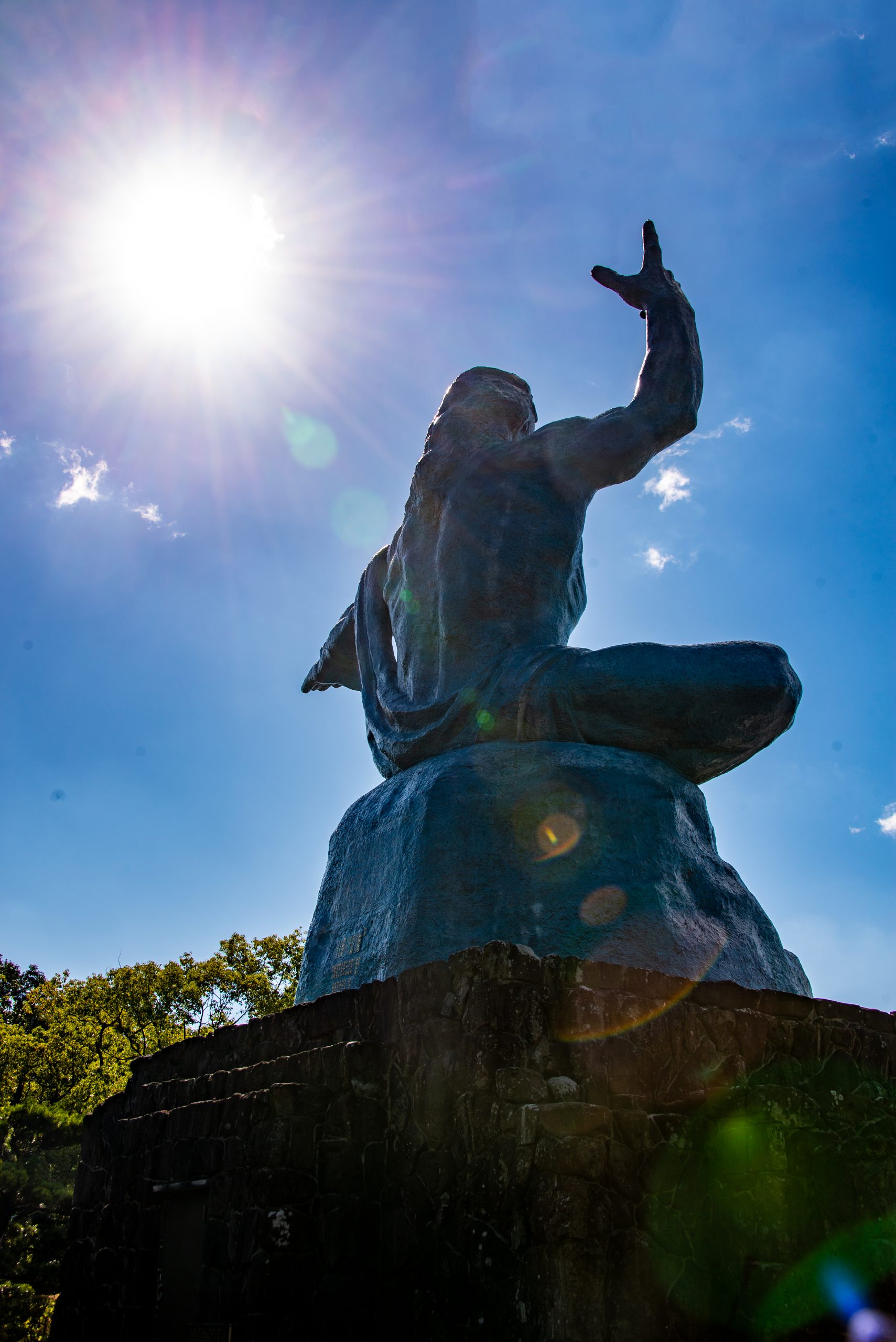
At the center of the bomb’s destruction today is the Nagasaki Peace Park. At one end is the Peace Statue, about 10 meters or 33 feet tall.
The statue mixes eastern and western art, religion, and symbology.
The right hand points to the sky, to where the bomb was dropped. The left arm extends outward to symbolize peace. One leg is folded in a meditative stance, the other extended as if to stand up and offer solace and help.
The Peace Memorial in Nagasaki. Photos by Corey Sandler, all rights reserved.
At the end of the trip, in late October, we began the long trip home to Boston. The first leg was a flight from Hong Kong to Tokyo.
As we reached the bottom of the home islands of Japan I noticed a city with a mountain and a plume of smoke rising up toward us. I checked our location on the airplane’s seatback video map: it was Sakurajima in Kagoshima.
Sakurajima from 35,000 feet aboard our airplane heading home. Photo by Corey Sandler, all rights reserved.
Next month I will conclude my observations on our Asian trip with notes and photos from two places that are betwixt and between modern powers: Taiwan and Hong Kong.
All text and photos copyright 2024 by Corey Sandler. If you would like to use an image for personal or commercial use, please contact me.
We came to Tokyo five days ahead of our cruise to allow us some extra time to explore some of the less-visited sections of the city. It also didn’t hurt to have a few extra days to acclimate to the 13-hour time zone change.
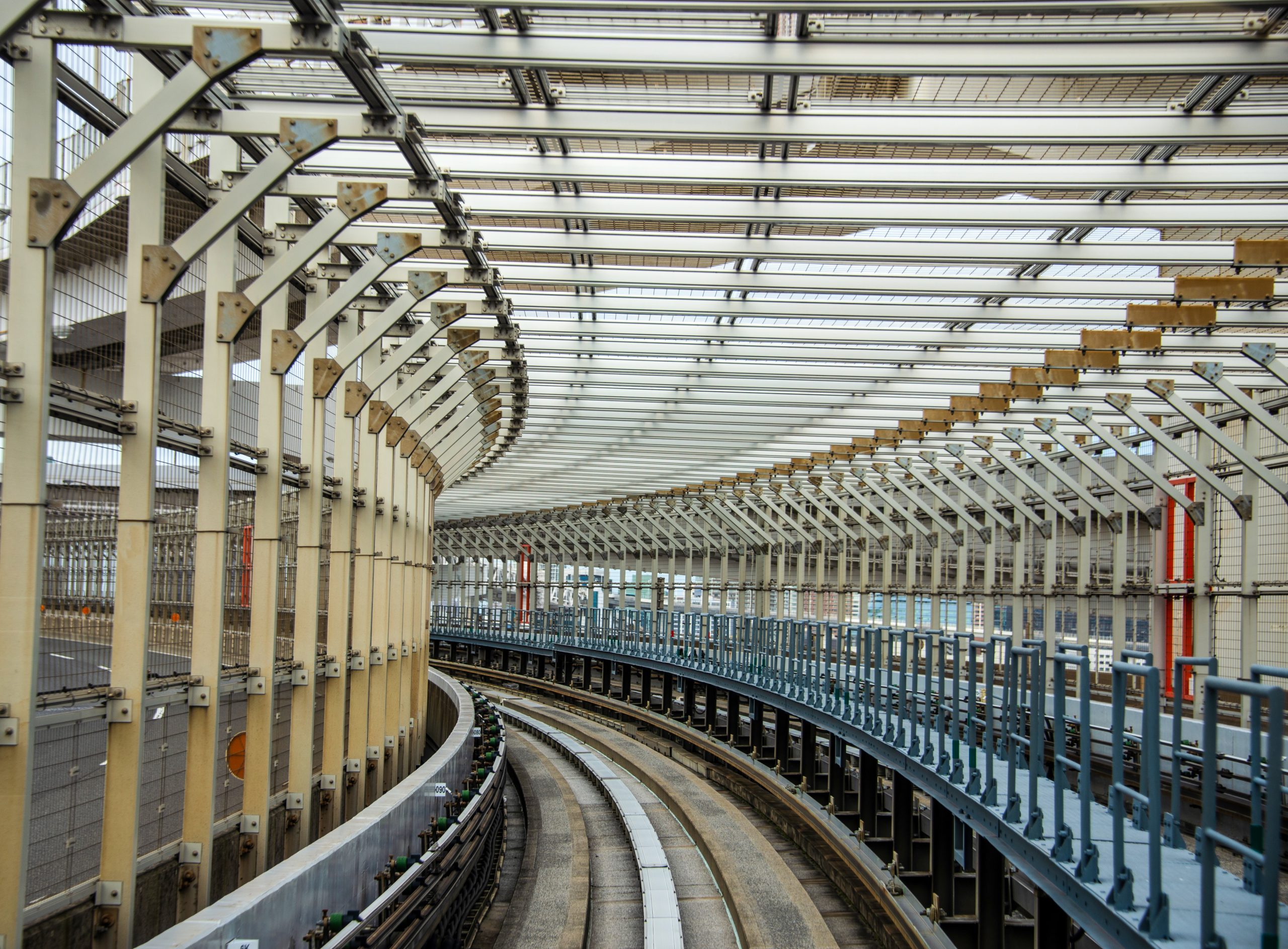
We stayed in a modern hotel in Tokyo’s Odaiba district, a very modern very strange place that includes several vertical malls, a replica of the Statue of Liberty, a massive model of Unicorn Gundam (look it up and feel free to explain it to me), and half a dozen or so stations on the driverless Yurikamome system that connects to Tokyo’s 11 other more conventional subway lines.
The guideway for the automated Yurikamome line as it crosses the Rainbow Bridge from the artificial island Odaiba to Tokyo. Photo by Corey Sandler, all rights reserved.
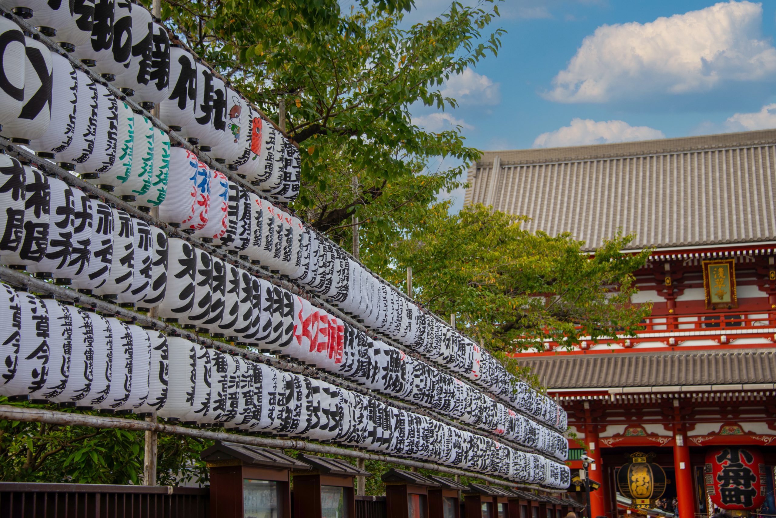
On our first day we went to the Asakusa Sensoji Temple, the oldest Buddhist temple in Tokyo, dating in its original form to the year 645. The shrine at the site is much younger, built in 1649. Both were severely damaged in World War II when much of Tokyo was fire-bombed, but have been rebuilt as they were.
The approach to the temple presents a religious site of a different sort, an outdoor market of several blocks called Nakamise. It’s the place to go for essentials like ornate fans or simple summer kimonos called yakuta. On the day of our visit, a Saturday leading up to a holiday, the stretch of stores was probably the most crowded place I’ve visited since the onset of the pandemic.
The entrance to Asakusa Sensoji Temple in Tokyo. The painted lantern-like signs carry the names of messages of merchants and individuals who have made contributions to the temple. Photo by Corey Sandler, all rights reserved.
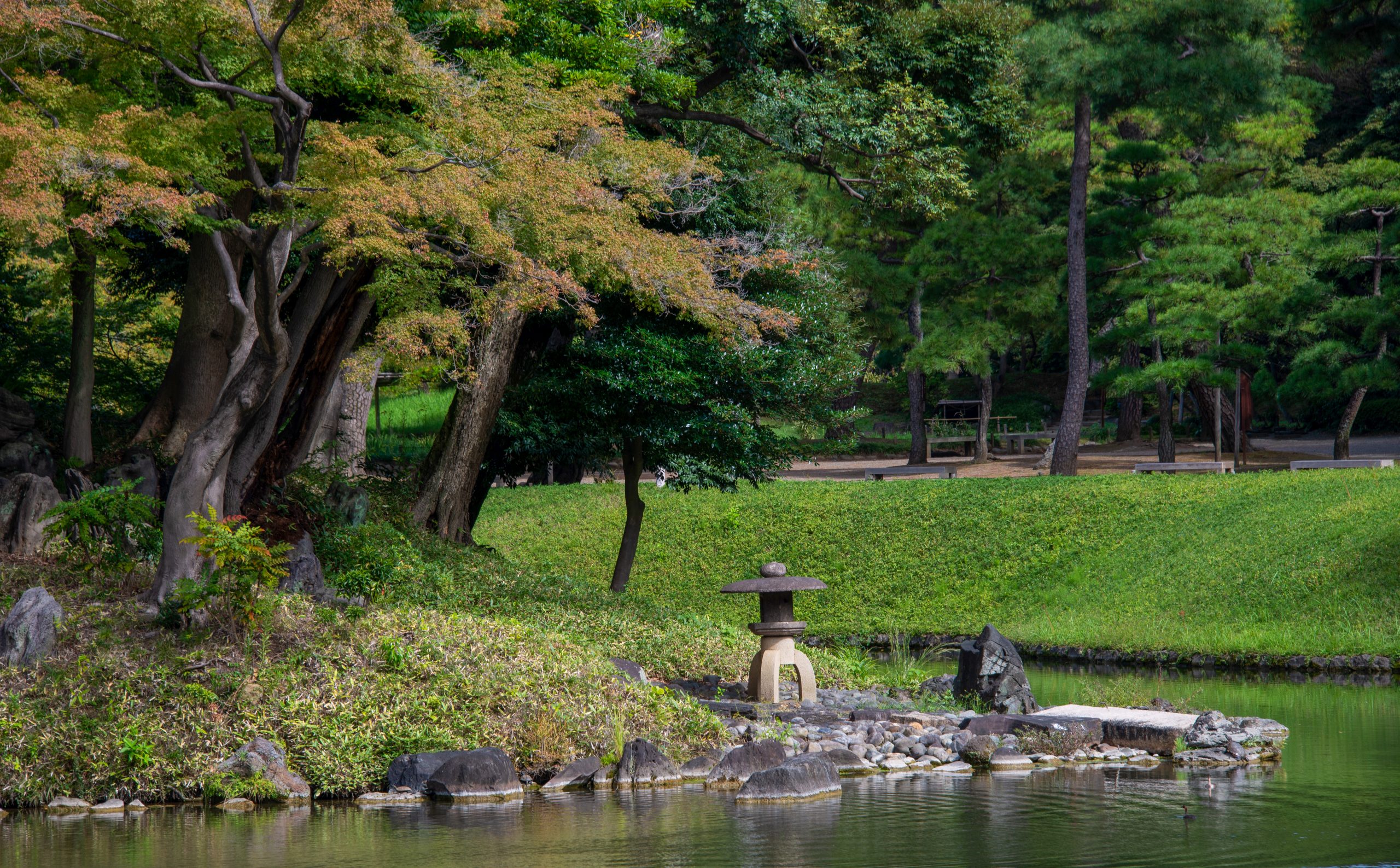
Another expedition took us through the spaghetti bowl of subway lines to a much quieter part of Tokyo, the Koisikawa Kōrakuen park in the Bunkyō district, a formal Japanese garden that dates from the early Edo period of Japan. The garden was established in 1629 and has been mostly left untouched as modern Tokyo grew around it.
It’s very easy to time travel within Koisikawa Kōrakuen, and the thick greenery helps isolate the ancient park from modern intrusions nearby, including the Tokyo Dome baseball stadium and an amusement park. Photos by Corey Sandler, all rights reserved.
A few days later we were in Osaka, Japan’s third most populous city (after Tokyo and its close neighbor Yokohama.)
This is the nation’s financial center, and also the home of a few of its largest electronics makers Panasonic, Sharp, and Sanyo.
There are some spectacular pieces of modern architecture in the city, but that’s not what we were looking for on this visit. Instead, we went to a very impressive piece of very old construction.
Sumiyoshi-taisha is a Shinto grand shrine, first established in 211 and modestly updated over the years. It was at first closely connected to imperial trade with China.
Sumiyoshi-taisha shrine in Osaka. Photo by Corey Sandler, all rights reserved.Colorful banners at the shrine reference donations by individuals and companies. Photo by Corey Sandler, all rights reserved.The Taiko-bashi bridge stands at one of the approaches to the main shrine. Photo by Corey Sandler, all rights reserved.A wedding ceremony at the shrine, taken at a respectful distance with a long telephoto lens. Photo by Corey Sandler, all rights reserved.
Next month I’ll post some photos from places where Japan’s ring of fire comes to the surface, the southern towns of Beppu and Kagoshima and also scenes from our visit to the atomic bomb cities of Hiroshima and Nagasaki.
All photos and text copyright Corey Sandler, 2023. If you would like to use a photo for personal or commercial use please contact me.
When you imagine Japan, do you conjure Samurai warriors?
Stealthy, lethal Ninjas?
Fierce soldiers who held out against overwhelming forces throughout World War II, including against overwhelming force in the final months?
Or…do you think of modern Japan as something very different?
Pokémon and Sailor Moon? Furry mascots for sports teams, corporations, and municipal governments?
And above all, kittens.
We’ve just returned from another trip to Japan. That marks twice in six months we have ventured to the far extremes of jet lag, a 13-hour flight and 13 time zones. Being there was great; getting there and back was grueling.
This time we met up with Viking Orion, sailing from Tokyo to central and southern Japan and then on to Taiwan and Hong Kong.
To me, one of the great joys of travel is to go where life and culture are different.
When I am away, I do not want to feel at home. I want to go down the rabbit hole with Alice to a place where the more you explore the curiouser and curiouser things become.
I was born just after the end of World War II and that makes me of the age that knew of fierce Japan, ruined Japan, and resurgent Japan. The country, most of its cities and ports reduced to rubble, literally rose from those ashes to become an economic powerhouse.
And though Japan was greatly changed by the war and by the mostly positive efforts of American occupation led by the intriguing General Douglas MacArthur, it rebuilt itself with a culture that took many things Western and turned them toward the East.
An arcade in a huge shopping mall in Tokyo’s Odaiba district topped by a massive model of Unicorn Gundam, a Japanese novel turned manga turned anime about space-traveling Transformer-like machines…or something like that. Photo by Corey Sandler, all rights reserved.
The first time I visited Japan, in the 1980s, I was bewildered by the unfamiliar colors of familiar objects like refrigerators and cars: lime green, tangerine, pink. Today, the color scheme has moved more toward neutral Western white, silver, and black.
But there are still some very perplexing examples of things that seem somehow lost in translation.
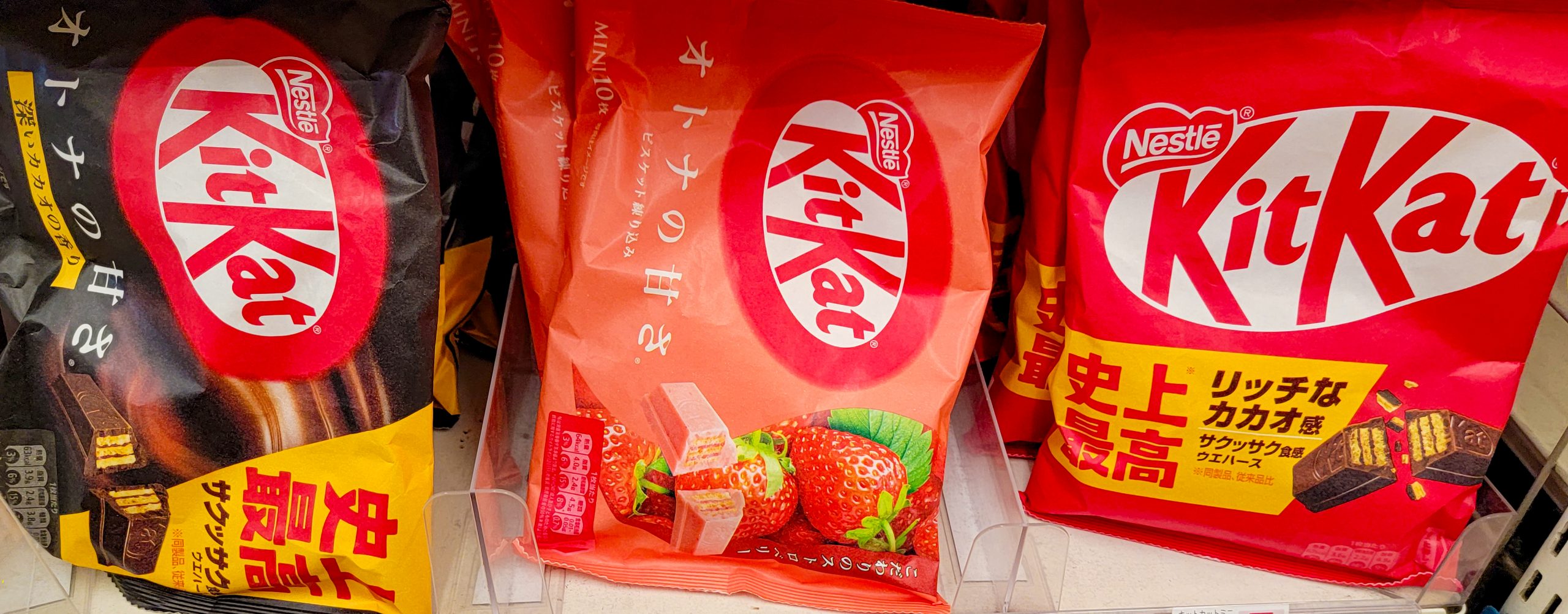
Consider the humble KitKat chocolate bar, a British invention now owned by the Swiss confectionary maker Nestlé, except for an American offshoot produced by Hershey. KitKat arrived in Japan in the 1970s when rights were acquired by Fujiya, which makes and sells brands including Look, Heart, and Milky chocolates and jellies.
In Japan, you can still buy the traditional chocolate bars, but why go for the familiar when you can also find KitKats in Dark Matcha (chocolate and green tea), Chestnut, Sweet Potato, Caramel Pudding, or Melon?
Alas, some of the 70 or so varieties are produced in small batches and only sold for short periods of time.
We stopped at several dozen convenience stores and other shops in search of our holy grail: KitKat Wasabi. Never found it, but there’s always next time.
KitKat in Japan, shown here in dark chocolate, strawberry, and traditional varieties. We hunted far and wide for the elusive wasabi flavor. Photo by Corey Sandler, all rights reserved.
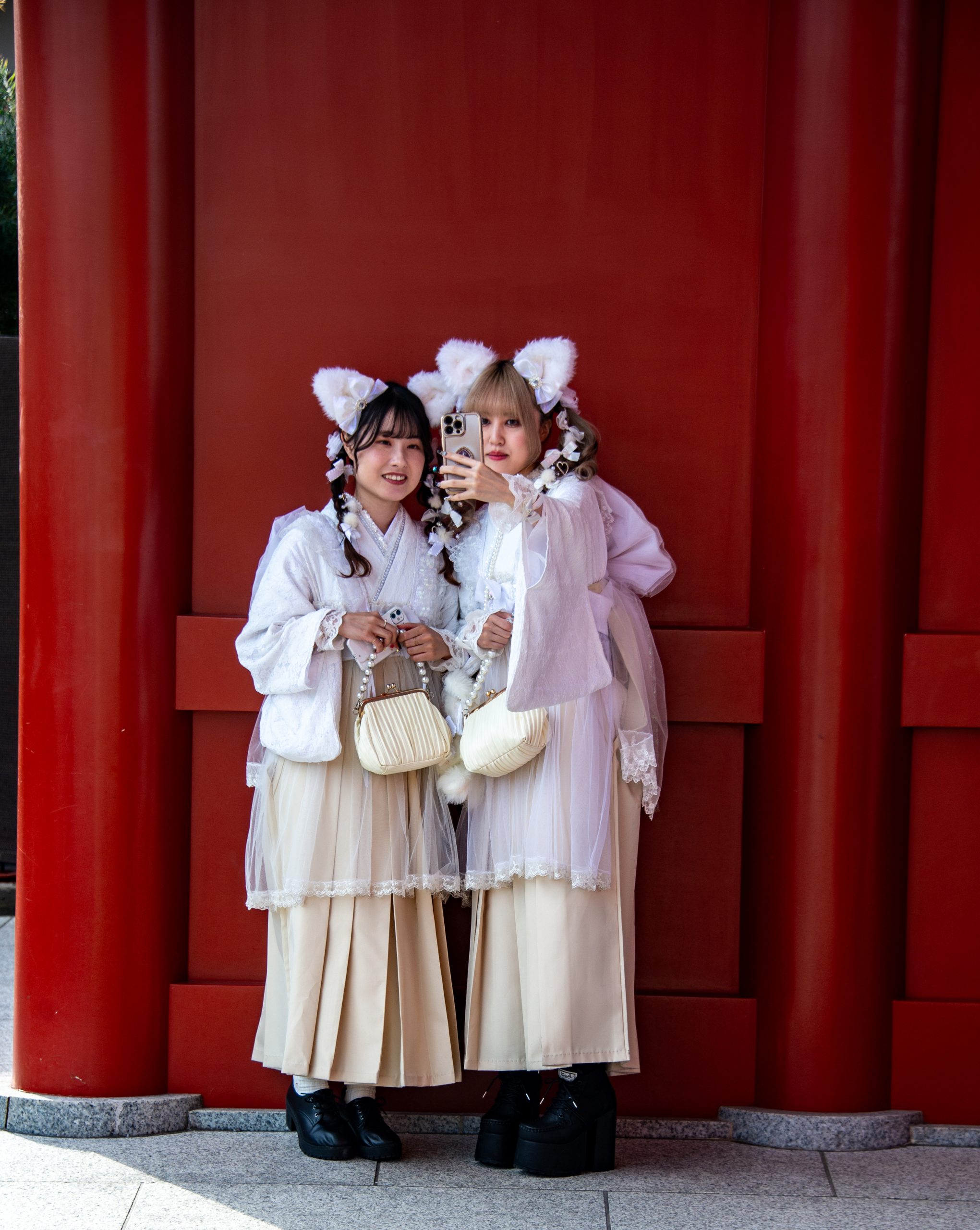
But for me the greatest source of wonderment in Japan is kawaii: the national fixation on cuteness.
I will not pretend to be a sociologist here.
I will observe that in many places around the world young girls seem to be engaged in a race to dress like, act like, and otherwise seek a very early entry into womanhood. In Japan many instead seem to be holding fast to childhood.
Kawaii girls pose for a selfie at Asakusa in Tokyo. Photo by Corey Sandler, all rights reserved.
I say young girls, because that seems to be the heart of kawaii, but there are also a sizeable contingent of young boys who do not easily put away childish things. Think Nintendo and anime comics and Japanese Boy Bands.
Kawaii (可愛い) means adorable or cute. There are cute girls and cute boys, and also kittens, lots of kittens.
Kittens everywhere. Photo by Corey Sandler, all rights reserved.
The hyperactive Japanese game and music and merchandising industries have extended that concept to cute categories within manga (comics or graphic novels) and anime (animated cartoons.)
Say hello to Super Mario Bros., Hello Kitty, and Pokémon.
Pokémon Center in Hiroshima, not far from the hypocenter of the world’s first atomic bomb. Photo by Corey Sandler, all rights reserved.
And then there are the mascots. Nearly every sports team, major corporation, store, city, and prefecture has a kawaii character.
The official mascots of the port of Shimizu, in the shadow of Mount Fuji. Shimizu is also the home of the S-Pulse football team, and S-Pulse mascots and characters are everywhere. Very cute. Photo by Corey Sandler, all rights reserved.The S-Pulse amusement park, with cute characters, in Shimizu. Somewhat incongruously, the yellow sign at the left points out tsunami escape routes. Photo by Corey Sandler, all rights reserved.
KitKat’s maker, Fujiya, is represented by Peko-chan, a girl in pigtails licking her lips. Peko-chan, to me, looks like a somewhat updated version of Anne of Green Gables, the fictional heroine of books by the Canadian author Lucy Maude Montgomery.
Anne, sometimes called Anne of Red Hair, took hold in the postwar years when American occupation forces imported the book as part of an effort to liberate Japanese girls from traditional gender roles. And very kawaii, too.
Certainly not every Japanese female has gone kawaii. But a stroll through Tokyo, especially on the weekend, leaves you almost surrounded by Lolita fashion, ribbons, bows, and parasols. Makeup styles aim to accentuate large, round doll-like eyes.
In the United States, many young girls play-act adult roles with Barbie dolls. Barbie is not a big factor in Japan, but instead there is Licca, a doll modeled after an 11-year-old girl.
So why kawaii? It could be seen as a way to seek a return to innocence in a country that was ravaged by war, including the horrors of two atomic bombs. In the 1950s, kawaii came into being…at the same time as Godzilla and his competitors. Curiouser and curiouser.
One of General MacArthur’s legacies is a constitution that renounced the right to wage war, at least in theory.
Or perhaps, sociology-wise, a broader move away from the strictures of the samurai, ninjas, and geishas.
Tokyo itself, the capital of the island nation and home to many things old and revered in Japan, has several conflicting personalities. Modern architecture ranges from emulation of things western like the expensive shops on the Ginza and the Eiffel Tower-like Tokyo Tower to inscrutable oddities like cartoon characters surrounding office buildings and very unusual decor at major corporations.
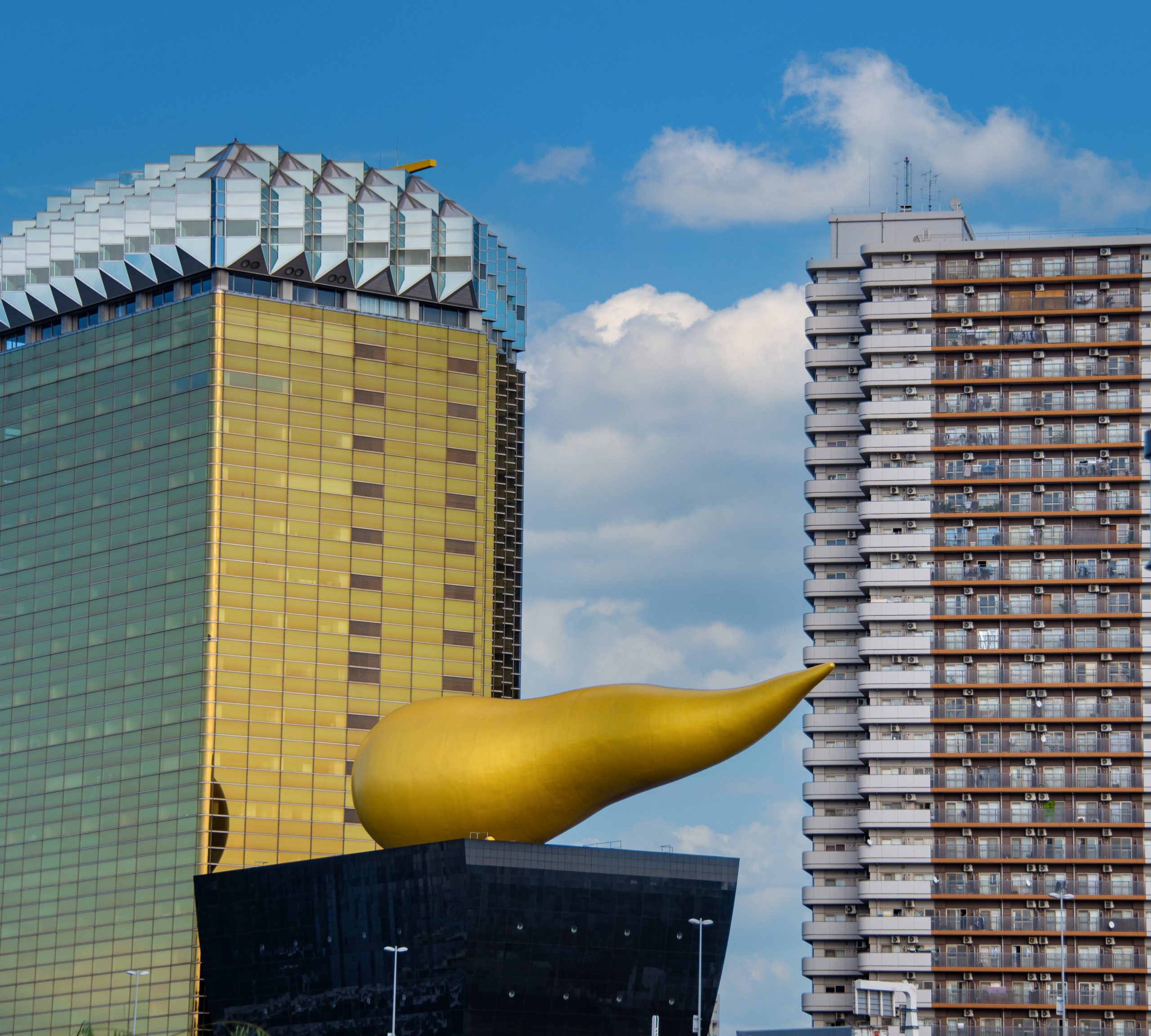
Guardians of the universe outside an office block in Tokyo. Photo by Corey Sandler, all rights reserved.A sorta-cute representation of a golden frothy head atop the headquarters of Asahi Brewerieson the banks of the Sumida River in Tokyo.Locals have other, scatalogical, nicknames for the sculpture. Photo by Corey Sandler, all rights reserved.
I’ll be back next month with photos and observations from other stops on this cruise, including the heavily freighted worlds of Hiroshima and Nagasaki, a visit to the neighborhood erupting volcano in Kagoshima, a drop-in in Taipei, Taiwan and a steamy time in schizophrenic Hong Kong.
All photos and text copyright 2023 by Corey Sandler, all rights reserved. If you would like a copy of a photo for personal or commercial use please contact me for permission.
I am told that this past summer was a particularly hot and uncomfortable season in much of the United States and Europe and elsewhere. I cannot testify to that, because as chance would have it we spent much of that time in places that ranged between cool and cold.
For the month of July, temperatures soared in the American West, the big cities of the central states, and much of Western Europe. In Athens, Greece authorities shut down the Acropolis for much of the month for the safety of tourists, guards, and various caryatids.
During the heart of the summer, we were in Sweden, Norway, the Faroe Islands, and Iceland, and wearing sweaters and jackets.
We returned to Boston for a three-week rainy and relatively temperate break in August and then departed for a cruise from New York to Nova Scotia, Greenland, and another circuit around Iceland. By the end of the cruise aboard Viking Saturn, we were in winter coats watching the first snow of the season land on the peaks of eastern Iceland.
Here is some of what we saw in September.
Down the Hudson River
We boarded Viking Saturn at New York’s historic cruise terminal along the West Side of Manhattan, near what used to be known as Hell’s Kitchen and later was the site of the tenements that formed the backdrop for “West Side Story.”
Today mid-Manhattan is mostly populated by soaring office and apartment towers. Our ship backed out of the pier and then headed south, down the Hudson River toward the open ocean.
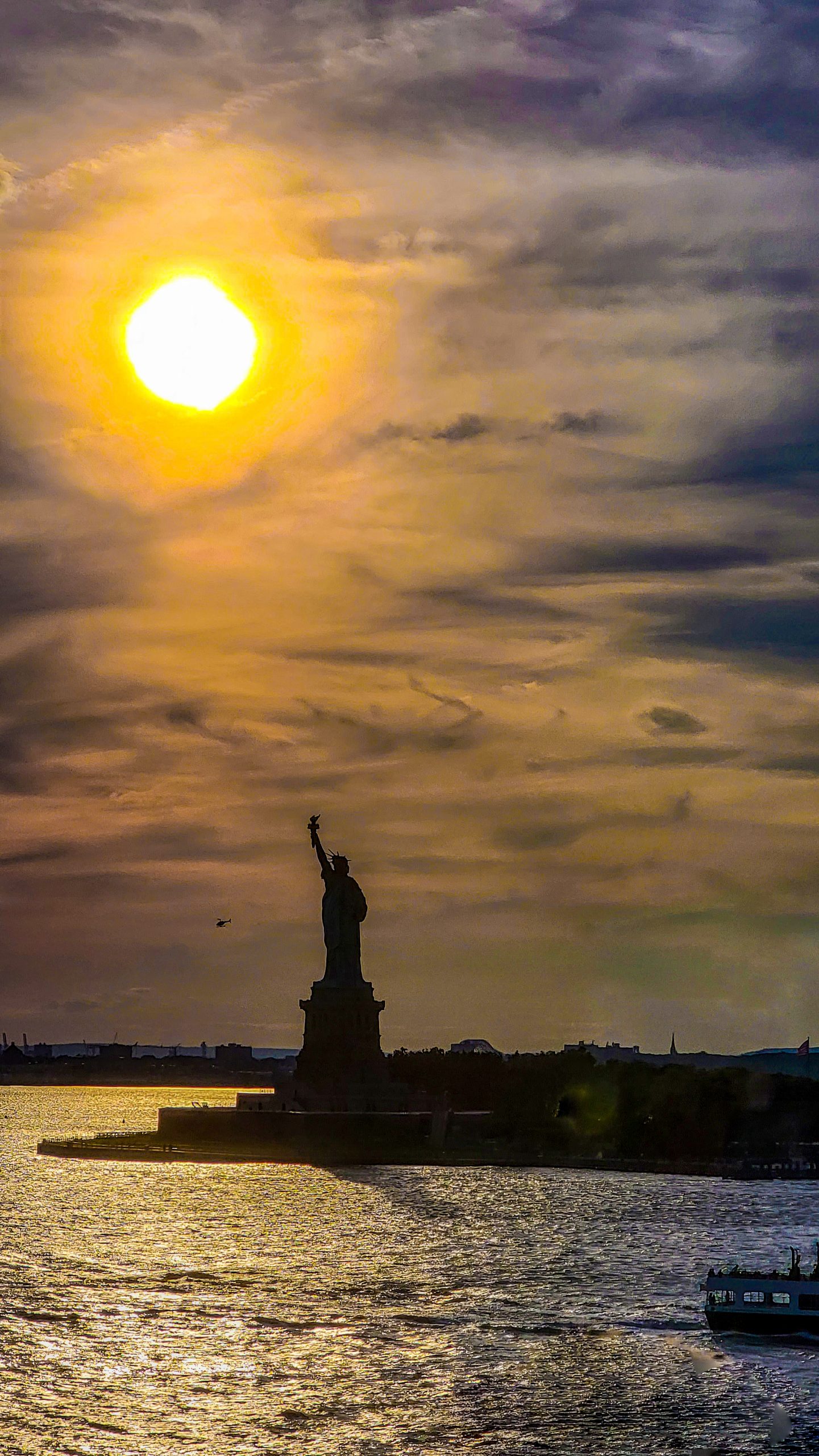
Lady Liberty in New York harbor as we began our journey in late afternoon. Photo by Corey Sandler, all rights reserved.
Halifax Puts on a Show
The handsome city of Halifax, Nova Scotia always sparkles.
It is home to one of the world’s largest natural harbors, vying for second place (behind Sydney, Australia) with Cork, Ireland or perhaps Poole in Dorset, England or Falmouth in Cornwall, England.
It is big by any measure, and it also holds the astounding story of the Halifax Explosion on December 7, 1917 when a munitions ship collided with another vessel creating the largest manmade explosion until the dawn of the Atomic Age.
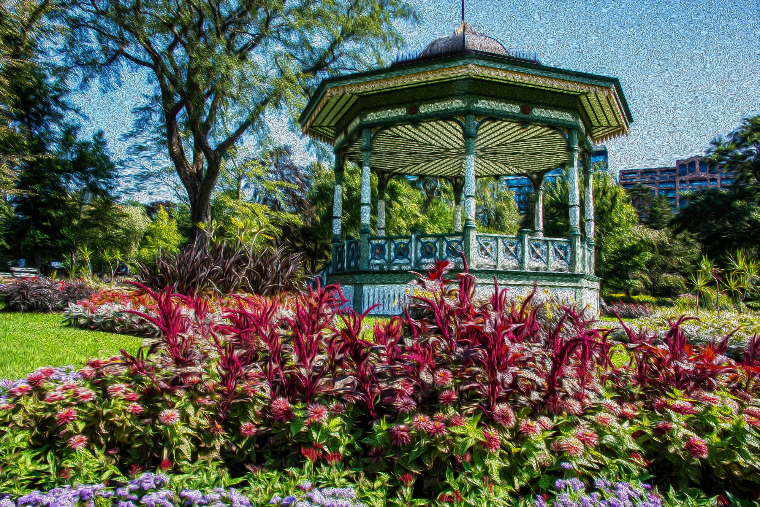
Among its gems is the Public Gardens, a formal Victorian garden established in 1867, the year of Canadian Confederation. No matter what the season, they always have something wondrous to show.
Thinking of its long an illustrious history, on this visit I applied a photo filter that mimics the look of an oil painting.
The Bandstand at the heart of the Public Gardens is used for public performances. Photo by Corey Sandler, all rights reserved.
Small Towns on the World’s Largest Island
We moved east to make two calls in Greenland, an autonomous territory of the Kingdom of Denmark that they used to refer to as Grønland. To be politically correct today, its official moniker in the Kalaallisut language is Kalaallit Nunaat. Kalaallisut is a dialect related to Inuktitut spoken by many Inuit tribes in northern Canada.
The vast island is home to only about 57.000 people and nearly all of them live in small communities that ring its west, south, and east coasts. The interior is still nearly unpopulated, with about 81 percent of the land covered by the vast Greenlandic Ice Sheet. Huge pieces of glaciers calve off every summer and mostly head west and south down the coast of Atlantic Canada and New England; it is believed that the iceberg that met the S.S. Titanic followed that route.
The economy is based on fishing and a bit of tourism, as well as the operations of an air base established by the United States during World War II and now under local control.
Scientists are concerned about the loss of the ice cover of Greenland as the climate changes; along with the effects on the global sea level there is also the mixed blessing of possible exposure of mineral and petroleum deposits in this otherwise nearly pristine place.
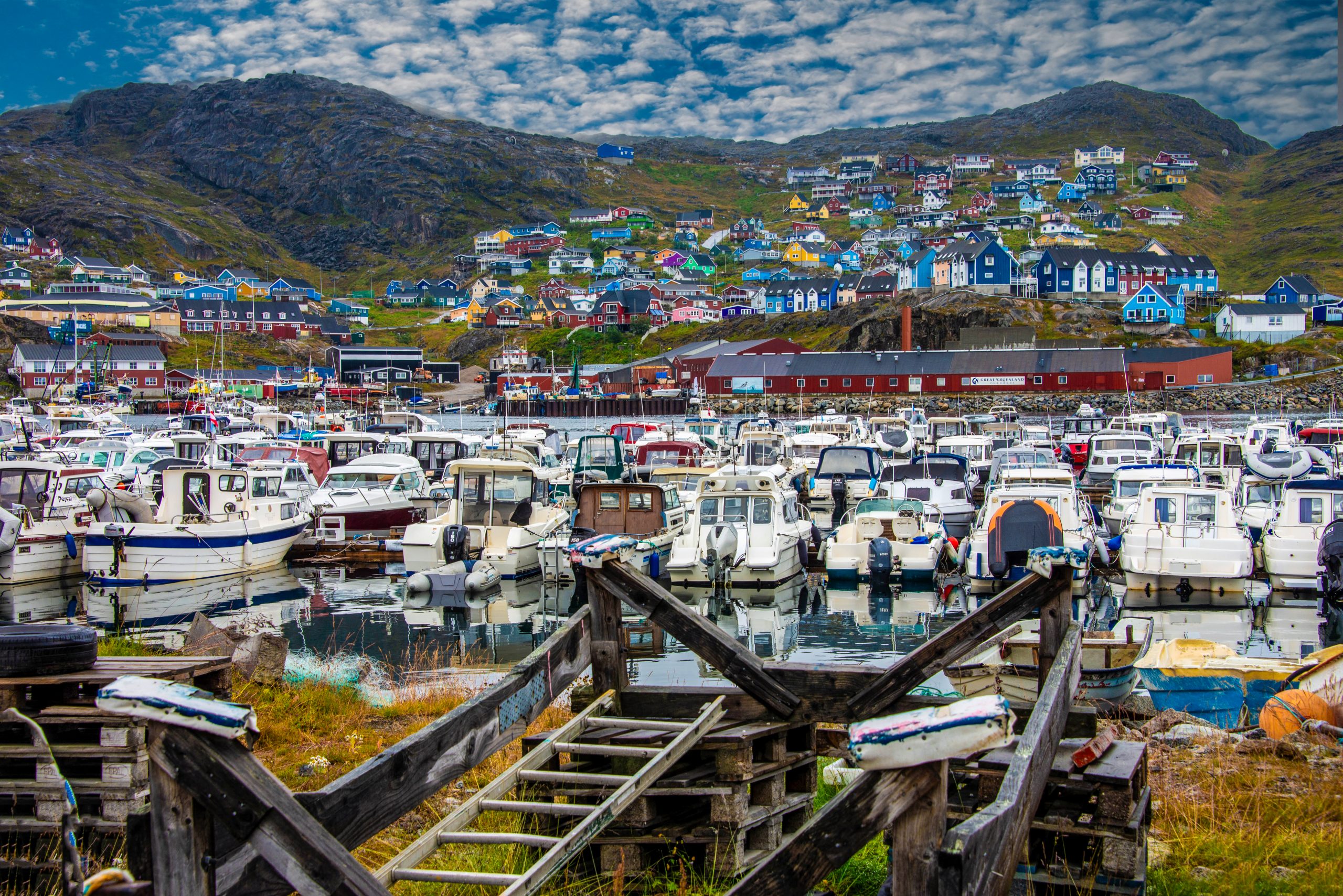
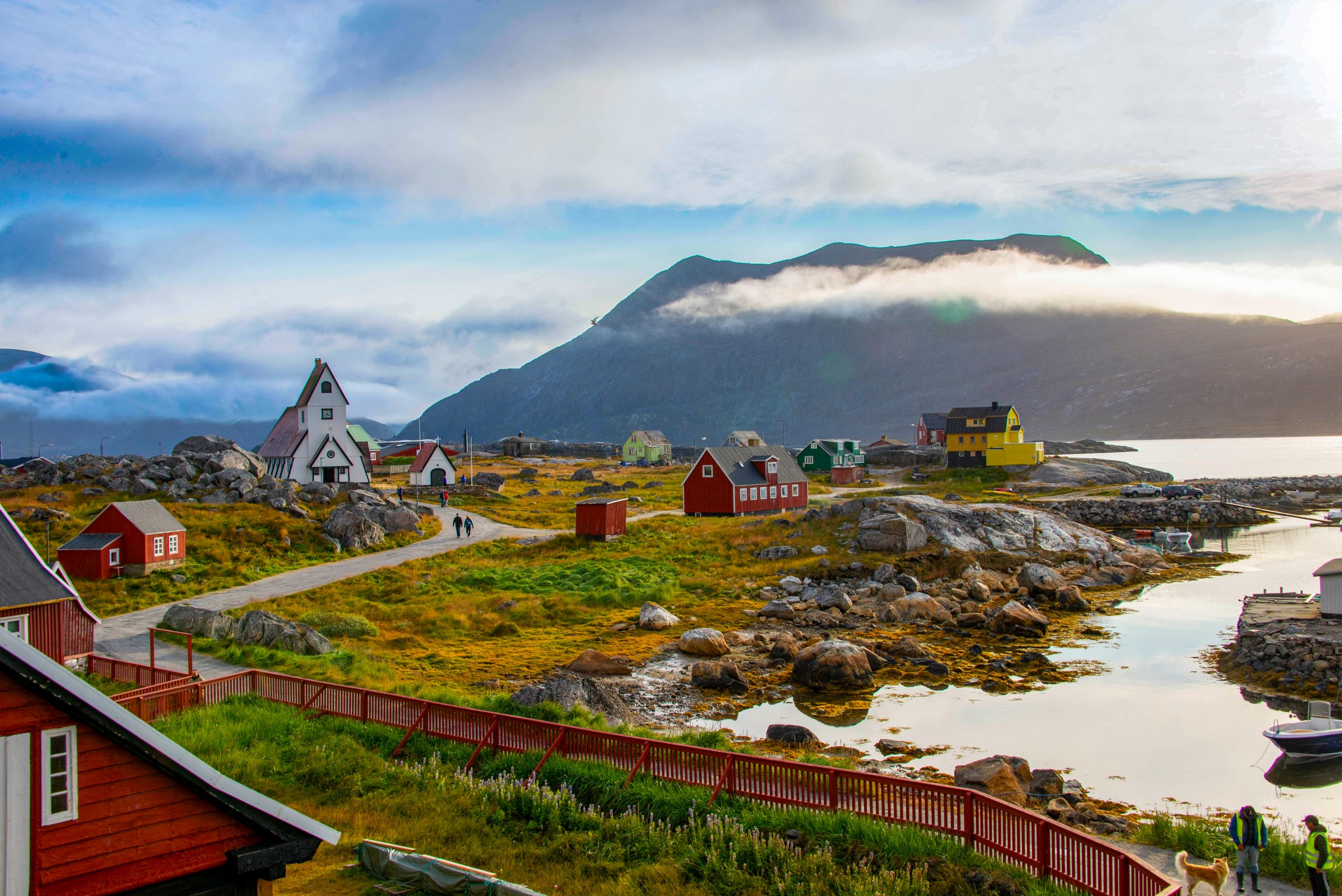
The village of Qaqortaq, Greenland as the island began to put the summer behind it and prepare for the cold and dark winter. Photo by Corey Sandler, all rights reserved.
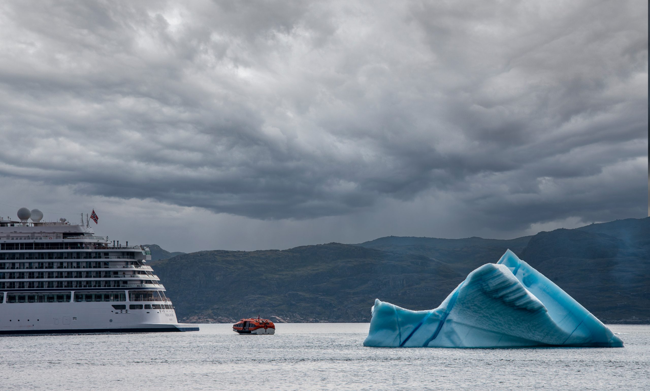
A ship’s tender navigates around an iceberg to return guests to Viking Saturn at anchor off of Qaqortaq. The blue hue of icebergs is caused by the compression of snow and ice over time, allowing only that color to be reflected. Photo by Corey Sandler, all rights reserved.
The even-smaller town of Nanortalik lies near the entrance to Prins Christian Sound, an inland route amongst the glaciers and mountains at the south end of Greenland. The locals have maintained a former whaling and sealing station as an outdoor museum. Photo by Corey Sandler, all rights reserved.
An Aqueous Version of Iceland’s Ring Road
We arrived at the West Fjords for a visit to the port of Ísafjörður and experienced Iceland’s version of summer all in one day: chilly and cloudy, heavy rain, and then a brief but uplifting glimpse of blue sky and sun.
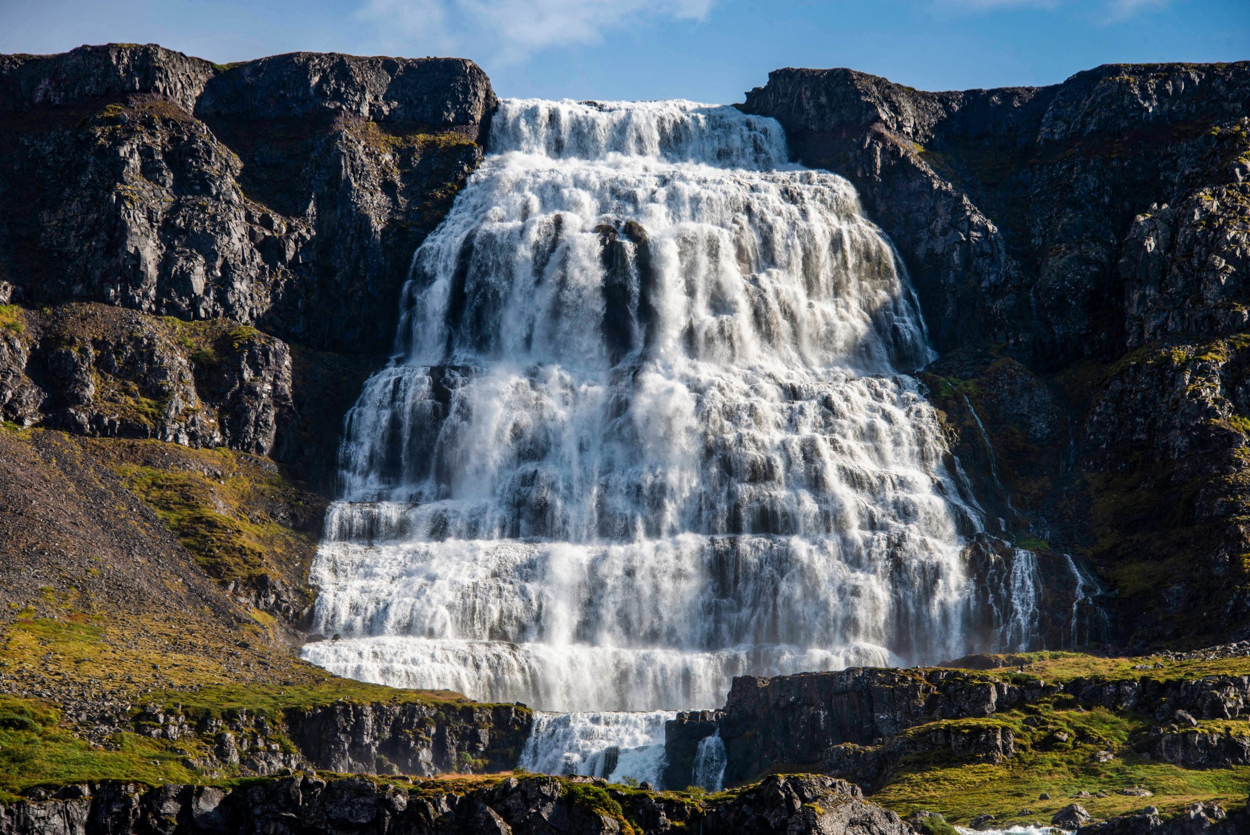
The Dynjandi waterfall near Ísafjörður is one outlet of a massive snowfield up above. On the west side of Iceland, most of the mountains are flat at the top, bulldozed by the weight of snow and ice and the movement of glaciers. Photo by Corey Sandler, all rights reserved.
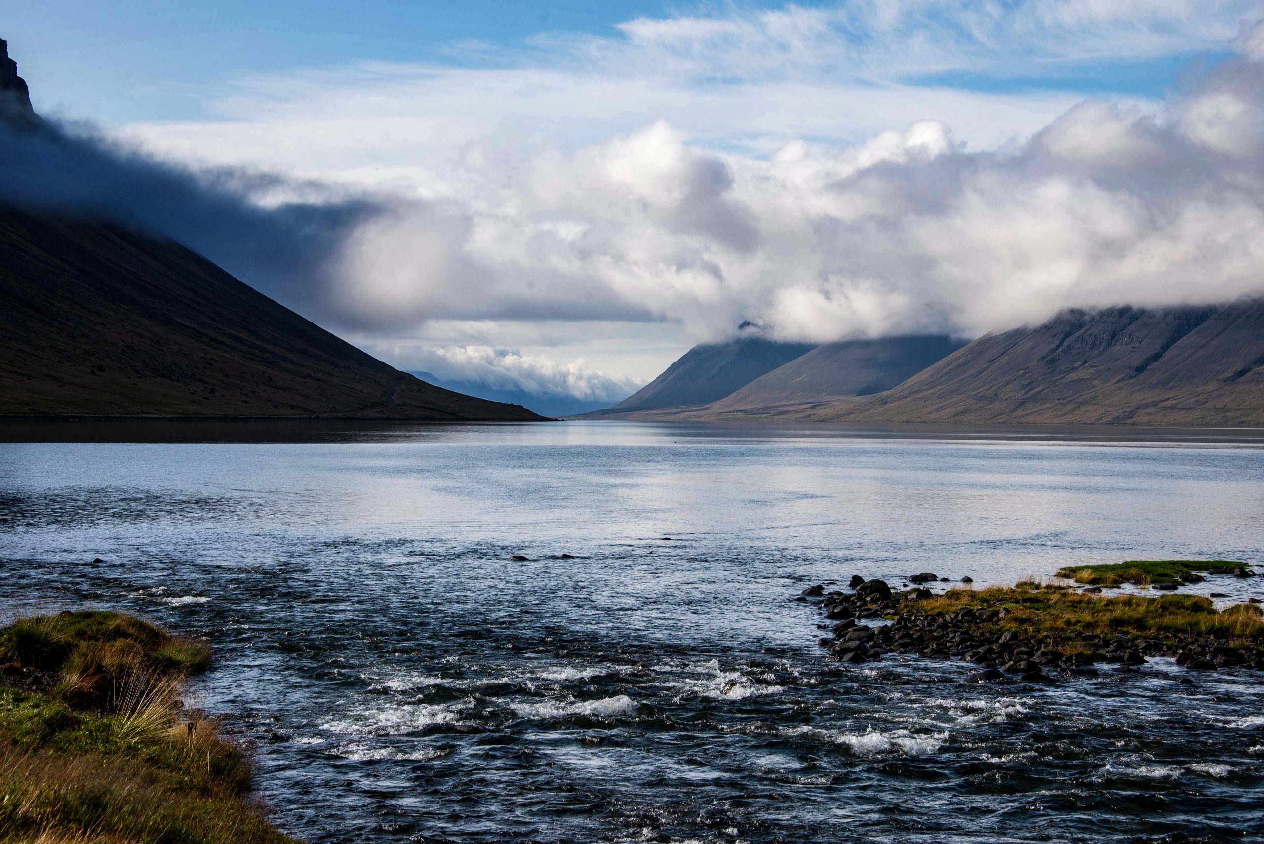
Dynjani drains into Arnarfjörður, which leads to the sea. Photo by Corey Sandler, all rights reserved.
Iceland’s East Side Story
We twice crossed into the Arctic Circle as we circumnavigated Iceland. When we pulled into Djupivogur on the country’s east coast, it seemed as if winter arrived with us, coating the hills with the first snow.
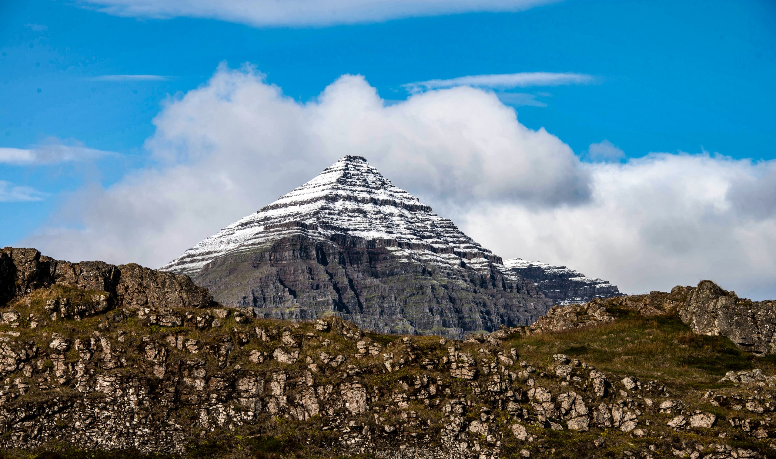
The pyramid-shaped Búlandstindur mountain, the most recognizable site in this part of Iceland, bore a fresh coating of snow from the night before. Photo by Corey Sandler, all rights reserved.
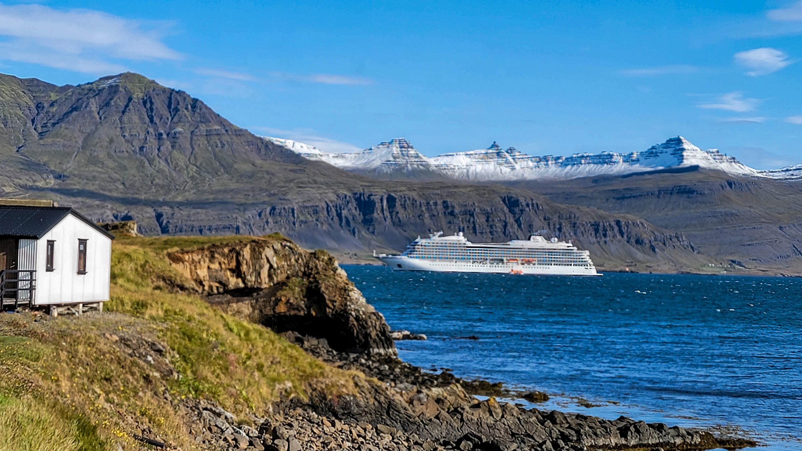
Viking Saturn at anchor in Djupivogur. On the east side of Iceland there are fewer glaciers and more young volcanoes and many of the mountains come to a sharp peak.Photo by Corey Sandler, all rights reserved.
Offshore to Heimaey
Our final port of call before the cruise came to its end in the capital city of Reykjavik was at Heimaey in the Vestmannaeyjar archipelago. This was near the original home of the West Men, Irish monks who were likely the first settlers.
Fifty years ago, in 1973, a long-dormant volcano on the island came to life and destroyed much of the town. Even worse, a long tongue of lava headed for the mouth of the harbor threatening to close it off completely.
A small cadre of locals, aided by international reinforcements, fought against the volcano pouring huge amounts of sea water on the lava and eventually stopping it before it completely closed off the harbor.
Viking Saturn found a spot outside the harbor–the sea bottom too deep and rocky to allow putting down an anchor–and hovered in place all day while tenders threaded the narrow opening into town.
VIking Saturn held her place outside the narrow entrance to the harbor at Heimaey. Photo by Corey Sandler, all rights reserved.
All photos copyright 2023 by Corey Sandler, all rights reserved. If you would like a copy of an image for personal or commercial purposes, please contact me.
Westward, Ho
In October, we will head west for a trip from Tokyo through the Japanese islands to Taiwan and on to Hong Kong. I hope you’ll visit me here in these pages.
We returned at the end of July from four weeks cruising from Stockholm to Bergen, and then on to Reykjavik…with a lot of wondrous stops in between. And as September begins, we are back at sea, sailing from New York to Atlantic Canada, Greenland, and coming to Iceland but this time from the other direction.
In full disclosure, this blog serves two audiences. I’m happy to share some photos and thoughts with readers. And it also helps us remember where we were and when.
When we left Bergen in mid-July, we headed up the coast of Norway for three port calls, and then went across the North Sea to the mist-shrouded Faroe Islands, and from there approached Iceland from the east for a counter-clockwise, aqueous version of the Ring Road.
The weather was somewhere about midpoint between delightful and dreadful, but we were lucky enough to miss the oppressive heat wave that was ongoing in Europe and much of North America.
Every place we went to was full of wonders. Somehow, though, whoever was in charge of the weather in Ålesund, Norway managed to pull off a Chamber of Commerce salute to our ship as we sailed away.
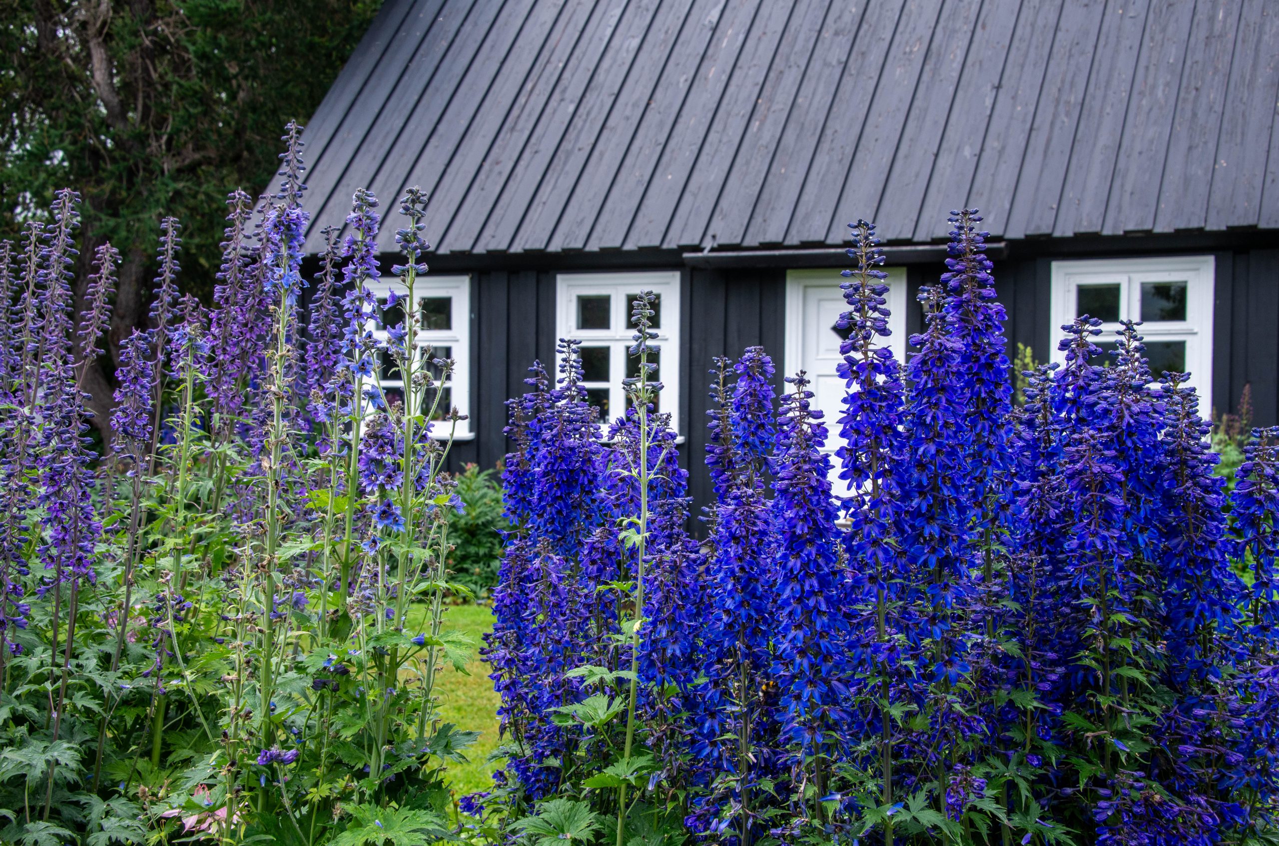
A double rainbow appeared over the stern of Viking Jupiter as we sailed away from Ålesund. Photo by Corey Sandler, all rights reserved.In the gray mist of Geiranger, the orange superstructure of a ship’s tender comes to the shore from Viking Jupiter. Photo by Corey Sandler, all rights reserved. From the Stegastein overlook near the port of Flåm, a view up a side fjord. Photo by Corey Sandler, all rights reserved.A bit of blue in Ålesund, Norway. The town is jammed with Jugendstil architecture, the Germanic version of Art Nouveau.Photo by Corey Sandler, all rights reserved.The port of Thorshavn in the Faroe Islands. The captain of Viking Jupiter said he had previously made six unsuccessful attempts to bring a ship into the often-foggy and windy place. I told him I had better luck: been to the Faroes about six times, although I had scarcely seen them because of bad weather. We split the difference: a cloudy, sometimes rainy day but we made port. Photo by Corey Sandler, all rights reserved.In Akureyri, Iceland–just 62 miles below the Arctic Circle–warm currents and other weather anomalies allow for a relatively temperate microclimate. The town’s botanical garden includes samples of nearly every type of flora of the island nation as well as samples imported from high latitudes around the world. Photo by Corey Sandler, all rights reserved.
So, if all goes to plan–not a certainty these days–as this month’s blog is posted, by this time we will have sailed down the Hudson River in New York, saluted the Statue of Liberty, and hung a pair of left turns to pass along the the length of Long Island and then head up the coast of New England.
In addition to my microphone aboard ship, I’ll have my cameras and lenses at the ready. Hope to see you here again in October.
All photos by Corey Sandler, all rights reserved. If you’d like a copy of one of my images for personal or commercial purposes, please contact me.
Hello, I must be going I cannot stay, I came to say, “I must be going” I’m glad I came but just the same I must be going
To me, that’s a natural turn of events. With the exception of the unwanted and unappreciated interruption of the Pandemic Years, I’ve been on the move most of my life.
It’s good to be going.
So, I’m interrupting the contemplative mood of the most recent set of blog entries to report on my most recent travels, from Stockholm across the Baltic and then up and around the corner to Norway.
And then from there northwestward ho, to the stubbornly iconoclastic Faroe Islands and a near-complete circumnavigation of the island nation of Iceland, which straddles the line that defines the European and American land masses.
We did this in great style, aboard Viking Jupiter, where I was guest lecturer for a month.
The old salt’s benediction used to go like this: “Fair winds and clear skies.” Fingers crossed, we can expand best wishes for travelers like this: “Fair winds, clear skies, and healthy air.”
As always, I travel with my camera and notebook.
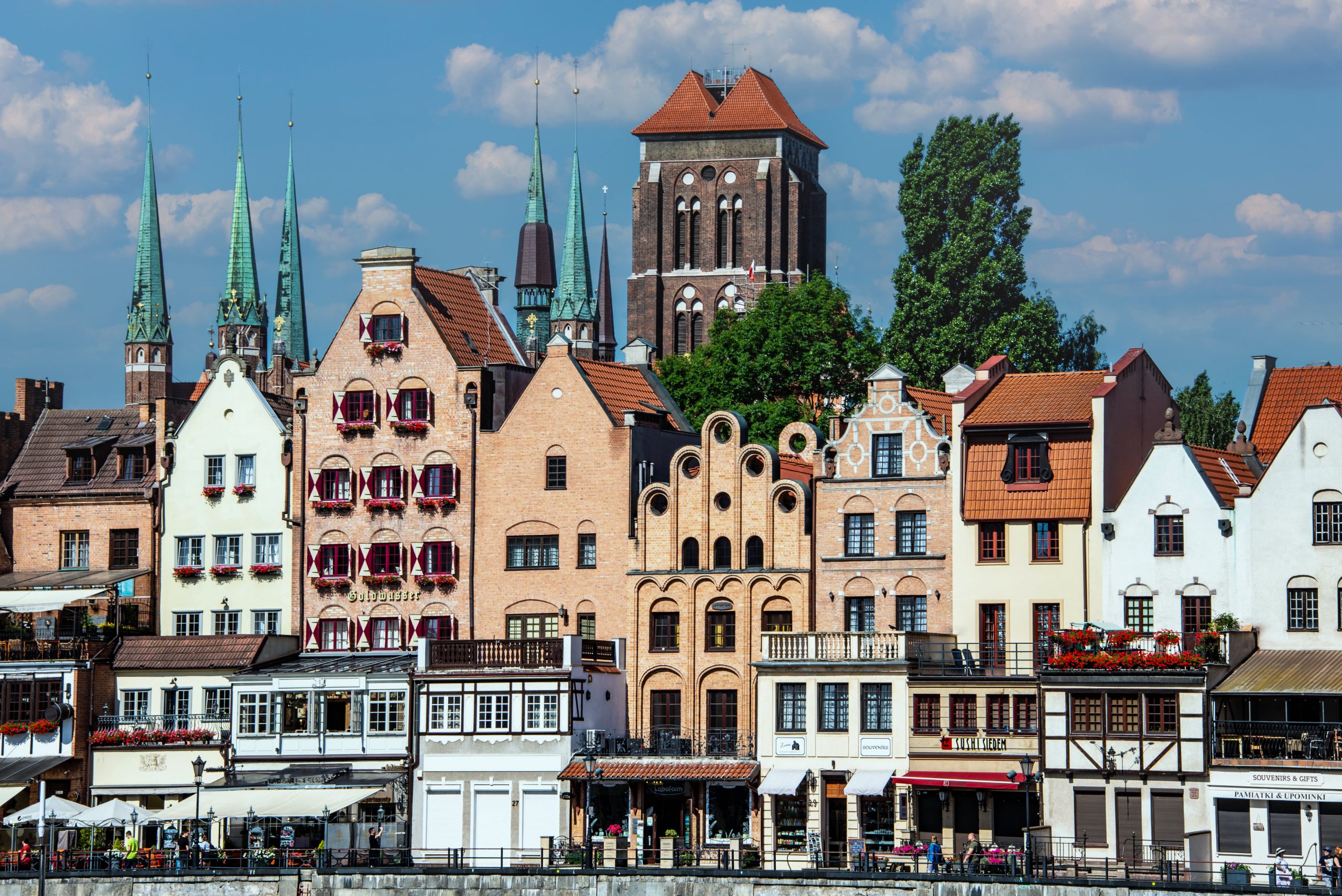
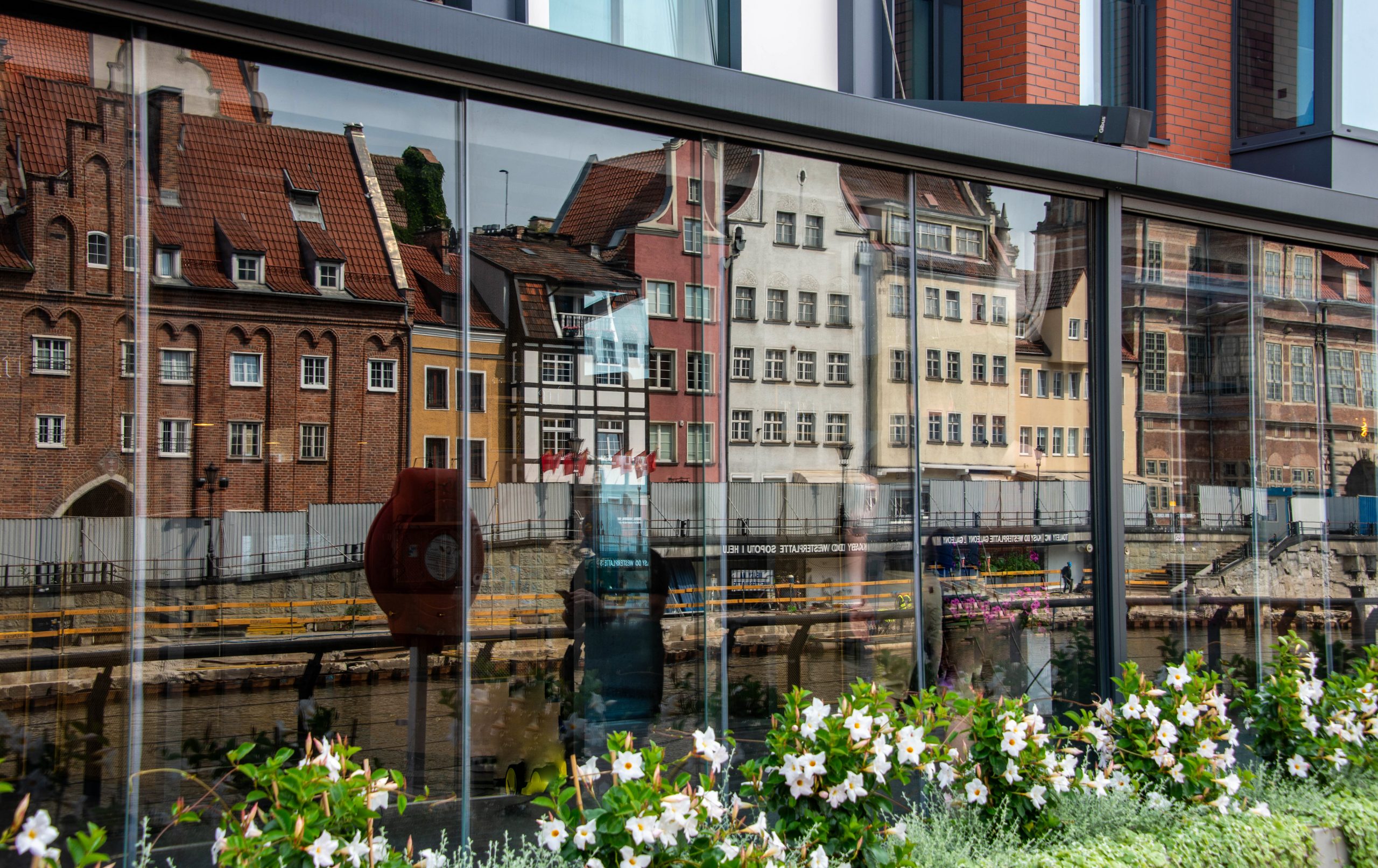
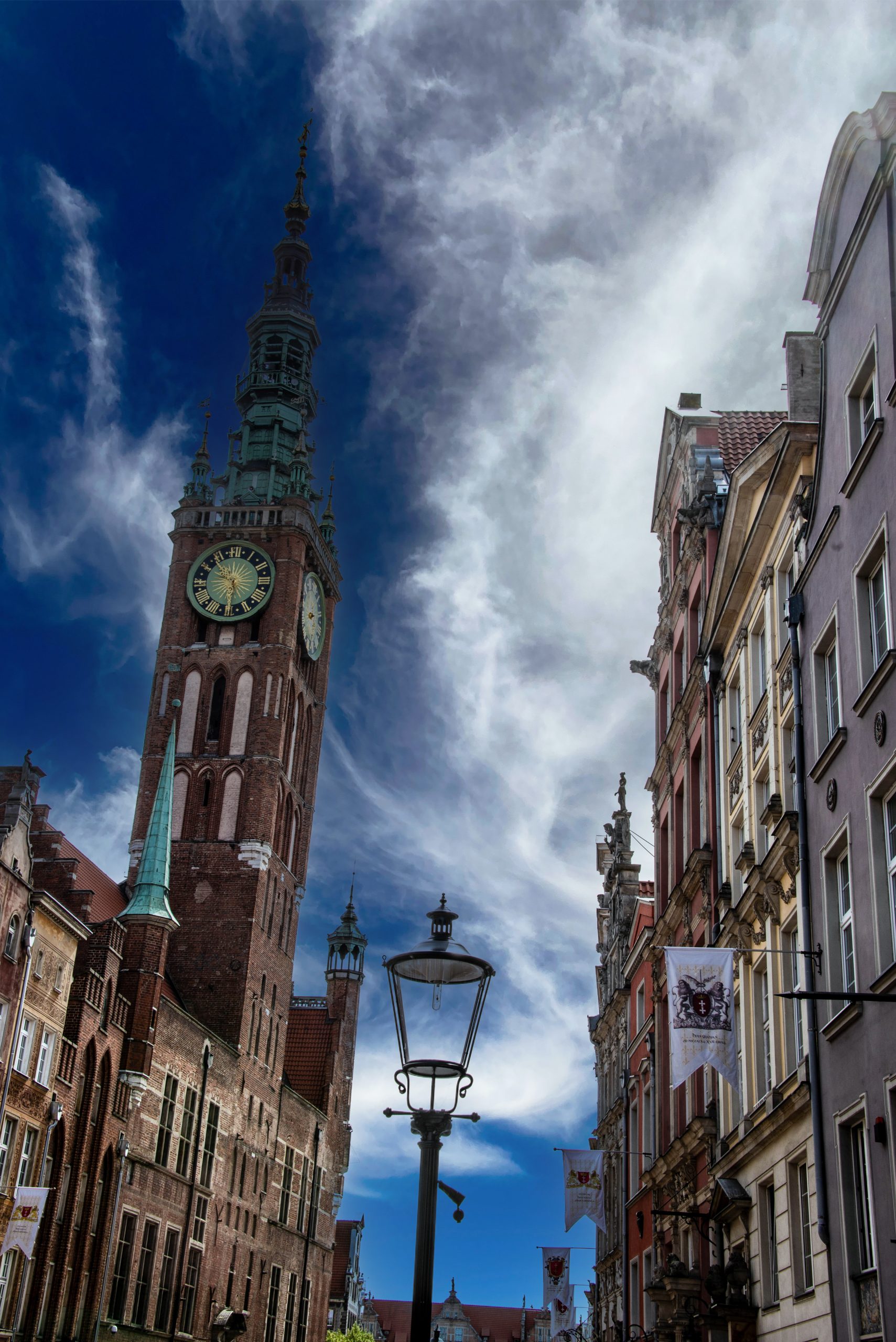
Our first port of call from Stockholm was south across the Baltic to Gdansk, Poland, a place that has seen more than of its share of history. It was once a very prosperous trading port for all manner of local businesspeople, including the Vikings and the Hanseatic League.
And then it came under control of Germany, until the messy aftermath of World War I when it was partitioned off to a reconstructed Poland as Danzig. That act was one of the excuses for war for Hitler, and it was in Danzig that the first actual battle of World War II was fought.
Much of Gdansk–now once again part of Poland–was destroyed in the war, but it was rebuilt as it was before and is now a handsome port of call.
Gdansk, Poland. Photos by Corey Sandler, all rights reserved.
A few days later we were in Warnemunde, Germany. This has been a popular seaside resort for more than a century, enduring a strange, stagnant period when it was part of the German Democratic Republic, better known as mostly humorless East Germany.
Warnemunde, Germany. Photos by Corey Sandler, all rights reserved.Ice Cream Under Brass, Copenhagen. Photo by Corey Sandler, all rights reserved.Vigelunds Park. Oslo, Norway. Photo by Corey Sandler, all rights reserved.Under Glass. Stavanger, Norway. Photo by Corey Sandler, all rights rerserved.The Hansa Kontor of Bryggen in Bergen, Norway. Photo by Corey Sandler.
I’ll be back next month with more photos from this series. In the meantime, I must be going…preparing for another voyage, this one from New York to a clockwise circle of Iceland.
If you’d like to purchase a copy of any of my photos for personal or commercial use, please contact me through this website.
We are, with fingers crossed, seeming to tiptoeing back to something approaching normalcy. Whatever that means.
Soon after I post this blog entry, we will be heading to the airport for what I am sure will be a predictably unpleasant red-eye flight to Europe to meet up with a ship in Stockholm.
Once we have landed, the travel commences and that is the enjoyable part.
But why do we travel?
You can travel to experience spectacular scenery. Or to time travel through history. Speaking for myself, the joy of travel is in how it helps you better appreciate and understand the place from where you started.
I go to learn how other people live and allow it to inform me about my own life.
A favorite fragment from T.S. Eliot:
“And the end of all our exploring
“Will be to arrive where we started
“And know the place for the first time.”
All That Glitters
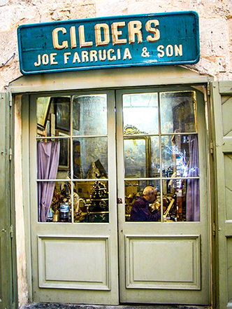
If ever I need to gild a lily, or anything else, I know the place to send you: the island nation of Malta where several practitioners are fully engaged in applying gold to clocks, statues, picture frames, and just about anything else. The craft is believed to have arrived with the Knights of Malta who extravagantly decorated their palaces when they arrived in the 16th century. Photo by Corey Sandler, all rights reserved.
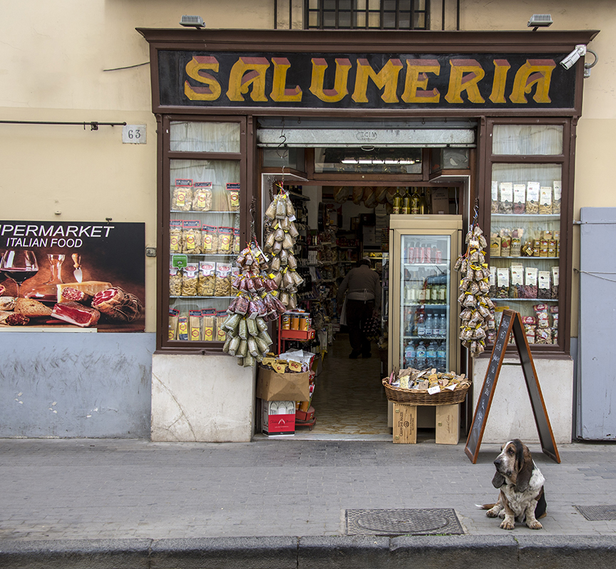
Hound Dog at the Salumeria
In Sorrento, Italy this Italian deli is under the watchful eye of a hound. Photo by Corey Sandler, all rights reserved.
Blood Bank
In Constanța, Romania they count the money and discount jokes about Vlad the Impaler better, known as Dracula. Photo by Corey Sandler, all rights reserved.
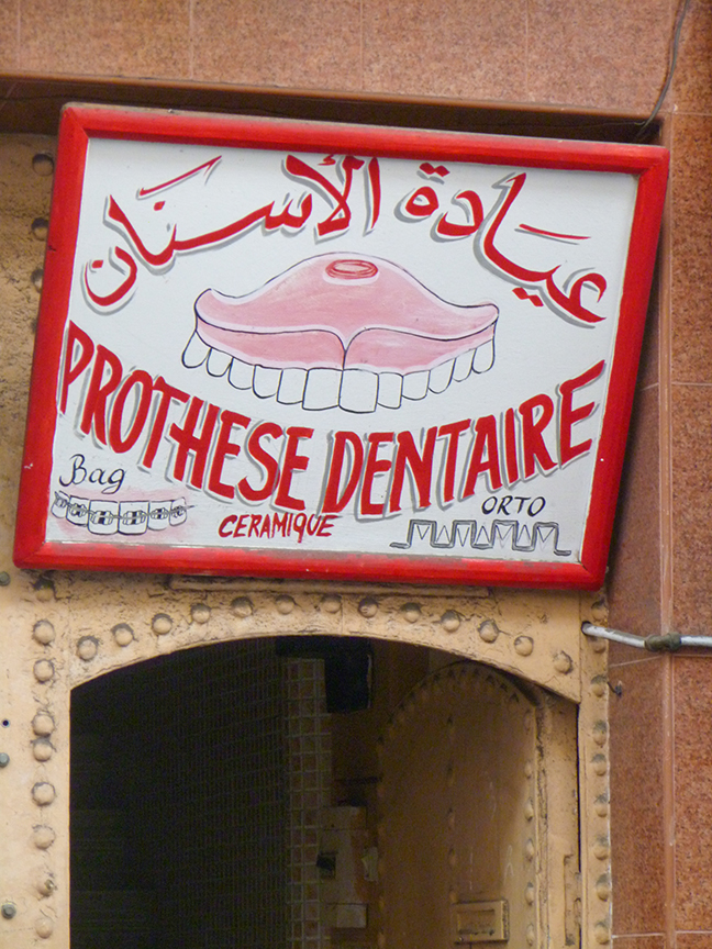
Adjusting Your Bite
In case I needed a reminder to take care of my teeth while traveling, finding this denture-maker in a back alley of the old souk in Casablanca, Morocco sealed the deal. Photo by Corey Sandler, all rights reserved.
Don’t Let the Bed Bugs Bite
The glamour of the Big Apple, along the West Side cruise ship piers of Manhattan. Photo by Corey Sandler, all rights reserved.
Photos and text copyright Corey Sandler. To obtain copies or otherwise use images, please contact methrough my website at www.coreysandler.com
If you were to ask a (talented) child to draw a picture of a volcano, what you’d get would likely look very much like Mount Fuji in Japan.
To put it another way, Mount Fuji is a near-perfect volcanic cone, the tallest mountain in Japan with its summit at 12,389 feet or 3,774 meters. It stands on its own, covered or sprinkled with snow for about half the year.
In April, I was sailing on a ship into Shimizu, south of Tokyo, ready to head out on an expedition to fulfill my mind’s-eye plan for a photo of Mount Fuji. As the sun rose on a gray and cloudy, while the ship was still maneuvering through the harbor, Mount Fuji came to me.
Mount Fuji comes to me, like a magic hat above the countryside. Photo by Corey Sandler, all rights reserved.
I chose to make this image a study in rich black and white.
We had traveled from Tokyo to the southern islands of Japan and back to Yokohama aboard Regent Seven Seas Explorer, and on the last full day of the cruise we called at Shimizu, a bustling city south of Tokyo also known as Shizuoka. The weather forecast for the day called for heavy clouds and that’s what greeted us as we sailed into the harbor.
Mount Fuji was right there, off the starboard side…or so the GPS map on my phone told us. But all we saw was a wall of cloud from sea level to the skies.
But I don’t give up that easily. I kept a weather eye on the sky, and saw it begin to brighten slightly and then a half-volcano-sized hole opened. I took the first of many photos from the veranda of our suite before our ship came to the dock.
For centuries, Japanese artists, poets, and spiritual leaders have made Fuji the object of rhapsodic study.
Fuji is an active stratovolcano, still bubbling within; its most recent significant eruption came in 1707 and across its known recent history it has erupted every few hundred years. You do the math…
It is hard to miss Fuji if you venture south of Tokyo; in fact, on a clear day the summit is visible from the capital city 62 miles away.
Many Japanese consider it a life’s goal to climb to the summit, typically a five-to-twelve-hour trek of about 12 miles on various trails that approach from nearly every direction. Climbing season runs from early July to mid-September, and the best experience is supposed to be a nighttime hike that culminates with sunrise from the summit.
A Japanese aphorism says that a wise person will ascend Mount Fuji once in a lifetime, but only a fool would climb it twice.
I’d consider the hike, although my visits to Japan have all been during the mountain-climbing off-season. That’s my excuse, and I’m sticking to it.
A View from a Shrine
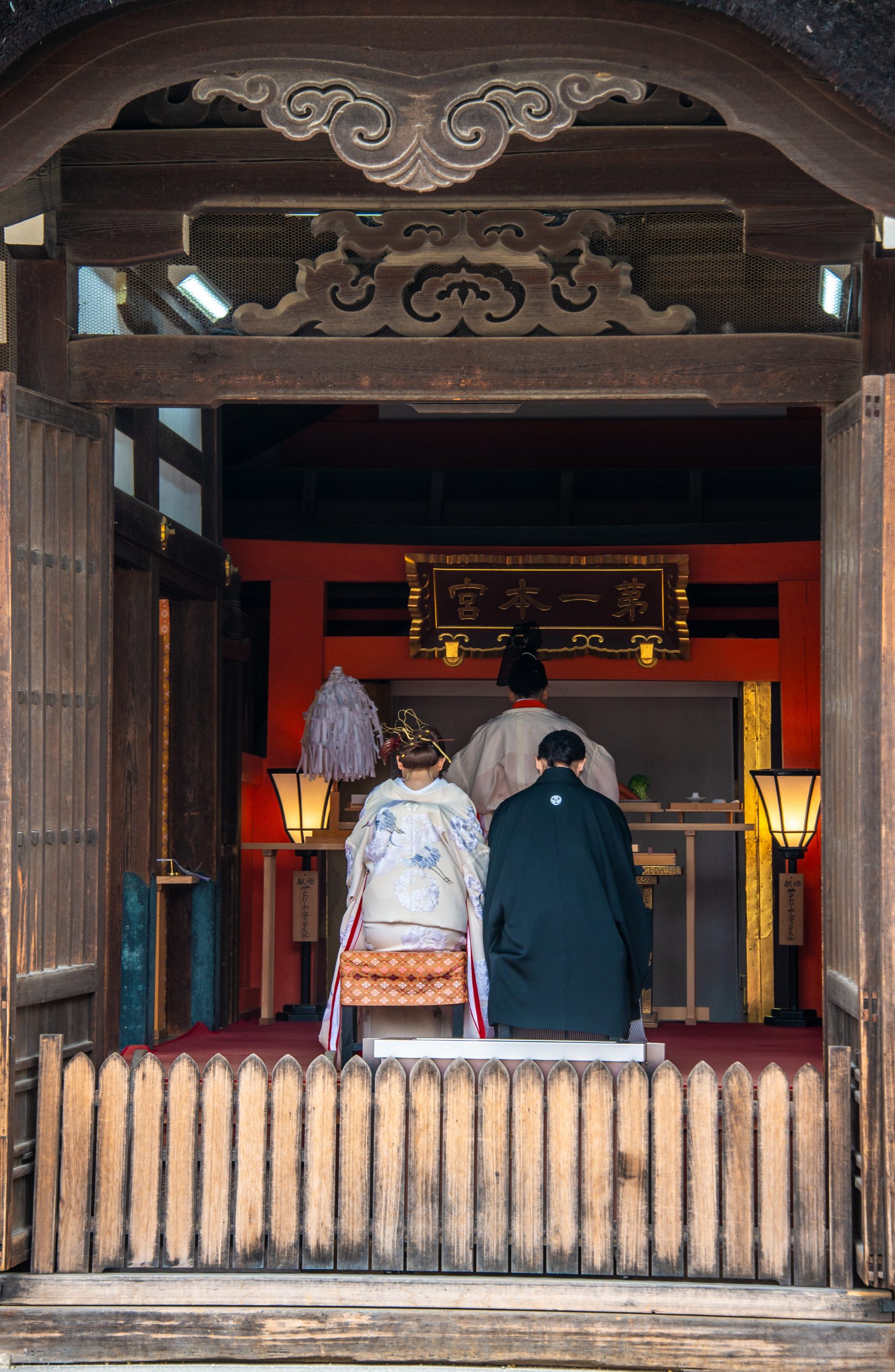
A few hours later, I went with a group of guests on a pilgrimage to the Fujisan Hongu Sengen Taisha Shrine, constructed in the 17th century at least partly to admire the volcano.
Our guide kept speaking of the beauties of the mountain and pointing vaguely in the direction of the huge volcano, but the clouds were once again completely blocking the view.
We toured the shrine, watched a very young couple dressed in traditional clothing make a pre-wedding visit (accompanied by a camera crew) and toured the gardens. We were just past the peak of cherry blossom trees, but wisteria was having its moment.
As I often do, I wandered a bit from the group and looked for non-traditional photos and angles. I turned a corner and suddenly was face-to-face with a volcano. The volcano. Fuji.
After I snapped a few safety photos, I ran back to alert the guide and guests. Here’s some of what we saw:
Fuji from Hongu Sengen Taisha Shrine
Fuji, ready for its closeup. Photos by Corey Sandler, all rights reserved.
And then, under the thesis that any worth doing is worth overdoing, we drove an hour back and then past Shimizu to visit Miho no Matsubara, a quiet seaside pine grove with a soft lava sand beach.
Once again, Fuji was elusive at first. But rounding a curve on the beach, we found the mountain once again.
Fuji from the Beach
Okinawa, A Place Apart
A few days earlier, we had called at Naha, the capital city of the prefecture of Okinawa. It includes more than 160 islands inhabited and uninhabited.
For most of its history, Okinawa had been an independent country, the capital of the Ryukyu Kingdom. It became part of Japan in 1879.
Most of the people of Okinawa speak a distinctive dialog not easily interchangeable with Japanese. Even today, many residents identify themselves not as Japanese, but as Okinawans.
When World War II, Naha and Okinawa Island were essentially invaded by the Japanese military who fortified the island and conscripted teenage boys into combat and teenage girls into nursing and other support roles.
As Allied forces advanced toward the mainlands of Japan, the outer islands became critical defensive positions. In April of 1945, four months before the end of the war, a force of mostly American Army and Marine Corps troops launched an invasion with 185,000 troops, the largest amphibious assault in the Pacific war.
The American intent was to use bases on Okinawa as staging areas for the planned invasion of Japan’s home islands about 340 miles away.
They faced fierce resistance including a retreat by many Japanese troops–and Okinawan civilians–into caves. The battle lasted 81 days.
Precise numbers are hard to come by, but one estimate says 12,500 Americans were killed or missing in action. On the Axis side, 77,166 Japanese soldiers and about 30,000 Okinawan conscripts died. And perhaps 100,000 to 150,000 Okinawan civilians were killed in the assault.
Okinawa remained under American occupation until 1972, and there are still a half dozen American military bases on the islands.
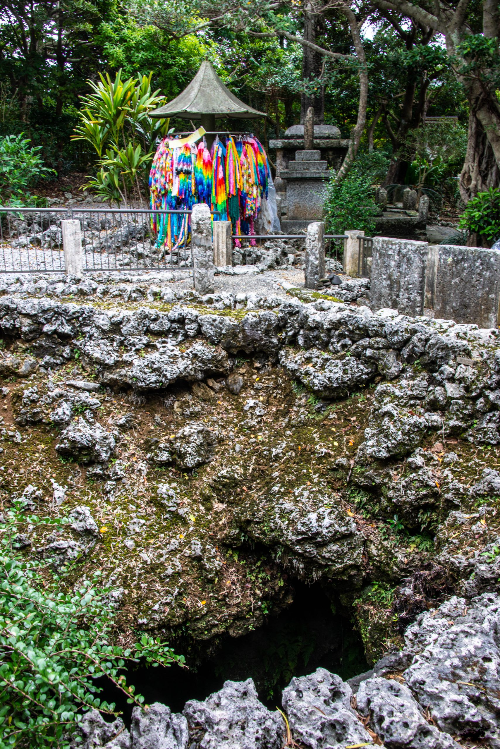
Himeyuri Peace Museum
One of the caves of Okinawa where civilians and troops died. Photo by Corey Sandler, all rights reserved.
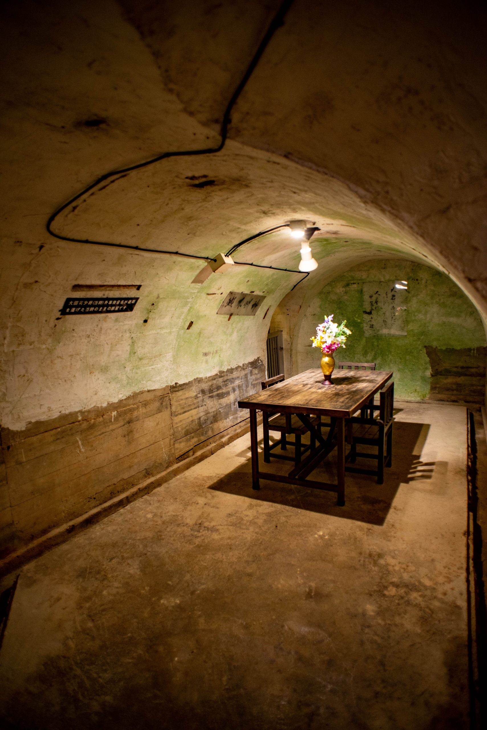
Okinawan Naval Headquarters
In the weeks leading up to the assault, Japanese naval authorities ordered the construction of a massive network of underground tunnels and rooms in a limestone mountain near what would be the climactic battlesite.
After decades, the rooms and tunnels were opened to visitors, frozen in time and toured mostly in silence.
A command center of the Japanese Navy dug out of a mountainside in Okinawa. Photo by Corey Sandler, all rights reserved.
Cruise’s End
Two weeks after we started, Regent Explorer brought us to the bustling port of Yokohama on the Pacific Ocean. That day began about 6:30am and ended 27 hours later–on the same day–when our jumbo jet touched down in another great port, Boston on the Atlantic Ocean. Photo by Corey Sandler, all rights reserved.
Photos and text copyright Corey Sandler. To obtain copies or otherwise use images, please contact methrough my website at www.coreysandler.com
So we took off from Boston on a non-stop flight to Tokyo, leaving at about 1:30pm on a Sunday and landing 14 hours later at 4:15pm on a Monday. I know the science and the geography and the horological concepts well, but still…
Who knows where the time goes?
We lost a day on the calendar and 13 hours on the clock to I’m not sure where. But we did go back to something close to normalcy, a return to cruising.
This time we met up with the handsome Regent Seven Seas Explorer for a two-week partial circle of Japan and a side trip to southern South Korea. It felt great to be back at sea, and back on the stage for a series of talks on music and art and culture.
We came home last night on a day that stretched 37 hours. We left about 6:20pm on a Tuesday and landed in Boston at 5:55pm on that same day of the week. Who knows where the time goes?
The title of this blog comes from the great song by Sandy Denny of the English folk group Fairport Convention; it became famous with Judy Collins’ cover in 1968.
Across the morning sky All the birds are leaving Ah, how can they know it’s time for them to go?
I do not count the time
Who knows where the time goes? Who knows where the time goes?
Our flight from Boston stayed ahead of the setting sun all the way, following a Great Circle Route that took us near Montreal and through northern Quebec to James Bay and Hudson Bay. I suspect I was the only person on the jumbo jet who had ever set foot in places like Moose Factory and Whampamagoostui; I spent weeks there researching my book about Henry Hudson.
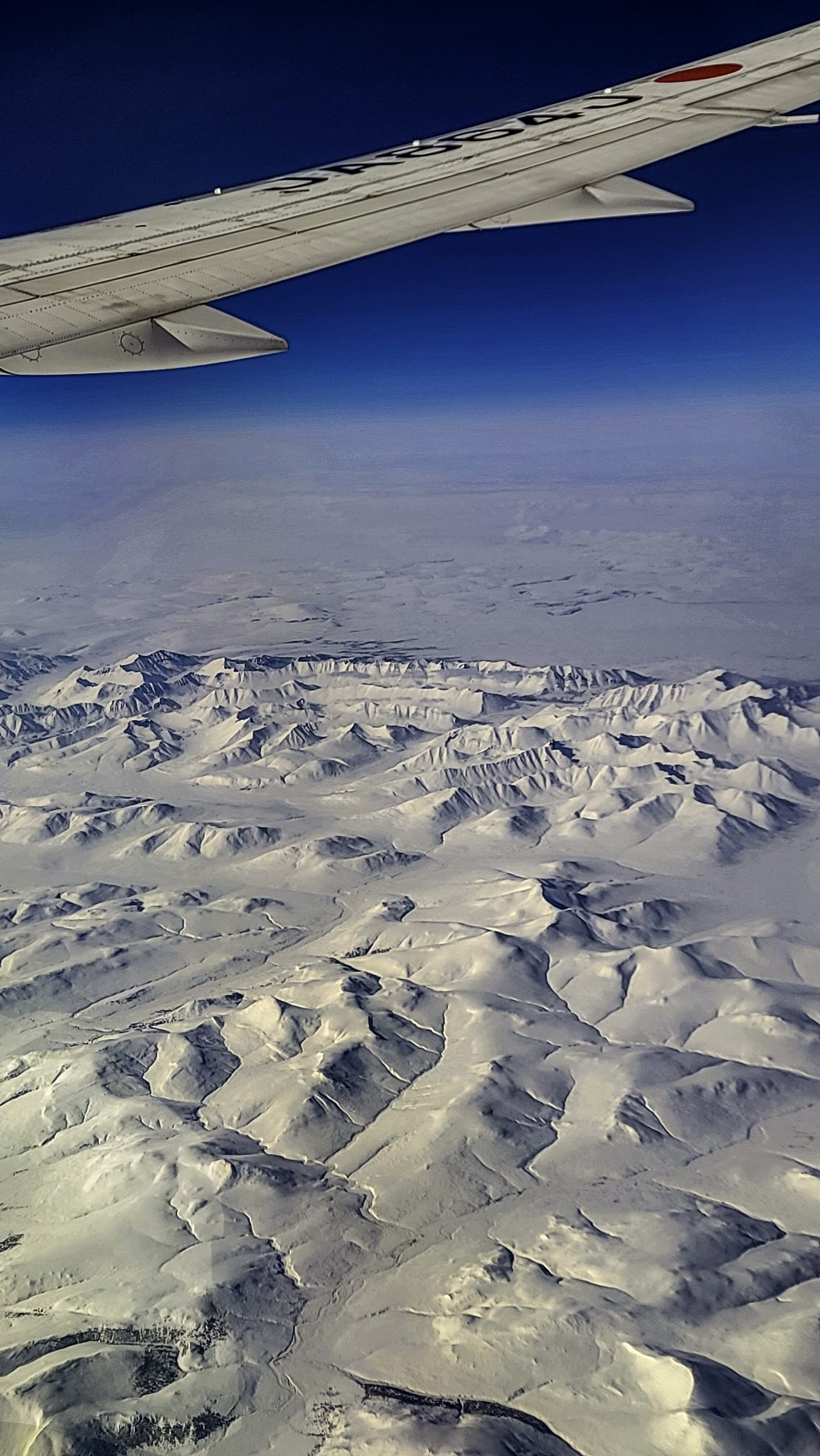
After we reached subarctic Canada we crossed the empty still-snow-covered Rockies before arcing down out to sea from Siberia and into Tokyo.
Westward Across Frozen Canada
The Rockies of Western Canada from 37,000 feet. Photo by Corey Sandler, all rights reserved
There is a Ship
Regent Seven Seas Explorer at the dock in Kobe, Japan. Photo by Corey Sandler, all rights reserved.
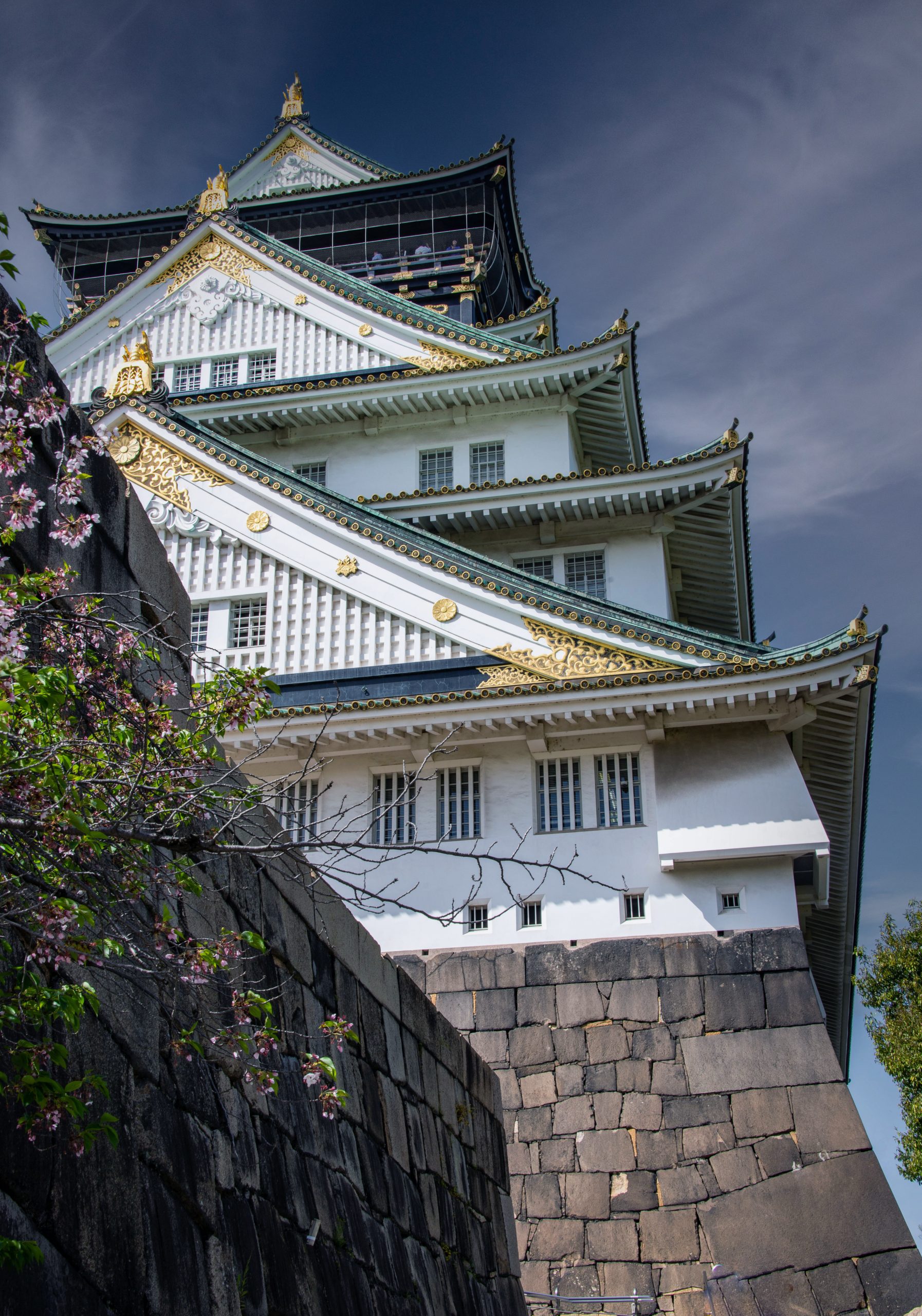
Osaka Castle
Osaka Castle dates, in its original form, to about 1615. The structure, heavily damaged in World War II, was rebuilt as the pride of the city. Photo by Corey Sandler, all rights reserved.Photo by Corey Sandler, all rights reserved.
Umeda Sky Building, Osaka
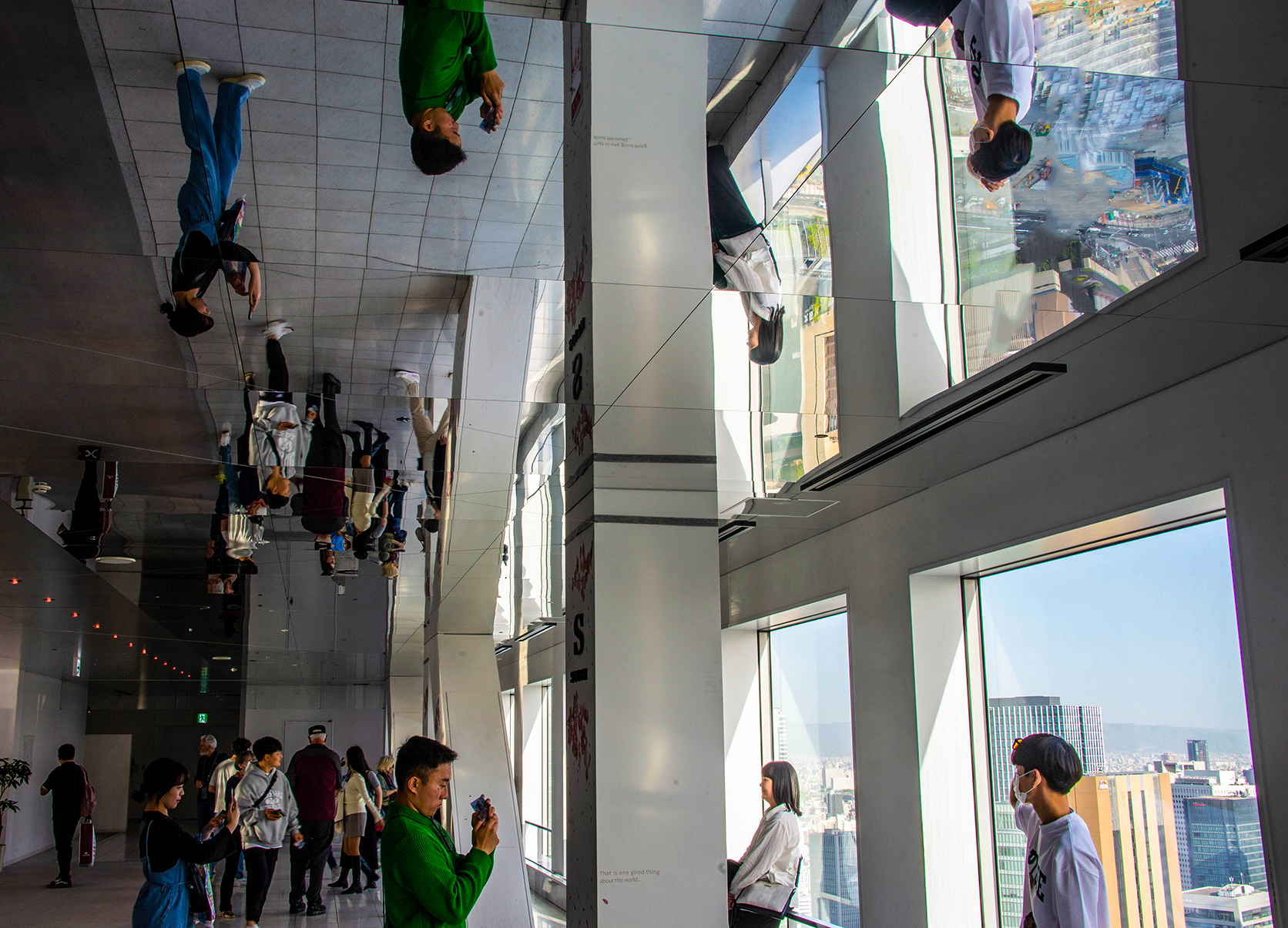
The very modern Umeda Sky Building in Osaka includes a glass walled elevator that leads to a glass-tube escalator that ends at an extraordinary observatory with a mirrored ceiling. If this place does not give you vertigo, you are immune to that sensation. Photo by Corey Sandler, all rights reserved.
The Kanmon Strait
Heading for Busan, South Korea, we passed through the narrow Kanmon Strait which separates Honshu and Kyushu, two of Japan’s four main islands. Photo by Corey Sandler, all rights reserved.
Hot Foot, Cool Customers in Busan
Thoughts of Peace in a Place of War
The Peace Park in Nagasaki, site of the second atomic bomb attack of World War II. Photo by Corey Sandler, all rights reservedThe reconstructed Deijima trading post from the early 17th century in Nagasaki. Dutch and other traders setup shop here on an island kept distant from the locals.
I’ll share some more photos next month.
Photos and text copyright Corey Sandler. To obtain copies or otherwise use images, please contact methrough my website at www.coreysandler.com
As April begins, I’m still on dry land for a while, looking for signs.
Is that a new ship on the horizon? Watch this space.
Meanwhile, we have moved into spring, after an almost snowless winter in the American northeast, which is just plain wrong. It portends a long, hot summer, which is something of which I am not fond,
I reached into my digital closet to find some memories of hot times around the world.
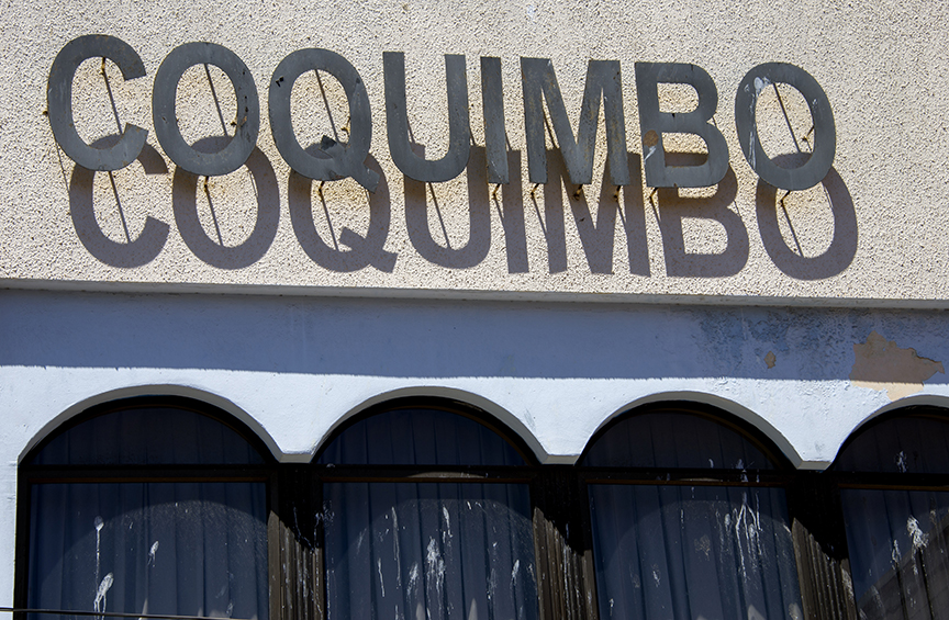
Hot, hot, hot
Coquimbo, Chile is a hot, humid place with little shade. I took this picture of the sign at our ship’s dock as I lunged for a breath of cooled air aboard. Photo by Corey Sandler, all rights reserved.
Cool, Baby (Even When It is Hot)
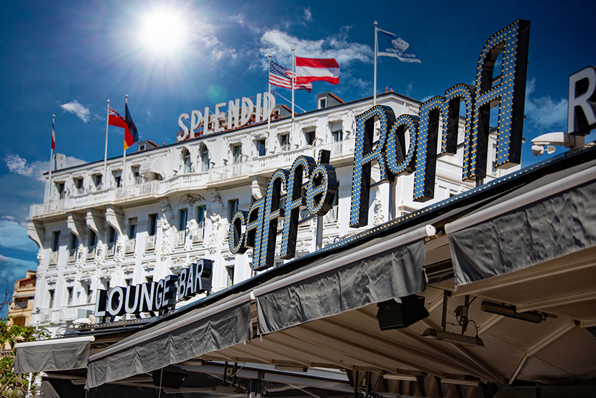
Cannes, the chic capital of the French Riviera, is a Disneyland for the rich and famous who gather to gawk at each other and pretend to ignore those who come to see them strut. Photo by Corey Sandler.
Mind Your Children
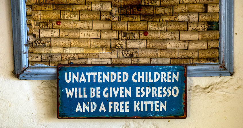
A tavern owner on Patmos in Greece makes a point. Photo by Corey Sandler, all rights reserved.
The Moorish Gothic Firehouse of Ponce
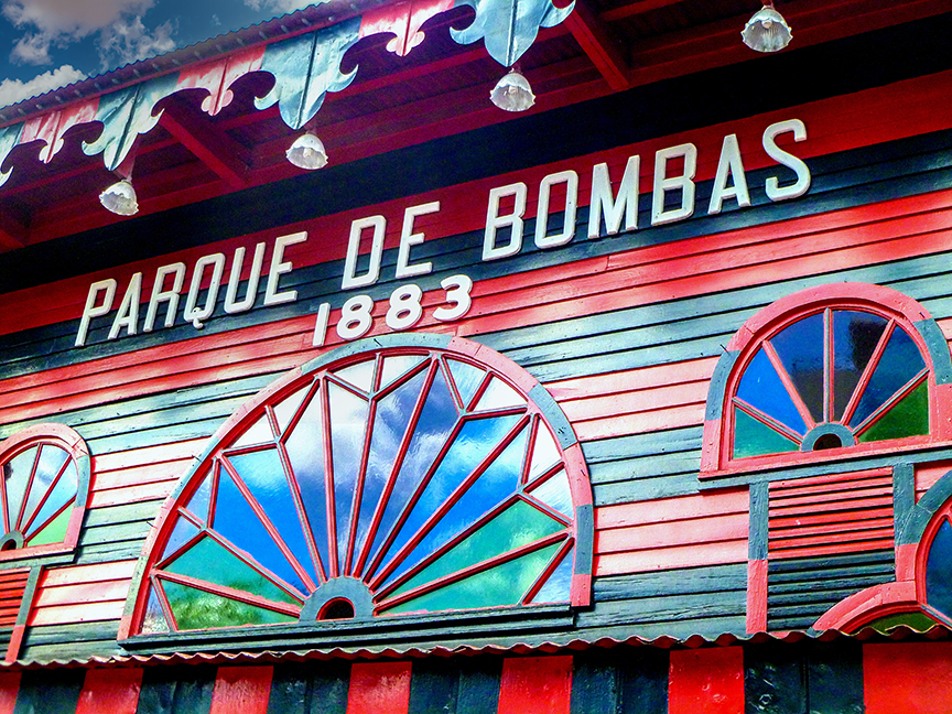
One of the signature structures of Puerto Rico, the Parque de Bombas was built in 1892 by the Spanish government for an international exhibition in Ponce, the island’s second city. After the fair it was converted into a firehouse, a role it held until 1990. The Municipal Band plays concerts there every Sunday. Photo by Corey Sandler, all rights reserved.
The Fire Box
The firebox of a working steam engine on the Bodmin & Wenford Railroad in Fowey, Cornwall. Photo by Corey Sandler
Photos and text copyright Corey Sandler. To obtain copies or otherwise use images, please contact methrough my website at www.coreysandler.com
It’s the heart of winter in the American northeast, and as much as I enjoy snow and crisp, cold mornings I also sometimes allow myself to dream of summer. So I have dipped into my collection from warmer climes of days past and to come.
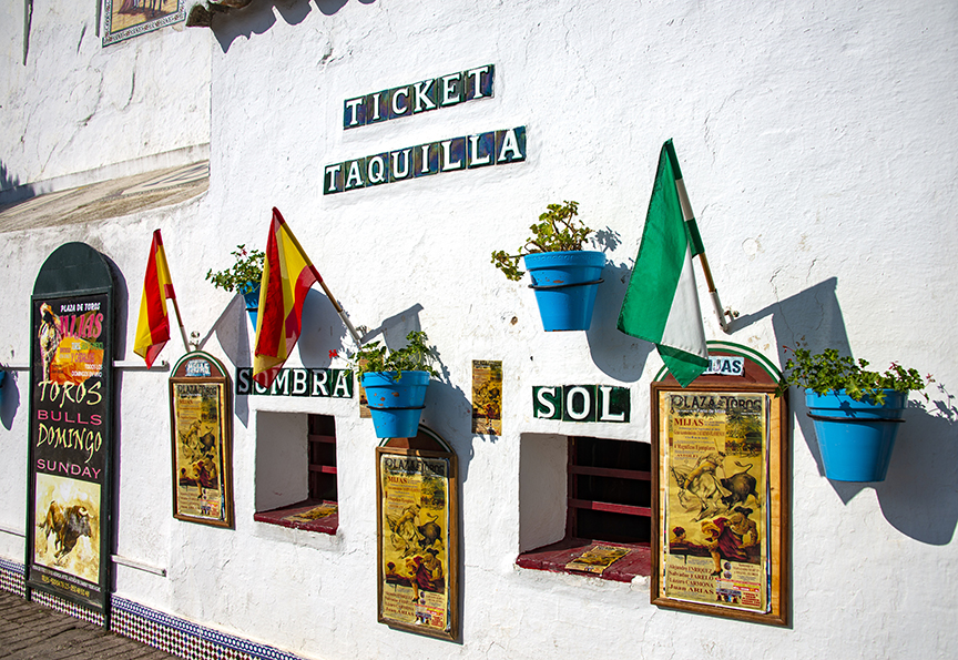
Sun or Shade, Senor?
The taquilla at the bull ring in Mijas, Spain offers seats in sombra or sol, although there is not much difference when the sun is at high noon. Photo by Corey Sandler, all rights reserved.
Polynesian Paradise
Much-traveled artist Paul Gauguin came to the end of his life in Calvary Cemetery in Altuona on Hiva Oa in the Marquesas Islands of French Polynesia. Nearby is the grave of another great artist, the poet, songwriter, and singer Jacques Brel, who died in France but whose body was brought back to buried near his final home on Hiva Oa. Photo by Corey Sandler, all rights reserved.
Forget-Me-Not
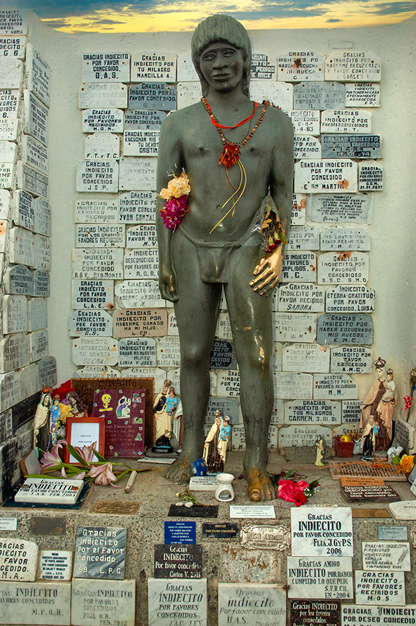
The sprawling Sara Braun Municipal Cemetery in Punta Arenas, Chile near the bottom of South America includes thousands of photos and mementos of the dead. The plaques at this well-worn statue offer thanks to the “Indiecito” or “little Indian” for favors received.This highly local recognition is offered in homage to the story of an “unknown Indian” found in the wreckage of a doomed schooner in Patagonia in 1929. The story and the statue are not officially recognized by the Catholic church, but the odd devotion continues. Photo by Corey Sandler, all rights reserved.
Rooms with No View
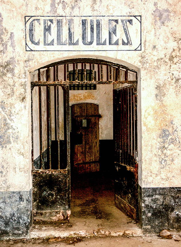
Devil’s Island and the other islets of the French penal colony off the east coast of South America are among the most evocative places I’ve visited. The story of Papillon and Alfred Dreyfuss come to life in this tropical hell. And I yet I come back time and again to absorb a bit more. Photo by Corey Sandler, all rights reserved.
The Slave of the Slaves
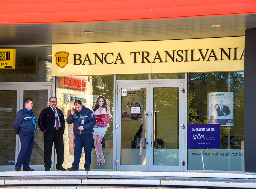
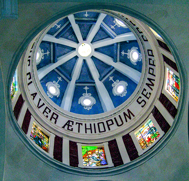
The Church of San Pedro Claver is named for a Spanish monk known as “El Esclavo de esclavos”, the “Slave of Slaves.” Claver devoted his life to the slaves brought to Cartagena, Colombia even begging in the streets. His story humanizes the slave trade in a different way than most histories of that sad commerce. Photo by Corey Sandler, all rights reserved.
Photos and text copyright Corey Sandler. To obtain copies or otherwise use images, please contact methrough my website at www.coreysandler.com
Sensory overload: we are surrounded by signs and billboards and other demands for our attention, to the point where we tune them out.
As I travel near and far, I often give myself an assignment: look for unusual doors, special architecture, rippling reflections…and sometimes signs of the times.
In the next few entries here, I’ll share some of what I’ve seen spelled out in full view.
I’ll begin with time travel, old signs of the times.
Long Gone, Not Forgotten
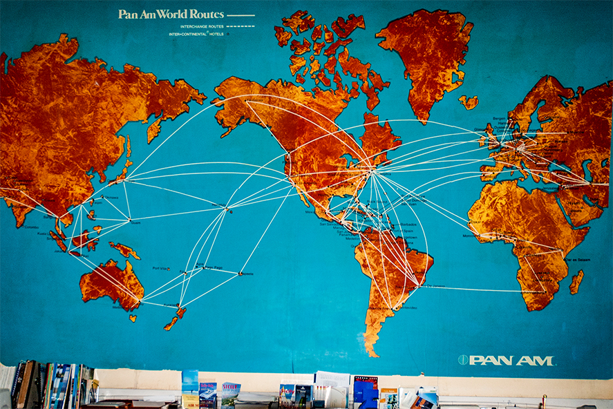
In an old-school office in a timeworn travel agency in the reliquary that is Valletta, Malta I found this wall-sized display of the Pan Am route map. Pan Am was one of the world’s first airlines, begun in 1927, and a pioneer in transoceanic and long distance flights on flying boats and then the first passenger jets. It ceased operations in 1991. Photo by Corey Sandler, all rights reserved.
On the Grand Parade
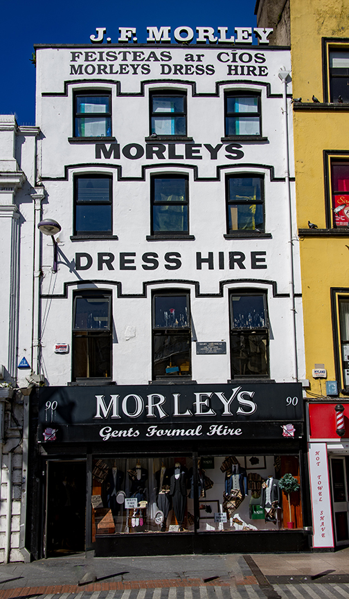
J.F. Morley’s Gents Formal Hire, on the Grand Parade in Cork, Ireland has tended to the temporary needs of gents since the early 1940s. Styles have changed over the years…just a little bit. Photo by Corey Sandler, all rights reserved.
Accessories for Harvard Yard
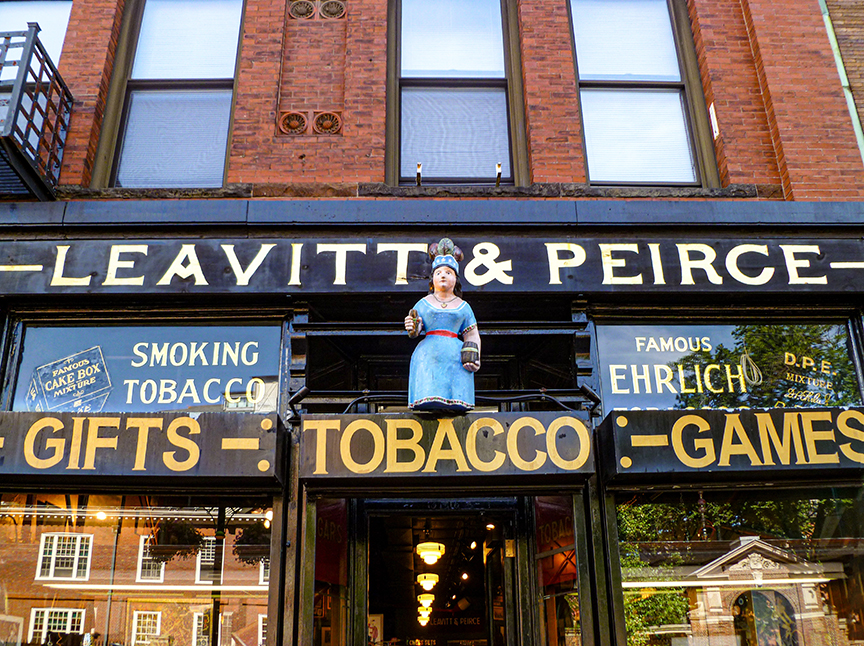
Since 1883, professors…and students…at Harvard College have only to cross the street from Harvard Yard to Leavitt & Pierce to fill their pipes. They also sell essentials like chess sets, puzzles, shaving kits, and cufflinks. Photo by Corey Sandler, all rights reserved.
Don’t Let Your Dogs Bark
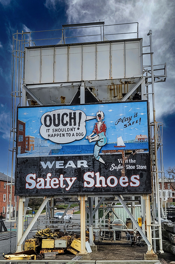
Useful advice on an old sign at the historic Charlestown Navy Yard in Boston. The shipyard opened in 1800 and at its peak employed more than 50,000 builders, mechanics, and technicians. It ceased operations in 1974 but today is home to the USS Constitution (“Old Ironsides”) in the shadow of Bunker Hill. Photo by Corey Sandler, all rights reserved.
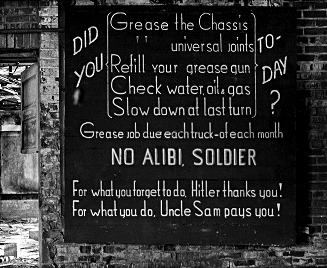
No Alibi
Camp Drum in northern New York State near the Canadian border has served as a U.S. military training base since 1908, in various forms. In the late 1960s, I visited the installation and found this sign in an abandoned maintenance building. Photo by Corey Sandler, all rights reserved.
Photos and text copyright Corey Sandler. To obtain copies or otherwise use images, please contact methrough my website at www.coreysandler.com
My principal forms of expression are words and photography. But there are times when I feel the urge to venture into impressionism. Blame it–or credit it–to the pandemic, when most of us turned inwards.
As a former newspaperman, I was thrilled to come across a quote by the artist Henri Matisse, who said “Impressionism is the newspaper of the soul.”
And so, I revisited some of my favorite photographs from my world travels and reimagined them constructed out of daubs of oil paint rather than pixels.
But first, a new image from Boston: a cold, cold dose of cheer at the annual Tuba Christmas performance in downtown. We arrived early to watch the slow accumulation of instruments: a tribe of Tubas of various keys, an amalgamation of Euphoniums, a swarm of Sousaphones, and one old Ophicleide.
Tuba Christmas in Downtown Boston 2022 brought nearly 100 bottom note players, and produced enough heat to hold off the snow for a few hours. Photo art by Corey Sandler, 2022. All rights reserved.The Cathedral-Basilica of Notre-Dame de Québec is the oldest church in Canada, a National Site of Canada, and part of the UNESCO World Heritage area of the glorious city. The first cathedral was constructed in 1647, twice destroyed by fire, and rebuilt in grander and grander form. Photo art by Corey Sandler, all rights reserved.Vineyard Under Shrouds. Near Wolfville, Nova Scotia. Photo art by Corey Sandler, all rights reserved.Volcano Road. Arrecife on Lanzarote, Canary Islands off the coast of Africa. Photo art by Corey Sandler, all rights reserved.Fresnel Lens. Gibbs Hill Lighthouse, Bermuda. Photo art by Corey Sandler, all rights reserved.Inner Light. Valmagne near Pézenas in southern France. Photo art by Corey Sandler, all rights reserved.Overhead. Within The Vatican. Photo art by Corey Sandler, all rights reserved.Caribbean sunset. Offshore of Nevis. Photo art by Corey Sandler, all rights reserved.
Photo art and text copyright Corey Sandler. To obtain copies or otherwise use images, please contact methrough my website at www.coreysandler.com
It’s airports I hate. Waiting in line for check-in. Going through customs. Security checkpoints. And then there are the passengers, at least some of them.
I am, for better or worse, old enough to remember when you could drop your bag at the curb and then walk directly to the boarding gate with a paper ticket and expect the plane to be there and ready to leave on time. Hah!
Allow me one more peeve, if you please. Now, once I am seated (by the window, of course) I want to watch the world go by. I have taken thousands of air flights, in all sorts and sizes of plane, all over the world and I still am fascinated by all I see. Please don’t ask me to close my window shade as we soar over Greenland or the Alps or Africa so that someone three seats away can play Sudoku or shoot at aliens on a cell phone.
Over the Rockies in winter, heading east from Los Angeles. Photo by Corey Sandler, all rights reserved.A glacier splits as it nears the sea in Greenland. Photo by Corey Sandler, all rights reserved.Crossing Norway in Winter. Photo by Corey Sandler, all rights reserved.Lining up for an early morning landing in Oslo. Photo by Corey Sandler, all rights reserved.A rare exception to my dislike of airports: Laguardia’s Marine Air Terminal in New York, frozen in time (with help from recent restoration) and perhaps the oldest major terminal still in use. Photo by Corey Sandler, all rights reserved.
Photos and text copyright Corey Sandler. To obtain copies or otherwise use images, please contact methrough my website at www.coreysandler.com
Fall has come to New England, the most spectacular time of the year in a beautiful place. Last week included several quintessential autumn days, clear skies above red and yellow leaves along the blue harbor.
That was followed by three days in which we were encased in pea soup fog, a whiter shade of pale. I could not see the ocean from my window, although I knew it was still there.
And now, as I prepare this blog for publication on the first day of November, we’re back in the sun. But those of us who live here know that will change once more; winter is coming.
In offseason, there are two tall ships tied up in Boston harbor, including the USS Constitution, put into service in 1798 and still an active-duty U.S. Navy ship, venturing out into the harbor from time to time to show her colors. And there is the tall ship called Tall Ship–born as Caledonia in 1947–now moored in East Boston and consigned to less glorious use as a floating oyster bar and outdoor saloon.
The appeal of the tall ship is global, at least in nations that border on the sea. I have come across beautiful relics–and a few modern alternatives–in many far corners.
Here are a few more from my collection.
India’s Wave
India’s INS Tarangini, photographed alongside in Bordeaux, France at the 2018 Tall Ships Regatta. Photos by Corey Sandler, all rights reserved. The ship is also as depicted under full sail in a postage stamp commemorating her 2003-2004 circumnavigation of the globe.
Tarangini is derived from a Hindi word meaning “waves” or “full of waves.” The handsome three-masted barque was commissioned in 1997 as a sail training ship for Indian Navy.
She is square-rigged on the fore and main masts, and fore-and-aft rigged on the mizzen mast closest to the stern, which means she can carry a lot of sail and move along in many different wind conditions.
In Bordeaux, her crew was attired in full dress uniforms that would have made Lord Nelson proud. In fact, she has a sister ship named Lord Nelson, designed by the same architect. That ship has sailed for a British foundation but as I write her future is uncertain.
Poland’s Pride
Dar Pomorza (Gift of Pomerania) at the pier in Gdynia, Poland. Photo by Corey Sandler, all rights reserved.
Like many members of the surviving fleet of tall ships, Dar Pomorza has gone through many hands over the years. She was built in 1909 in Germany as the training ship Prinzess Eitel Friedrich, wife of a Prussian prince.
In 1920 she was taken as war reparations by Great Britain, then brought to France. In 1929 she was purchased by the Polish community of Pomerania as a training ship for the Polish Naval Academy in Gdynia, which in the period between the world wars was part of the Free State of Danzig along with the nearby city of Gdańsk.
In 1934 and 1935 she traveled around the world, including a passage through the Panama Canal, as an assertion of pride by the nation of Poland even as war clouds gathered back home. When the Second World War began, with the first shots fired at Gdańsk, she was interned in neutral Sweden at Stockholm.
After the war she was returned to Poland, now under Soviet suzerainty. With the fall of the Soviet Union, the ship became a museum ship moored in Gdynia.
She has three sister ships, including Statsraad Lehmkuhl, which I wrote about in an earlier blog post.
Russia, Docked
Kruzenshtern is now a sail training ship for Russia. Photo by Corey Sandler, all rights reserved.
The four-masted barque was built in Germany in 1926 as part of the Flying P-Liners; there are four of these large and fast cargo-carriers still in existence but Kruzenshtern is the last one still sailing.
When she was built in Bremerhaven she was named Padua after the Italian city. After World War II she was surrendered to the Soviet Union as war reparations and renamed after the 19th century explorer Adam Johann von Krusenstern who conducted the first Russian circumnavigation of the globe. He had been born in the Governate of Estonia of the Russian Empire.
As the cargo ship Padua, among her assignments was transporting material to and from South America, and later carrying wheat from Australia.
As Kruzenshtern, the ship’s home port is in the somewhat obscure Russian exclave of Kaliningrad on the Baltic Sea; Kaliningrad was formerly the German port of Königsberg but was not given up by Russia even after the dissolution of the Soviet Union.
I have seen and photographed all four of the surviving Flying P-Liners: Pommern, a museum ship in Mariehamn, Finland; Peking, which spent many years at the South Street Seaport in New York and is now a museum ship in Hamburg, Germany, and Passat, also a museum ship, displayed in Travemünde, Germany.
A Swedish Pleasure Craft
The Swedish Royal Schooner Amphion at the Maritime Museum in Stockholm. Photo by Corey Sandler, all rights reserved.
In the immortal words of Mel Brooks, it’s good to be king. Amphion was the personal pleasure craft of King Gustav III of Sweden.
Launched in 1778, the vessel was intended as a royal yacht and headquarters frigate. In Greek mythology, Amphion was the son of Zeus and a patron of the arts.
Her construction preceded the introduction of marine engines that supplemented windpower on most sailing vessels. Instead, the ship included a galley deck that allowed for a complement of oarsmen.
The ship was lavishly decorated and appointed, but a failure as a vessel unable to make much progress with her two masts and she was too heavy to make much use of the 16 pairs of oars.
On her maiden voyage to Stockholm, poor weather conditions left Amphion shipwrecked in the archipelago of Stockholm, and Gustav III was required to come ashore by tender, most unbefitting a royal.
In 1884, Amphion was broken up for firewood, but her figurehead and stern castle were preserved.
A Polynesian Theory
Thor Heyerdahl’s Kon-Tiki on display in Stockholm. Photo by Corey Sandler, all rights reserved.
Kon-Tiki is a relatively modern conception of an ancient craft that Norwegian explorer and author Thor Heyerdahl believed might have been used by people from South America to settle Polynesia in pre-Columbian times.
There’s a lot to unpack there.
Heyerdahl from Norway came to Callao, near Lima in Peru to supervise construction of a primitive balsa wood raft with a rudimentary sail.
The book he wrote about his adventure was a major worldwide bestseller, and the documentary he made won an Academy Award in 1951.
Heyerdahl’s trip did indeed establish the possibility that this sort of sailing vessel could have followed currents and winds from Peru to Polynesia.
That said, modern scientists are generally unconvinced that this was the route and method used by the settlers of Polynesia and Hawaii.
But it was a great story, and it is thrill to see the flimsy raft. Not in Peru. Not on one of the islands of Polynesia. But instead in a special museum in Stockholm.
This sort of unexpected connection between disparate places is the reason I travel.
Photos and text copyright Corey Sandler. To obtain copies or otherwise use images, please contact methrough my website at www.coreysandler.com